Afs Pro 700 Guide V28 Comp 1rn5x
This document was ed by and they confirmed that they have the permission to share it. If you are author or own the copyright of this book, please report to us by using this report form. Report 3i3n4
Overview 26281t
& View Afs Pro 700 Guide V28 Comp as PDF for free.
More details 6y5l6z
- Words: 64,318
- Pages: 320
AFS® Pro 700 Display Framework Precision Farming E-Notes Printer 3rd Party Manager Telematics
SOFTWARE OPERATING GUIDE Software Version 28.*
Part number 47424317 1st edition English November 2012
Contents 1 GENERAL Introduction . . . . . . . . . . . . . . . . . . . . . . . . . . . . . . . . . . . . . . . . . . . . . . . . . . . . . . . . . . . . . . . . . . . . . . . . . . . . . . . . . Manual scope. . . . . . . . . . . . . . . . . . . . . . . . . . . . . . . . . . . . . . . . . . . . . . . . . . . . . . . . . . . . . . . . . . . . . . . . . . . . . . . Display. . . . . . . . . . . . . . . . . . . . . . . . . . . . . . . . . . . . . . . . . . . . . . . . . . . . . . . . . . . . . . . . . . . . . . . . . . . . . . . . . . . . . . Desktop software . . . . . . . . . . . . . . . . . . . . . . . . . . . . . . . . . . . . . . . . . . . . . . . . . . . . . . . . . . . . . . . . . . . . . . . . . . .
1-1 1-3 1-4 1-8
2 ICONS AND WINDOWS TOUCH CONTROLS Introduction . . . . . . . . . . . . . . . . . . . . . . . . . . . . . . . . . . . . . . . . . . . . . . . . . . . . . . . . . . . . . . . . . . . . . . . . . . . . . 2-1 Windows . . . . . . . . . . . . . . . . . . . . . . . . . . . . . . . . . . . . . . . . . . . . . . . . . . . . . . . . . . . . . . . . . . . . . . . . . . . . . . . . 2-2 Keypads . . . . . . . . . . . . . . . . . . . . . . . . . . . . . . . . . . . . . . . . . . . . . . . . . . . . . . . . . . . . . . . . . . . . . . . . . . . . . . . . 2-7 Buttons . . . . . . . . . . . . . . . . . . . . . . . . . . . . . . . . . . . . . . . . . . . . . . . . . . . . . . . . . . . . . . . . . . . . . . . . . . . . . . . . 2-11
"HOME" SCREEN Introduction . . . . . . . . . . . . . . . . . . . . . . . . . . . . . . . . . . . . . . . . . . . . . . . . . . . . . . . . . . . . . . . . . . . . . . . . . . . . "Home" screen area . . . . . . . . . . . . . . . . . . . . . . . . . . . . . . . . . . . . . . . . . . . . . . . . . . . . . . . . . . . . . . . . . . . Status and warning icon area . . . . . . . . . . . . . . . . . . . . . . . . . . . . . . . . . . . . . . . . . . . . . . . . . . . . . . . . . Left-hand area . . . . . . . . . . . . . . . . . . . . . . . . . . . . . . . . . . . . . . . . . . . . . . . . . . . . . . . . . . . . . . . . . . . . . . . . .
2-12 2-14 2-18 2-22
"TOOLBOX" SCREENS Introduction . . . . . . . . . . . . . . . . . . . . . . . . . . . . . . . . . . . . . . . . . . . . . . . . . . . . . . . . . . . . . . . . . . . . . . . . . . . . "Display Setup" screen . . . . . . . . . . . . . . . . . . . . . . . . . . . . . . . . . . . . . . . . . . . . . . . . . . . . . . . . . . . . . . . . "Operator Setup" screen. . . . . . . . . . . . . . . . . . . . . . . . . . . . . . . . . . . . . . . . . . . . . . . . . . . . . . . . . . . . . . . "Run Layout" screen ("Run" screen customization) . . . . . . . . . . . . . . . . . . . . . . . . . . . . . . . . . . . "Vehicle Name" window . . . . . . . . . . . . . . . . . . . . . . . . . . . . . . . . . . . . . . . . . . . . . . . . . . . . . . . . . . . . . . . "Precision Farming Setup" screen. . . . . . . . . . . . . . . . . . . . . . . . . . . . . . . . . . . . . . . . . . . . . . . . . . . . . "Software Activation" screen . . . . . . . . . . . . . . . . . . . . . . . . . . . . . . . . . . . . . . . . . . . . . . . . . . . . . . . . . .
2-23 2-23 2-30 2-37 2-50 2-55 2-60
3 SETUP "PRECISION FARMING" APPLICATION: BUILDING BLOCKS Introduction . . . . . . . . . . . . . . . . . . . . . . . . . . . . . . . . . . . . . . . . . . . . . . . . . . . . . . . . . . . . . . . . . . . . . . . . . . . . . 3-1 "Profile Setup" screen . . . . . . . . . . . . . . . . . . . . . . . . . . . . . . . . . . . . . . . . . . . . . . . . . . . . . . . . . . . . . . . . . . 3-1 Additional windows . . . . . . . . . . . . . . . . . . . . . . . . . . . . . . . . . . . . . . . . . . . . . . . . . . . . . . . . . . . . . . . . . . . . 3-15
"PRECISION FARMING" APPLICATION: MAPS AND MAP TOOLS Introduction . . . . . . . . . . . . . . . . . . . . . . . . . . . . . . . . . . . . . . . . . . . . . . . . . . . . . . . . . . . . . . . . . . . . . . . . . . . . 3-21 Work maps . . . . . . . . . . . . . . . . . . . . . . . . . . . . . . . . . . . . . . . . . . . . . . . . . . . . . . . . . . . . . . . . . . . . . . . . . . . . 3-21 Swath map . . . . . . . . . . . . . . . . . . . . . . . . . . . . . . . . . . . . . . . . . . . . . . . . . . . . . . . . . . . . . . . . . . . . . . . . . . . . 3-39
"PRECISION FARMING" APPLICATION: FIELD BOUNDARIES, OBSTACLES, AND MARKS Introduction . . . . . . . . . . . . . . . . . . . . . . . . . . . . . . . . . . . . . . . . . . . . . . . . . . . . . . . . . . . . . . . . . . . . . . . . . . . . 3-46 Field boundaries . . . . . . . . . . . . . . . . . . . . . . . . . . . . . . . . . . . . . . . . . . . . . . . . . . . . . . . . . . . . . . . . . . . . . . . 3-46
Field obstacles . . . . . . . . . . . . . . . . . . . . . . . . . . . . . . . . . . . . . . . . . . . . . . . . . . . . . . . . . . . . . . . . . . . . . . . . 3-62 Field marks . . . . . . . . . . . . . . . . . . . . . . . . . . . . . . . . . . . . . . . . . . . . . . . . . . . . . . . . . . . . . . . . . . . . . . . . . . . . 3-74
"PRECISION FARMING" APPLICATION: GPS RECEIVER SETUP "GPS Setup" screen . . . . . . . . . . . . . . . . . . . . . . . . . . . . . . . . . . . . . . . . . . . . . . . . . . . . . . . . . . . . . . . . . . . 3-79 "DGPS Alarm" and "DGPS Type" windows . . . . . . . . . . . . . . . . . . . . . . . . . . . . . . . . . . . . . . . . . . . 3-90 Real Time Kinematic (RTK) setup . . . . . . . . . . . . . . . . . . . . . . . . . . . . . . . . . . . . . . . . . . . . . . . . . . . . . 3-92 RTK setup - AgGPS 450/900 radio. . . . . . . . . . . . . . . . . . . . . . . . . . . . . . . . . . . . . . . . . . . . . . . . . . . . 3-93 RTK setup - Ag3000 or DCM-300 modem . . . . . . . . . . . . . . . . . . . . . . . . . . . . . . . . . . . . . . . . . . . 3-103 OmniSTAR® subscription service setup . . . . . . . . . . . . . . . . . . . . . . . . . . . . . . . . . . . . . . . . . . . . . 3-107 Autonomous (raw GPS) setup. . . . . . . . . . . . . . . . . . . . . . . . . . . . . . . . . . . . . . . . . . . . . . . . . . . . . . . . 3-124
"PRECISION FARMING" APPLICATION: GPS AND RESOURCE STATUS Introduction . . . . . . . . . . . . . . . . . . . . . . . . . . . . . . . . . . . . . . . . . . . . . . . . . . . . . . . . . . . . . . . . . . . . . . . . . . . 3-125 "GPS Status" screen . . . . . . . . . . . . . . . . . . . . . . . . . . . . . . . . . . . . . . . . . . . . . . . . . . . . . . . . . . . . . . . . . 3-125 "Constellation Map" screen. . . . . . . . . . . . . . . . . . . . . . . . . . . . . . . . . . . . . . . . . . . . . . . . . . . . . . . . . . . 3-135 "GPS Receiver" screen. . . . . . . . . . . . . . . . . . . . . . . . . . . . . . . . . . . . . . . . . . . . . . . . . . . . . . . . . . . . . . . 3-137 "Resource Status" screen . . . . . . . . . . . . . . . . . . . . . . . . . . . . . . . . . . . . . . . . . . . . . . . . . . . . . . . . . . . . 3-138
SATELLITE AVAILABILITY Planning software . . . . . . . . . . . . . . . . . . . . . . . . . . . . . . . . . . . . . . . . . . . . . . . . . . . . . . . . . . . . . . . . . . . . 3-139 Planning online . . . . . . . . . . . . . . . . . . . . . . . . . . . . . . . . . . . . . . . . . . . . . . . . . . . . . . . . . . . . . . . . . . . . . . . 3-148
"PRECISION FARMING" APPLICATION: RADAR, DISTANCE, AND AREA CALIBRATION Introduction . . . . . . . . . . . . . . . . . . . . . . . . . . . . . . . . . . . . . . . . . . . . . . . . . . . . . . . . . . . . . . . . . . . . . . . . . . . 3-151 Radar and distance calibration . . . . . . . . . . . . . . . . . . . . . . . . . . . . . . . . . . . . . . . . . . . . . . . . . . . . . . . 3-151 Area calibration . . . . . . . . . . . . . . . . . . . . . . . . . . . . . . . . . . . . . . . . . . . . . . . . . . . . . . . . . . . . . . . . . . . . . . . 3-158
"E-NOTES" APPLICATION Introduction . . . . . . . . . . . . . . . . . . . . . . . . . . . . . . . . . . . . . . . . . . . . . . . . . . . . . . . . . . . . . . . . . . . . . . . . . . . 3-163 "Field Notes" screen . . . . . . . . . . . . . . . . . . . . . . . . . . . . . . . . . . . . . . . . . . . . . . . . . . . . . . . . . . . . . . . . . . 3-164 "Weather Notes" screen . . . . . . . . . . . . . . . . . . . . . . . . . . . . . . . . . . . . . . . . . . . . . . . . . . . . . . . . . . . . . . 3-166 "Xtra Notes" screen. . . . . . . . . . . . . . . . . . . . . . . . . . . . . . . . . . . . . . . . . . . . . . . . . . . . . . . . . . . . . . . . . . . 3-169
4 OPERATION DATA MANAGEMENT Introduction . . . . . . . . . . . . . . . . . . . . . . . . . . . . . . . . . . . . . . . . . . . . . . . . . . . . . . . . . . . . . . . . . . . . . . . . . . . . . 4-1 "Import" screen . . . . . . . . . . . . . . . . . . . . . . . . . . . . . . . . . . . . . . . . . . . . . . . . . . . . . . . . . . . . . . . . . . . . . . . . . 4-3 "Filter List" screen (crop type filter) . . . . . . . . . . . . . . . . . . . . . . . . . . . . . . . . . . . . . . . . . . . . . . . . . . . . . 4-6 "Delete" screen . . . . . . . . . . . . . . . . . . . . . . . . . . . . . . . . . . . . . . . . . . . . . . . . . . . . . . . . . . . . . . . . . . . . . . . . . 4-8 "Map Management" screen. . . . . . . . . . . . . . . . . . . . . . . . . . . . . . . . . . . . . . . . . . . . . . . . . . . . . . . . . . . . 4-26
MEMORY STICK MANAGEMENT Introduction . . . . . . . . . . . . . . . . . . . . . . . . . . . . . . . . . . . . . . . . . . . . . . . . . . . . . . . . . . . . . . . . . . . . . . . . . . . . 4-35
Multiple vehicle practices . . . . . . . . . . . . . . . . . . . . . . . . . . . . . . . . . . . . . . . . . . . . . . . . . . . . . . . . . . . . . . 4-36 Rotating memory stick practices . . . . . . . . . . . . . . . . . . . . . . . . . . . . . . . . . . . . . . . . . . . . . . . . . . . . . . 4-37
5 DIAGNOSTICS Introduction . . . . . . . . . . . . . . . . . . . . . . . . . . . . . . . . . . . . . . . . . . . . . . . . . . . . . . . . . . . . . . . . . . . . . . . . . . . . . . . . . "Version" screen . . . . . . . . . . . . . . . . . . . . . . . . . . . . . . . . . . . . . . . . . . . . . . . . . . . . . . . . . . . . . . . . . . . . . . . . . . . . "CAN Status" screen . . . . . . . . . . . . . . . . . . . . . . . . . . . . . . . . . . . . . . . . . . . . . . . . . . . . . . . . . . . . . . . . . . . . . . . "Fault Archive" screen . . . . . . . . . . . . . . . . . . . . . . . . . . . . . . . . . . . . . . . . . . . . . . . . . . . . . . . . . . . . . . . . . . . . . .
5-1 5-2 5-3 5-4
6 "PRINTER" APPLICATION Introduction . . . . . . . . . . . . . . . . . . . . . . . . . . . . . . . . . . . . . . . . . . . . . . . . . . . . . . . . . . . . . . . . . . . . . . . . . . . . . . . . . "Printer Settings" screen. . . . . . . . . . . . . . . . . . . . . . . . . . . . . . . . . . . . . . . . . . . . . . . . . . . . . . . . . . . . . . . . . . . . Print to a file . . . . . . . . . . . . . . . . . . . . . . . . . . . . . . . . . . . . . . . . . . . . . . . . . . . . . . . . . . . . . . . . . . . . . . . . . . . . . . . . Connect to a printer . . . . . . . . . . . . . . . . . . . . . . . . . . . . . . . . . . . . . . . . . . . . . . . . . . . . . . . . . . . . . . . . . . . . . . . . Print to a printer . . . . . . . . . . . . . . . . . . . . . . . . . . . . . . . . . . . . . . . . . . . . . . . . . . . . . . . . . . . . . . . . . . . . . . . . . . . .
6-1 6-2 6-4 6-5 6-7
7 THIRD PARTY SYSTEMS Introduction . . . . . . . . . . . . . . . . . . . . . . . . . . . . . . . . . . . . . . . . . . . . . . . . . . . . . . . . . . . . . . . . . . . . . . . . . . . . . . . . . Rawson Accu-Rate system. . . . . . . . . . . . . . . . . . . . . . . . . . . . . . . . . . . . . . . . . . . . . . . . . . . . . . . . . . . . . . . . . Raven variable rate system . . . . . . . . . . . . . . . . . . . . . . . . . . . . . . . . . . . . . . . . . . . . . . . . . . . . . . . . . . . . . . . . HARDI control system . . . . . . . . . . . . . . . . . . . . . . . . . . . . . . . . . . . . . . . . . . . . . . . . . . . . . . . . . . . . . . . . . . . . . . Flexi-Coil control system . . . . . . . . . . . . . . . . . . . . . . . . . . . . . . . . . . . . . . . . . . . . . . . . . . . . . . . . . . . . . . . . . . .
7-1 7-1 7-2 7-3 7-4
8 "TELEMATICS" APPLICATION "Telematics" screen. . . . . . . . . . . . . . . . . . . . . . . . . . . . . . . . . . . . . . . . . . . . . . . . . . . . . . . . . . . . . . . . . . . . . . . . . 8-1 "Text Messages Received" screen . . . . . . . . . . . . . . . . . . . . . . . . . . . . . . . . . . . . . . . . . . . . . . . . . . . . . . . . . 8-8
1 - GENERAL
1 - GENERAL Introduction The AFS Pro 700 display can serve as the operator interface for: • Precision planting, harvesting, and spraying • Vehicle-specific applications – for example, yield monitoring, “as applied” or prescription planting, performance monitoring • AFS AccuGuide™ • The virtual terminal for vehicles, implements, and systems that conform to the ISO 11783 standard
Layered architecture The display uses a layered software architecture to greatly simplify the learning curve for any operator. Each layer inherits the capabilities of the previous layer. This creates standard resources, tools, and screens for all applications on the display.
Framework Shared resources, tools, and screens – the “Framework” layer in the illustration – mean that the operator can spend less time learning and more time using the applications on the display. Shared resources may be operator preferences, implement descriptions, crop types, grower-farm-field-task structure, etc. The operator enters this information once. The information is then available in any application on the display, even if the operator moves the display to a different vehicle. Standard pop-up keypads and options windows are examples of shared tools. The same tools are used to create lists, select options, and enter names or values. The operator only needs to learn these tools once because they are the same in every application on the display. Common icons and "Home" screen organization simplify navigation through all applications on the display.
Vehicle Increasingly, the AFS Pro 700 display will be an operator’s primary tool for interfacing with the vehicle, whether a tractor, combine, or sprayer. On many vehicles, the operator controls automated steering with the display. On some combines today, the operator not only monitors harvest operations, but also controls them directly from the display. The vehicle uses the display to communicate its unique control and monitoring needs to the operator, while offering greater performance control and .
1-1
RCIL11DSP074BBG
1
1 - GENERAL
ISO 11783 Created by the International Organization for Standardizations (ISO), ISO 11783 is an electronic standard for agricultural equipment. The goal of ISO 11783 is to increase farmers’ equipment options. The standard accomplishes this goal by standardizing and simplifying control and communication in: • Agricultural vehicles • Displays • Implements • Software • Data storage
RAIL12DSP1041BA
2
RAIL12DSP1007BA
3
• Cables • Connectors When used as the virtual terminal for an ISO 11783 implement, the display receives its implement control and reporting functions for the implement from the implement itself. These functions and windows are the responsibility of the implement manufacturer. Read the operator’s manual from the implement manufacturer before using the implement. Obey all safety messages in the manual and on the implement decals when using the implement.
1-2
1 - GENERAL
Manual scope The Case IH software applications that are available for the AFS Pro 700 display takes full advantage of its layered architecture. There is vehicle software, farming software (for example, harvesting, planting, etc.), and extended feature software (for example, “Precision Farming,” “Trip Computer,” etc.) that can be layered together in your display. This display manual is the base manual for all software applications. A software operating guide is then available for any vehicle-specific or farming function application. The purpose of this display manual is to explain: • The standard tools that are used by all applications on the display • Navigation through the various screens in any application • “Toolbox” screens that are used by all applications • Components of the “Precision Farming” application • Generic calibrations • Common “Data Management” screens • Common “Diagnostics” screens By reading this manual, an operator will gain the basic knowledge and skills that are required to learn any application that is available for the AFS Pro 700 display.
1-3
1 - GENERAL
Display Installation and removal The AFS Pro 700 display can be easily moved from one vehicle to another. First, disconnect the electrical connector from the display. Then: • Remove the four screws that connect the display to the . Transfer only the display to another vehicle.
RAIL12DSP1045BA
1
RAIL12DSP1048BA
2
RAIL12DSP1046BA
3
OR • Loosen the knob on the ing arm and move the display to another vehicle that already has an available ing arm.
OR • Remove the display with its from the vehicle mounting. Transfer both the display and all mounting hardware another vehicle.
1-4
1 - GENERAL
Memory stick The AFS Pro 700 display uses a 4 GB Universal Serial Bus (USB) memory stick, part number 84398840, to store and retrieve information during farming operations.
RAIL12DSP1042AA
4
RCIL11DSP073BBG
5
Insert the memory stick in the slot located on the back of the AFS Pro 700. Push the stick in until it is fully seated. The memory stick must be inserted before the display is powered for the system to detect the presence of the stick. NOTE: To avoid data corruption, never remove the memory stick until the display is powered down completely.
1-5
1 - GENERAL
Screen care Clean the screen area of the display with a soft nonabrasive cloth and window cleaner. NOTICE: Do not use solvent cleaners, which can damage the screen area.
RAIL12DSP1043BA
6
RAIL12DSP1044BA
7
Storage case A case may be provided to protect the display: • During transport between vehicles OR • For storage During the winter months, place the display in the case and store it in a controlled environment.
1-6
1 - GENERAL
Power ON and power OFF When the ignition switch is turned ON, the display loads its startup page. The Light Emitting Diode (LED) on the front of the display should be green, indicating that the display is both programmed and powered ON. If the LED is not lit, check the harness connector to the display. Then check the cab power fuses for the display. To function properly, the display requires switched power, unswitched power, and ground. If the LED is lit, but is not green, your Case IH dealer for assistance. RAIL12DSP1369BA
8
RAIL12DSP1373BA
9
When the ignition switch is turned OFF, there is a short delay before the screen goes blank. During this delay, the display uses unswitched power to save the current settings and to close all files in display memory or on the memory stick. The screen displays a “DO NOT REMOVE THE MEMORY STICK” icon until the display is completely powered OFF. Data loss may occur if the memory stick is removed before all files are properly closed. The display sounds three short beeps when the process is complete. The absence of the short beeps may indicate that unswitched power to the display is not present. Absence of unswitched power can result in the loss or corruption of information on the memory stick. Check the cab unswitched power fuses for the display, or your Case IH dealer for assistance. This problem must be resolved for the display to function properly.
1-7
1 - GENERAL
Desktop software “Desktop software” is a generic phrase that is used throughout this manual. The phrase refers to the software that is loaded on your home or business computer for organizing and analyzing your farming data and activities. NOTE: The desktop software is only used with applications that log data. To take full advantage of the farming applications on your display, you must use: • Case IH AFS Harvest and Application Control Systems version 12 or higher
The desktop software will operate on any personal or business computer with these requirements: Component Processor
Minimum 1 GHz
Operating system
Windows XP SP3 256 MB RAM 1 GB RAM 4 GB 4 GB+
Memory Free hard drive space Media drive
CD or DVD
OR Monitor size Display resolution
• AFS Office version 2012 or higher your Case IH dealer for more information. Both software packages offer a clean migration path for all of your accumulated Case IH harvesting and product application data from previous years. Other harvest logs, created with JD Greenstar™, New Holland, or Ag Leader yield monitor systems, can form the building blocks for your farming needs. Whether your experience level with the “Precision Farming” application is expert or novice, check with your dealer for training on the tools that are available for the desktop software and the display software. “Desktop computer” is another generic phrase used in this manual to refer to the computer that runs the desktop software.
1-8
Printer Modem Port for memory stick
17" 800 x 600 at 16-bit color
USB 1.0 port
Recommend 2 GHz or faster Windows 7
CD-RW DVD-RW 19" 1280 x 1024 at 24/32-bit color Color 56K baud USB 2.0 port
2 - ICONS AND WINDOWS
2 - ICONS AND WINDOWS TOUCH CONTROLS
Introduction
RAIL12DSP1374GA
1
Your display features a touch sensitive screen. The operator makes selections and enters information by pressing windows, icons, or buttons that are displayed on the screen.
2-1
2 - ICONS AND WINDOWS
Windows All screens on the display are composed of windows (except for the "Home" screen, explained later). The example shown has ten windows that are separated by grid lines. There are two types of window: control windows and reporting windows. The operator uses control windows to stop or start a function, or to select the operational mode for a function – for example, “On,” “Off,” “Manual,” and “Automatic.” Other control windows allow the operator to input a required parameter – for example, name, date, time, crop type, implement, distance, and height. Reporting windows report status or a measurable value – for example, speed, position, fuel consumption, seed population, yield, and area. As such, reporting windows are seldom -modifiable, and resetting a counter is the only permitted action.
RCIL11DSP080BBG
1
RCIL11DSP081BBG
2
RAIL12DSP1000BA
3
Window components always include a label (1) and a field (2). A graphic icon (3) is optional. The label describes what a window is displaying. The icon identifies graphically what the window is displaying. The field is a container for information.
Predefined option windows The shape of the field indicates how it functions. A field with a down arrow indicates that a pop-up options window with predefined options is available. NOTE: The options are predefined by the application. Press the field to display the pop-up options window. NOTE: The window changes color when selected.
2-2
2 - ICONS AND WINDOWS
The pop-up options window displays in the center of the screen. Press any option in the window to select it for the field. Press the “Close” button to exit the window without changing the current setting.
RCIL11DSP086BBG
4
RCIL11DSP084BBG
5
RCIL11DSP085BBG
6
Depending on the field selected, the options list may be quite extensive. Pop-up windows automatically expand to two columns as required.
When the options exceed the space viewable on a single screen, a scroll bar appears on the right side of the pop-up options window. Press the down arrow in the scroll bar to page down through the options. Press the up arrow in the scroll bar to page up through the options. Press an arrow multiple times to page through an extensive list of options in the direction selected.
2-3
2 - ICONS AND WINDOWS
The location box in the scroll bar indicates the location of the current page in the scrolling list: this page is located midway through the list. The size of the location box decreases as the number of scrollable pages increases in the scrolling list.
RCIL11DSP085BBG
7
RAIL12DSP1001BA
8
RCIL11DSP098BBG
9
Information input windows A field without a down arrow indicates: • A field that requires the operator to input text (or select among text entries that were previously created by the operator) OR • A field that requires the operator to input a number The label and context indicate what type of input or selection is required. A name field requires a name, a distance field requires a measured distance, etc. Press the field to display the pop-up options window or keypad. NOTE: The window changes color when selected.
Text windows The pop-up options window displays in the center of the screen. If no entries were previously entered for the field, the only option is “New” – to create a new entry. Thereafter, the choices are “Select,” “Edit Name,” and “New.” Use “Select” to choose an entry from the -created list. Use “Edit Name” to edit the name for the currently selected entry on the list. Use “New” to add an entry to the current list. Press the desired option.
2-4
2 - ICONS AND WINDOWS
If the operator presses “Select,” a pop-up options window of existing entries displays. NOTE: This window also expands to two columns as required and s a scroll bar for large lists. Press any entry in the window to select it for the field. Press the “Close” changing the field.
button to exit the window without
RCIL11DSP086BBG
10
RCIL11DSP087BBG
11
RCIL11DSP088BBG
12
If the operator presses "Edit Name" or "New," the alphanumeric keypad displays. Use the keypad to create or edit an entry. Press the “Enter” button on the keypad to save the entry. See 2-7 for more information about keypads.
Numeric windows Month, day, year, hour, and minute are examples of numeric windows – windows that only accept a number. Press the field to access the numeric keypad. Use the keypad to enter the number. Press the “Enter” button on the keypad to save the number. See 2-7 for more information about keypads.
2-5
2 - ICONS AND WINDOWS
Bar graph windows Bar graph windows appear in many shapes and sizes throughout the various applications. They generally work in the same manner. Press the bar graph to access the pop-up bar graph window.
RCIL11DSP089BBG
13
RCIL11DSP090BBG
14
Press anywhere on the bar graph to immediately adjust the field to a new setting. OR Press the right or left arrow buttons to increase or decrease the value by a preset increment – for example, 1 %, 5 % or 10 % – provided for this type of bar graph. Press the “Enter” button to save the setting. Settings take effect when they are saved. Press the “Close” button to exit the window without changing the setting.
2-6
2 - ICONS AND WINDOWS
Keypads Alphanumeric and numeric keypads are part of the “Framework” software on the display. They are available to all of the applications on the display.
RCIL11DSP091BBG
1
RCIL11DSP092BBG
2
Each application changes the keypads to fit its needs. Because ISO 11783 implements their own software to the display, the character sets on the alphanumeric keypad may vary between your Case IH farming software and software that is loaded into the “VT” application (virtual terminal). In general, applications both uppercase and lowercase alphabets (toggle using the up arrow button), and extended character sets beyond the alphabet.
2-7
2 - ICONS AND WINDOWS
Some applications both alphanumeric keypads and numeric keypads. The selected window determines which keypad is appropriate for the operator to input the required information. Use both uppercase and lowercase letters when creating entries to improve readability on the display.
RCIL11DSP093BBG
3
RCIL11DSP493BBG
4
Applications customize the numeric keypads as well. The decimal point (or comma) and minus sign are present on some numeric keypads and absent on others, depending on whether decimal increments or negative numbers are appropriate for a given window – for example, GPS receiver offset values.
2-8
2 - ICONS AND WINDOWS
Keypad access Whenever a keypad is needed to enter a name or value, the keypad is displayed when the operator presses: • "New" or "Edit" on a pop-up options windows OR • A numeric field – a field that only accepts a numeric value. The keypad displays in the center of the current screen. Press the “Delete All” entry in the keypad. Press the “Delete” acter or number.
button to clear the current
button to clear the previous char-
button to toggle between uppercase Press the “Shift” and lowercase letters. Press the “123” button to toggle between the numeric and special characters and the alphabet windows. button on the keypad to Press the “Enter” save the name or value. The keypad closes, and the window displays the newly created name or value. Press the “Close” change.
button to exit without making a
2-9
RCIL11DSP091BBG
5
2 - ICONS AND WINDOWS
Input errors Text entry windows are limited in length to a maximum of 18 characters. The keypad does not accept any additional characters when this limit is reached. If an operator attempts to enter a name that already exists for the selected field, an input error message appears. The message occurs when the operator presses the “Enter” button on the keypad to save the name. The message prompts the operator to use another name. Press the “OK” button to acknowledge and clear the message. The operator has the option of editing an existing name or entering a variation on the existing name.
RCIL11DSP094BBG
6
RCIL11DSP095BBG
7
If an operator attempts to enter a number that exceeds the range allowed for the selected window, an input error message appears. The message occurs when the operator presses the “Enter” button on the keypad to save the value. The message shows the valid range for the selected field. The valid range is defined by the application that is using the keypad. Press the “OK” button to acknowledge and clear the message. Limit the number to the specified range.
2-10
2 - ICONS AND WINDOWS
Buttons A buttons is a three-dimensional icon that, when pressed, performs the action that is described by the text or graphic label on the button. Common text buttons include “OK,” “Yes,” “No,” “None,” “Enter,” “Start,” and “Stop.” Common icon buttons include Close” , down , left arrows (up
, “Select” , and , right ).
Buttons, although present on a screen, are not available when they are dimmed. A dimmed button indicates that something else is required to perform the action. The software operating guide for the selected field explains the steps required to complete the action that is associated with the button.
RCIL11DSP096BBG
1
RCIL11DSP097BBG
2
When all of the prerequisites are met, the button is active and performs the action that its text or graphic label describes.
2-11
2 - ICONS AND WINDOWS
"HOME" SCREEN
Introduction When the vehicle ignition switch is turned ON, the display loads its startup page and sounds one long beep to indicate that it is starting.
RAIL12DSP1369BA
1
RCIL11DSP099BBG
2
When the installed applications are ready, the "Run 1" screen displays. The “Run 1” screen is the default startup page for all applications. NOTE: The contents and arrangement of information on the “Run” screens are determined by the operator. Place the windows that are most useful for the current operation on the “Run 1” screen. Press the “Back” icon on the navigation bar to return to the "Home" screen.
The vehicle application – tractor, combine, or other – creates: • The "Home" screen (A) for the vehicle and other farming applications on the display • The status and warning icon area (B) for all applications on the display • The left-hand area (C) which may be configurable for some vehicles • The current time and date (D) may also be shown somewhere on the screen The icons and content of the "Home" screen, as shown in the examples, vary with the vehicle.
2-12
2 - ICONS AND WINDOWS
RCIL11DSP001GBG
3
"Home" screen - combine example
RCIL11DSP002GBG
4
"Home" screen - tractor example 2-13
2 - ICONS AND WINDOWS
"Home" screen area The icons on the “Home” screen organize the screens for all farming applications by function. Autoguidance, performance, planting, harvesting, and any vehicle-specific applications can add components to these navigation icons.
Press the “Toolbox” icon to access screens for setting display preferences and operator preferences, customizing the “Run” screens, setting up the GPS receiver, etc. The selections vary with the applications that are installed. The “Toolbox” screens provide the location where shared tools can be configured.
RCIL11DSP003ABG
1
RCIL11DSP001ABG
2
RCIL11DSP004ABG
3
RCIL11DSP012ABG
4
RCIL11DSP005ABG
5
Press the “Run” icon to access the six customizable screens for all applications that are installed on the display. These are the screens that the operator normally uses while operating the equipment. NOTE: The names for the “Run” screen navigation icons cannot be edited. Press the “Diagnostics” icon to access screens for checking software versions, controller status, specific sensor signals, resource usage, GPS signal status (if equipped), GPS receiver interface (if equipped), and fault codes.
Press the “Calibration” icon to access the screens for vehicleand application-specific calibrations such as distance, area, crop, steering sensor, etc.
2-14
2 - ICONS AND WINDOWS
Press the “Performance” icon to access screens for viewing the active data set and analyzing operational results.
RCIL11DSP006ABG
6
RCIL11DSP002ABG
7
RCIL11DSP100BBG
8
Press the “Data Management” icon to access screens for importing data, filtering data, deleting data, and managing map items.
NOTE: The remaining icons are more vehicle-specific. Refer to the vehicle operator’s manual. When any "Home" screen icon is pressed, the application uses “last screen recall” to determine which screen to display. NOTE: The “Toolbox” screens are shown as an example. The first time an operator enters the “Toolbox” screens in the current work session, the first screen (“Display Setup”) is shown by default. Thereafter, when the operator enters the “Toolbox” screens, the last screen that was viewed displays. “Last screen recall” is used uniformly through all the functional icons. “Last screen recall” persists until the display is powered OFF at the end of the work session. All “Toolbox” screens share the same navigation bar (1) at the bottom of the screen. Each “Toolbox” screen displays the "Toolbox" icon (2) and a screen label (3). Press any icon in the navigation bar to access the screen for that icon. Press the “Back” icon on the navigation bar to return to the previous screen or the "Home" screen.
2-15
2 - ICONS AND WINDOWS
The number of “Toolbox” screens depends on the vehicle applications and the mix of other applications that are installed on your display. Your “Toolbox” screens may have fewer or more navigation icons than those shown. The navigation bar adds an arrow to indicate when there are additional icons beyond those that are visible. Press the forward arrow to view the next page of navigation icons.
RCIL11DSP461BBG
9
Press the back arrow to view the previous page of navigation icons.
RCIL11DSP102BBG
10
RCIL11DSP103BBG
11
Some navigation icons open sub-menus. These icons are shaped like down arrows.
Press the down arrow icon to access the sub-menu screens. NOTE: The example shown is for the optional “VT” application (virtual terminal) and its “Toolbox” screens. The “VT” application is used with ISO 11783-compliant implements.
2-16
2 - ICONS AND WINDOWS
The navigation icons for the sub-menu displays. The presence of a second icon (1) in the screen label indicates that these screens are a sub-menu of the “Toolbox” screens. Press the “Back” icon (2) on the navigation bar to return to the main “Toolbox” screens.
RCIL11DSP462BBG
This same operating pattern applies to all of the functional icons and their screens.
2-17
12
2 - ICONS AND WINDOWS
Status and warning icon area The vehicle determines the location and the size of the status and warning icon area. The status and warning icon area may have two or three rows. It may be located at the top or at the bottom of the left-hand area. Nonetheless, the status and warning icon area has the same function across all vehicles and applications. The icons behave in the same way across all vehicles and applications. The status and warning icon area is present on all screens and has two basic functions: • The warning icons alert the operator that some component is not functioning as expected. • The status icons alert the operator about the current state of an event.
RCIL11DSP104BBG
1
RCIL11DSP105BBG
2
Red is the color of danger. Icons that report danger flash continuously and are always shown first in the status area. These icons only clear when the dangerous condition is removed. Danger icons mean: • Safe operation of the vehicle is not possible. Stop the vehicle. • An immediate hazardous situation is present. If not avoided, the situation will result in death or serious injury. OR • A critical component or condition required for proper vehicle operation is not present.
2-18
2 - ICONS AND WINDOWS
The window contains: • The danger icon • The fault message • An icon for the problem area • A fault code reference • A brief explanation of the dangerous condition • An instruction that explains where to find more information. A danger message can only be acknowledged and momentarily cleared by pressing the “OK” button. The fault must be corrected to stop the message from reoccurring. More information is available in the "Fault Archive" screen in Diagnostics (Home > Diagnostics > Fault). RCIL11DSP106BBG
3
RCIL11DSP107BBG
4
Yellow is the color of caution. Caution icons are shown after danger icons in the status area, or are shown first when no danger icons are present. Caution icons only clear when their cause is removed. Caution icons mean: • Operation of the vehicle is possible with the loss of one or more functions. The operator must decide whether to continue operating with the loss of the function indicated. • A potentially hazardous situation is present. If not avoided, the situation could result in loss of vehicle control, loss of data, or minor to moderate system damage • A default value has been manually overridden by an operator using a window on a “Run” screen. OR • An unsafe practice is in progress Caution icons are accompanied by a pop-up window (except when an operator overrides a default value).
2-19
2 - ICONS AND WINDOWS
The window contains: • The caution icon • The fault message • An icon for the problem area • A fault code reference • A brief explanation of the condition • An instruction that explains where to find more information A caution message can be acknowledged in two ways: Press the “OK” button to clear the message and leave fault detection enabled for the specific item that caused the fault. As long as the fault condition is present, the warning icon continues to flash in the status and warning area, and an audible alarm sounds every 10 s. If the fault condition clears, the caution icon clears and the alarm is suppressed, but the system continues to monitor the specific item. Press the “Ignore” button to acknowledge the message and disable fault detection for the specific item that caused the fault. The caution icon remains in the status and warning area as a reminder that the condition is still present, but the icon is dimmed (or disabled) and no longer flashes. The audible alarm is also suppressed. NOTICE: Do not use Ignore to acknowledge a message unless there is a known sensor problem for which repairs must be delayed until a replacement sensor is available. Fault detection for the specific item is re-enabled at the next power cycle or by operator activation on the "Fault Archive" screen in diagnostics (Home > Diagnostics > Fault). The message window does not redisplay. Refer to the "Fault Archive" screen in Diagnostics for more information on the active fault code (Home > Diagnostics > Fault).
2-20
2 - ICONS AND WINDOWS
Most status icons communicate simpler messages: • An object is present or missing. • A function is enabled or disabled. OR • A tool is raised or lowered. The table below lists some of the more common icons you may encounter in the “Framework” or “Precision Farming” application. Some status icons are unique to the vehicle or the various farming applications. Refer to the vehicle operator’s manual or the software operating guide for information about other unique status icons.
RCIL11DSP265BBG
5
RCIL11DSP376BBG
6
NOTE: Many status and warning icons are interactive. Press the icon to display additional information.
The GPS receiver has acquired a valid GPS signal, but not a valid Differential GPS (DGPS) signal, if applicable.
A latching “Field Mark” button is actively marking its selected condition.
Field boundary recording is in progress.
The vehicle (with its implement or header) is approaching a field boundary or the end of the swath.
Field obstacle recording is in progress.
The vehicle (with its implement or header) is approaching a field obstacle.
The display detects the presence of the memory stick. The memory stick must be inserted before powering the display for it to be detected. An active grower, farm, field, and task must be selected before data can be recorded.
Recording to the memory stick is in progress.
The implement is raised.
The implement is lowered.
2-21
Recording to the display memory is in progress. Data is not being recorded to the memory stick.
2 - ICONS AND WINDOWS
Left-hand area The left-hand area is created by the vehicle. Refer to the vehicle operator’s manual and accompanying software operating guides for more information about this area. The left-hand area is always displayed regardless of whether the “Home” screen is selected. In some vehicles, the left-hand area is not configurable by the operator: the vehicle determines the content. If the area is configurable, a window placed in the lefthand area has priority over the same window placed on a “Run” screen. When the operator selects the “Run” screen that contains a window that is also used in the left-hand area, the window on the “Run” screen is blank.
RCIL11DSP383BBG
2-22
1
2 - ICONS AND WINDOWS
"TOOLBOX" SCREENS
Introduction This chapter introduces basic “Toolbox” screens that are common to all applications on the AFS Pro 600 and AFS Pro 700 displays. The information entered on these screens is a shared resource for all farming applications on the display. The techniques used to set up the display, operators, “Run” screen layouts, and vehicle name can be used in any other application.
"Display Setup" screen Use the “Display Setup” screen: • To set the current date and time on the display, • To select time format • To select display language • To select the operator’s interface level • To set the display backlight level for all applications • To select the current vehicle type On the "Home" screen, press the “Toolbox” icon to access the “Toolbox” screens.
RCIL11DSP108BBG
1
RCIL11DSP109BBG
2
The “Display Setup” screen displays by default. If a different “Toolbox” screen displays, press the “Disp” (display) icon on the navigation bar to access the “Display Setup” screen.
2-23
2 - ICONS AND WINDOWS
“Month,” “Day,” and “Year” Press the “Month” window to access the numeric keypad The display must be set to the correct date, since all saved information is date stamped.
RCIL11DSP110BBG
3
RCIL11DSP111BBG
4
RCIL11DSP112BBG
5
Use the numeric keypad input the current month. Press the “Enter” button on the keypad to save the change. button to exit the keypad without Press the “Close” changing the current setting.
Use the same process to change the “Day” and “Year” windows as required: 1. Press the window to display the numeric keypad. 2. Use the keypad to input a number. 3. Press the “Enter” button on the keypad to save the change.
2-24
2 - ICONS AND WINDOWS
“Hour,” “Minute,” and “Day/Night” Press the “Hour” window to access the numeric keypad. The display must be set to the correct time, since all saved information is time stamped. Use the keypad to input the current hour. Press the “Enter” button on the keypad to save the change. button to exit the keypad without Press the “Close” changing the current setting. Repeat this process to adjust the “Minute” window.
RCIL11DSP113BBG
6
RCIL11DSP114BBG
7
Press the “Day/Night” window to access the pop-up options window. Press “AM” or “PM” to change the setting. button to exit the window without Press the “Close” changing the current setting.
2-25
2 - ICONS AND WINDOWS
“Language” A language change on the “Display Setup” screen changes language for all applications on the display. If the selected language is not available for an application, the application will use its default language. Press the “Language” window to display the pop-up options window for available languages. Press the desired language to change the setting. button to exit the window without Press the “Close” changing the current setting.
RCIL11DSP017BBG
8
RCIL11DSP115BBG
9
If a new language is selected, a message displays: “This change requires the display to perform a full reset. To continue select Yes, or [select] No to cancel. Press the “Yes” button to load the new language into memory. Press the “No” button to cancel the request. The new language remains active until it is changed.
2-26
2 - ICONS AND WINDOWS
“Interface Level” Two interface levels are available: “Basic” and “Advanced.” Choose “Advanced” if you intend to record the results of your farming operations for analysis with the desktop software. This includes summary data, “as applied” data, and harvest results (yield and moisture). Choose “Basic” if you do not intend to record production results. NOTE: To enable mapping and data logging to the memory stick (for analysis with the desktop software), set the “Interface Level” window to “Advanced.” Each individual application – harvesting, planting, spraying – controls the effect of the “Basic” or “Advanced” setting on that application. Choosing ”Basic” simplifies the structure of farming data: fewer windows are required to perform operations and temporarily store information in display memory. The “Basic” setting prevents logging to the memory stick, so the increased simplicity also means that the summary data and the production results will not be available for analysis in the desktop software. Press the “Interface Level” window to display the pop-up options window. Press the desired interface level to change the setting. button to exit the window without Press the “Close” changing the current setting.
RCIL11DSP116BBG
10
RCIL11DSP117BBG
11
If the interface level is changed, a message displays: “The change requires the display to perform a full reset. To continue select Yes, or [select] No to cancel.” Press the “Yes” button to confirm the change and restart the display. Press the “No” button to cancel the request.
2-27
2 - ICONS AND WINDOWS
“Backlight” Press the “Backlight” window to access the pop-up bar graph window. NOTE: Some vehicles both a daytime and a nighttime setting for display brightness. Turn the headlights OFF when selecting the daytime setting. Turn the headlights ON when selecting the nighttime setting. Press anywhere on the bar graph to immediately adjust the backlight to the new level. OR Press the right or left arrow button to increase or decrease the backlight in 5 % increments. The backlight of the display immediately reflects the new setting as changes are made.
RCIL11DSP118BBG
12
RCIL11DSP109BBG
13
Press the “Enter” button to save the setting. Press the “Close” button to exit the window without changing the current setting.
“Current Vehicle” NOTE: Select the correct vehicle type! Vehicle selection chooses the core application for the display: for example, “Large Tractors” or “Medium Tractors.” The selected vehicle type interacts with other applications and determines setup and calibration requirements. Each vehicle type has different “Run” screens, "Home" screen icons, and menus. “Generic Tractor" and “Generic Combine” applications are available so that the display can operate on early Case IH vehicles that do not have full Controller Area Network (CAN) bus systems, or, in some cases, on non-Case IH equipment. Press the “Current Vehicle” window to access the pop-up options window.
2-28
2 - ICONS AND WINDOWS
Press the vehicle type in which the display is installed. Refer to the table below. Name “Large tractor” “Medium tractor”
“Generic combine” “AFX" ”Axial Flow 88 Series” “Cotton picker” ”Sprayer”
Series Magnum Steiger Magnum – Mid range Puma CVX Axial Flow 2X00 Axial Flow 10/20/30 series Axial Flow 8088 Cotton Express Module Express Patriot
Press the “Close” button to exit the window without changing the current setting. If the vehicle type is changed, the display restarts to load the new vehicle application into display memory. A message displays with the options to allow the display to restart or to cancel the vehicle change. The vehicle type remains active until it is changed.
2-29
RCIL11DSP120BBG
14
RCIL11DSP022BBG
15
2 - ICONS AND WINDOWS
"Operator Setup" screen Use the “Operator Setup” screen: • To create the operator list for all applications on the display or select your name for work tracking • To select preferences for each operator. Any changes made to the “Operator Setup” screen’s windows while an operator is selected are automatically stored to that operator. On the "Home" screen, press the “Toolbox” icon to access the “Toolbox” screens.
RCIL11DSP108BBG
1
RCIL11DSP109BBG
2
RCIL11DSP530BBG
3
Press The “Oper” (operator) icon on the navigation bar to access the "Operator Setup" screen.
Create or select an operator before changing the preference windows on this screen.
2-30
2 - ICONS AND WINDOWS
If a window is changed before an operator is selected, a message displays: “In order to save display settings, please select a valid operator.” Press the “OK” button to acknowledge and clear the message if required.
RCIL11DSP531BBG
4
RCIL11DSP532BBG
5
RCIL11DSP535BBG
6
“Operator” Every operator must have a unique ID for reporting purposes within the software. To share a common list of operators with multiple vehicles, create the list on one vehicle, and then transfer the list, via the memory stick, to the other vehicles. This ensures that the operator uses the same internal ID across all vehicles. A maximum of 20 operators can be created. NOTE: An operator can also be created with the desktop software and then imported. Press the “Operator” window to access the pop-up options window. If no operators have been created, the only option is “New” to create a new operator. If “New” is chosen, the alphanumeric keypad displays. Use the keypad to create a name. Press the “Enter” button on the keypad to save the name. NOTE: Be consistent when entering operator names, particularly if the display is used on different vehicle types. The software interprets the names “PETER,” “Peter,” and “peter” as three different operators. Your ability to measure productivity or summarize production results may be complicated if work tasks are linked to operators that are named inconsistently.
2-31
2 - ICONS AND WINDOWS
Thereafter, the options are “Select,” “Edit Name,” or “New.”
RCIL11DSP533BBG
7
RCIL11DSP534BBG
8
RCIL11DSP535BBG
9
If “Select” is chosen, a pop-up options window of current operators displays. Press your name in the window. Any display preferences associated with this name take effect upon selection. The screen updates with the selected operator name.
If “Edit Name” is chosen, the alphanumeric keypad displays. Use the keypad to edit the selected operator name. Press the “Enter” button on the keypad to save the name. NOTE: Do not use “Edit Name” to replace one operator name with another name: “Edit Name” does not change the unique ID that is assigned for reporting purposes. NOTE: Be consistent when entering operator names, particularly if the display is used on different vehicle types. The software interprets the names “PETER,” “Peter,” and “peter” as three different operators. Your ability to measure productivity or summarize production results may be complicated if work tasks are linked to operators that are named inconsistently.
2-32
2 - ICONS AND WINDOWS
Duplicate names are not permitted. If you attempt to save a name that already exists, a message displays: “Duplicate name exists. Enter another name.” The message occurs when the “Enter” button on the keypad is pressed. Press the “OK” button to acknowledge and clear the message. button to exit the keypad without Press the “Close” changing the original name, or use the keypad to modify or select a variation on the name to continue.
RCIL11DSP536BBG
10
RCIL11DSP580BBG
11
RCIL11DSP581BBG
12
Operator preferences Operator preferences can be changed at any time by modifying selections on the "Operator Setup" screen. The settings are immediately recorded for the selected operator as the settings are changed. The settings are used across all applications that are installed on the display.
“Units” Press the “Units” window to display the pop-up options window for units of measurement. Available selections are: • “Metric” • “USA” • “Imperial” Press your preference to change the setting. Press the “Close” current setting.
button to exit without changing the
“Grid Lines” Grid lines are the vertical and horizontal lines that separate the windows. Press the “Grid Lines” window to access the pop-up options window. Press “No” to turn grid lines OFF or press “Yes” to turn grid lines ON. Press the “Close” current setting.
button to exit without changing the
2-33
2 - ICONS AND WINDOWS
“Time Format” Press the “Time Format” window to access the pop-up options window. Press your preference to change the setting. Press the “Close” current setting.
button to exit without changing the
RCIL11DSP582BBG
13
RCIL11DSP583BBG
14
RCIL11DSP584BBG
15
“Display Volume” Press the “Display Volume” window to access the pop-up bar graph window. This bar graph sets the volume for any warning or message beeps sounded on the display. Press anywhere on the bar graph to immediately adjust the volume to the new level. OR Press the right or left arrow to increase or decrease the volume level in 5 % increments. The speaker beeps at the new volume level as each new setting is selected. Press the “Enter” button to save the change. Press the “Close” current setting.
button to exit without changing the
“Display Mode” Press the “Display Mode” window to choose one of four display modes from the pop-up options window: • “Icon/Icon” • “Mixed/Icon” • “Mixed/Text” • “Text/Text” See the illustrations on the next page to understand the differences among the four modes before making a choice. NOTE: Every window does not change appearance for all four modes. Press your preference to change the setting. Press the “Close” current setting.
button to exit without changing the
2-34
2 - ICONS AND WINDOWS
Display modes - "GPS Status" screen “Icon/Icon” mode
RCIL11DSP503BBG
“Mixed/Icon” mode
16
RCIL11DSP504BBG
17
In “Icon/Icon” mode, the navigation bar and the windows In “Mixed/Icon” mode, the navigation bar displays with display with icons only - that is, without any text labels. icons only (no text labels), and the windows display with icons and text labels. “Mixed/Text” mode
RCIL11DSP505BBG
“Text/Text” mode
18
RCIL11DSP506BBG
19
In “Text/Text” mode, the navigation and the windows In “Mixed/Text” mode, the navigation bar displays with text labels (no icons), and the windows display with icons display with text labels (no icons). and text labels.
2-35
2 - ICONS AND WINDOWS
“Date Format” Press the “Date Format” window to access the pop-up options window. Use this window to select the format in which dates will appear on the display. “dd” denotes the two-digit day of the month (01-31) “mm” denotes the two-digit month of the year (01-12) “yyyy” denotes the four-digit year (for example, “2013”) Press your preference to change the setting. Press the “Close” current setting.
button to exit without changing the
RCIL11DSP585BBG
20
RCIL11DSP586BBG
21
“Decimal Symbol” Press the “Decimal Symbol” window to access the pop-up options window. Use this window to select the symbol to display when a decimal value is displayed. Press your preference to change the setting. Press the “Close” current setting.
button to exit without changing the
2-36
2 - ICONS AND WINDOWS
"Run Layout" screen ("Run" screen customization) Six “Run” screens are shared by all applications on the display – for example, harvesting with combine control and autoguidance OR tractor performance with autoguidance. Each “Run” screen is accessible from the navigation bar. If the “Precision Farming” application is installed, two “Summary Data” screens can also be customized with the "Run Layout" screen. Use the "Run Layout" screen in the “Toolbox” screens: • To customize the layout for each “Run” screen • To select control windows or reporting windows for the six “Run” screens • To customize the layout and select windows for the left-hand area • To customize the layout and select windows for the “Summary Data” screens, if applicable On the "Home" screen, press the “Toolbox” icon to access the “Toolbox” screens.
RCIL11DSP108BBG
1
RCIL11DSP109BBG
2
The "Display Setup" screen displays by default. Press the “Layout” icon on the navigation bar to access the "Run Layout" screen.
2-37
2 - ICONS AND WINDOWS
“Current Layout” “Default” is the default selection in the “Current Layout” window (1). The default layout for all six “Run” screens, the left-hand area (if applicable), and the “Summary Data” screens (if applicable) cannot be changed. The windows are dimmed to indicate their locked condition. The display uses the default layout for all screens whenever “Default” is selected in the “Current Layout” window. NOTE: Each farming application provides default layouts. The operator can restore the default layout by selecting “Default” in the “Current Layout” window. “Run 1” is the default selection in the “Run screen” window (2), which indicates that this is the layout for the first “Run” screen.
RCIL11DSP140BBG
3
RCIL11DSP140BBG
4
“2 x 6” is the default selection in the “Number of Windows” window (3), which indicates that the “Run 1” screen is organized in two columns with six rows.
“Run” screen layouts “Run” screen layouts are saved to the vehicle type and are not saved with the other operator preferences. The operator creates screen layouts for the vehicle in use. “Run” screen layouts created for one vehicle type can be shared with other vehicles of the same type, but cannot be accessed on another vehicle type, nor imported into another vehicle type. To change the layout of the “Run” screens, the operator must create a new layout. A new layout may include an operator’s preferences for all six “Run” screens, the left-hand area (if applicable), and the two “Summary Data” screens (if applicable). A maximum of 20 layouts may be created. Press the “Current Layout” window to access the pop-up options window.
2-38
2 - ICONS AND WINDOWS
If no other layouts exist, the only option is “New.”
RCIL11DSP141BBG
5
RCIL11DSP142BBG
6
RCIL11DSP144BBG
7
Thereafter, the options are “Select,” “Edit Name,” or “New.”
Select a layout If “Select” is pressed, a pop-up window of current layouts displays. Press your desired layout. Press the “Close” current setting.
button to exit without changing the
2-39
2 - ICONS AND WINDOWS
Create or edit a layout If “Edit Name” or “New” is pressed, the alphanumeric keypad displays. Use the keypad to create or edit the name. Press the “Enter” button on the keypad to save the name. NOTE: How the “Run” screen layouts are organized depends on how the display is used. When the display is widely used across different vehicle types, the selection list consists of layouts created on that vehicle type. When multiple operators share the display for a single vehicle type, each operator may prefer their own layout. Use the provided worksheets at the end of this section to plan the layout of the “Run” screens.
RCIL11DSP146BBG
8
RCIL11DSP147BBG
9
The selected or new layout screen can be edited – no windows are dimmed.
Select a “Run” screen Press the “Run Screen” window to select one of the six “Run” screen layouts for customization. The pop-up window of “Run” screens displays. Press the desired “Run” screen. The layout for the selected “Run” screen displays. NOTE: The options window in this example is for a vehicle with a customizable left-hand area. Some vehicles do not permit this, and “Left Area” does not display in the options window for those vehicles. The “Summary Data” screens only display in the options window if the “Precision Farming” application is installed on the display.
2-40
RCIL11DSP149BBG
10
2 - ICONS AND WINDOWS
“Number of Windows” (columns and rows) Press the “Number of Windows” window to change the number of columns and rows on the selected “Run” screen. The number of columns and rows can be different for each “Run” screen. The first number always indicates the number of columns. The second number indicates the number of rows. NOTE: A “Run” screen has a fixed size. Selecting fewer columns and rows increases the size of the windows to fill the screen area. Selecting more columns and rows decreases the size of the windows to fill the screen area. The pop-up options window displays. RCIL11DSP151BBG
11
RCIL11DSP153BBG
12
RCIL11DSP155BBG
13
Press the desired setting. The layout for the selected “Run” screen immediately updates to reflect the selection. In this example, the “Run 3” screen has a two column layout with four rows for placing eight or fewer windows.
Choose windows Most windows use only one location on a “Run” screen. There are exceptions, however. For example, map windows require multiple rows and/or columns. Refer to the appropriate software operating guide to identify windows that span multiple rows and/or columns. The "Run Layout" screen shows the overall area used by such windows by repeating the window label in italics.
2-41
2 - ICONS AND WINDOWS
Any window can appear only once on any “Run” screen. The same window can also appear on different “Run” screens, but never more than once on the same “Run” screen. When you place a window for the second time on any “Run” screen, the window is placed at the new location and removed from its previous location. NOTE: Some applications will not display the same window in the left-hand area and on a “Run” screen at the same time. If a window appears in the left-hand area, it gets priority since it displays on every screen. If the same window is also present on a “Run” screen, a blank area appears in its place. See the appropriate software operating guide for further information. RCIL11DSP157BBG
14
RCIL11DSP153BBG
15
RCIL11DSP159BBG
16
Press any window on the "Run Layout" screen to access the pop-up options window. NOTE: These examples are representative. They show the operation of the "Run Layout" screen and do not document the available windows from a specific farming application.
Press the desired window for this location on the layout screen. Use the up and down arrows in the scroll bar to page up and page down through the options window.
2-42
2 - ICONS AND WINDOWS
The window label appears at the selected location on the "Run Layout" screen. To place more windows, proceed in the same fashion: 1. Press a layout location to access the window list. 2. Press the desired window for placement.
RCIL11DSP161BBG
17
RCIL11DSP161BBG
18
RCIL11DSP108BBG
19
To check the appearance of the “Run” screen being customized at any time: 1. Press the “Back” icon on the navigation bar to return to the "Home" screen.
2. Press the “Run” icon to access the “Run” screens.
2-43
2 - ICONS AND WINDOWS
3. Press the appropriate “Run” screen on the navigation bar to review the layout results.
RCIL11DSP163BBG
20
RCIL11DSP464BBG
21
Left-hand area Customize the left-hand area, if applicable, in the same fashion as the “Run” screens. NOTE: Some vehicles determine the total content of the left hand area and do not allow any customization. To customize the left-hand area: 1. Select “Left Area” in the “Run Screen” window. 2. Select your preferred layout (number of rows) in the “Number of Windows” window. 3. Press a location on the "Run Layout" screen to display the window options list. 4. Press a window label for placement. 5. Repeat Steps 3 and 4 until the layout is complete.
2-44
2 - ICONS AND WINDOWS
Because the vehicle owns the left-hand area, there are some differences between the selections for “Run” screens and the selections for the left-hand area: • The left-hand area is a single column layout with fewer row selections to ensure readability.
RCIL11DSP465BBG
22
RCIL11DSP466BBG
23
• The vehicle limits the selection of windows to reporting windows that are appropriate to the left-hand area.
2-45
2 - ICONS AND WINDOWS
“Summary Data” screens (“Precision Farming” application required) An operator can also use the "Run Layout" screen to customize the “Summary Data” screens (Home > Performance > Sum1/Sum2). The “Summary Data” screens contain performance information that is appropriate to the vehicle and its function. For example, the summary content for tractors differs from the summary content for combines. Refer to the appropriate software operating guide to understand the purpose and operation of the “Summary Data” screens before customizing these screens. RCIL11DSP167BBG
24
RCIL11DSP169BBG
25
To customize a “Summary Data” screen: 1. Select “Summary Data 1” or “Summary Data 2” in the “Run Screen” window. 2. Select your preferred layout (number of columns and rows) in the “Number of Windows” window. 3. Press a location on the layout screen to display the pop-up options list. 4. Press a window label for placement. 5. Repeat Steps 3 and 4 until the layout is complete. NOTE: Some windows are only appropriate to the “Summary Data” screens, and therefore are not available on the “Run” screens. Other windows are common to both the “Run” screens and the “Summary Data” screens.
2-46
2 - ICONS AND WINDOWS
Layout worksheets Use the following worksheets to plan your “Run” screen layouts for your farming applications.
2 x 4 Layout
RCIL11DSP001FBG
2-47
26
2 - ICONS AND WINDOWS
2 x 5 Layout
RCIL11DSP002FBG
2-48
27
2 - ICONS AND WINDOWS
2 x 6 Layout
RCIL11DSP003FBG
2-49
28
2 - ICONS AND WINDOWS
"Vehicle Name" window Use the “Vehicle Name” window to create a -friendly name for the vehicle in which the display is currently installed. With the AFS Pro 700 display, information can be shared: • Between farming applications • Between vehicles of the same type (tractor to tractor) • Between vehicles of different types (combine to tractor and vice versa) • Between the display and the desktop software The information exchange occurs by sharing the memory stick between vehicles and/or the desktop software. To accomplish this, the display and the farming applications need a means to differentiate one vehicle from another. Each vehicle already has a unique identification number – its Product Identification Number (PIN) or serial number. No other vehicle, whether a combine, a tractor or sprayer, has the same PIN or serial number. The display transparently identifies the information from each vehicle using its PIN or serial number. The “Vehicle Name” window allows an operator to supply a more -friendly name for the vehicle. This vehicle name, once created, is what appears in the display and the desktop software. NOTE: The “Vehicle Name” window can be placed on any “Run” screen for operator convenience. NOTE: The vehicle PIN or serial number is entered at software installation on the display. On tractors, the "Vehicle" screen (Home > Toolbox > Vehicle) is the only location where the PIN displays. On large combines, the "Combine" screen (Home > Toolbox > Comb) is the only location where the serial number displays. When using a generic vehicle, the “Vehicle Name” window is only available on the “Run” screens, and there is no identification of the vehicle by its PIN or serial number. NOTE: See 4-1 for more information on sharing information between vehicles.
2-50
RCIL11DSP171BBG
1
2 - ICONS AND WINDOWS
"Vehicle" screen - tractor examples On the "Home" screen, press the “Toolbox” icon to access the “Toolbox” screens.
RCIL11DSP108BBG
2
RCIL11DSP070BBG
3
RCIL11DSP172BBG
4
Press the “Vehicle” icon on the navigation bar to access the "Vehicle" screen. An example PIN is shown. This is a reporting window that the operator cannot select or modify. NOTE: your Case IH dealer if this window is blank or if it contains the wrong information.
The software creates a default name for the vehicle. Press the “Vehicle Name” window to change the name. Press “Edit Name” to access the alphanumeric keypad.
2-51
2 - ICONS AND WINDOWS
Use the keypad to enter a new name for the vehicle. Press the “Enter” button on the keypad to save the name.
RCIL11DSP173BBG
5
RCIL11DSP457BBG
6
On some tractor series, the "Vehicle" screen contains the model and PIN windows, but the windows are both reporting windows that the operator cannot select or modify. The tractors are identified by PIN or serial number, and the display does communicate with the vehicle controllers on the Controller Area Network (CAN) bus. Vehicle-specific calibrations are saved to the vehicle’s PIN or serial number. With these tractors, the “Vehicle Name” window is only available on the “Run” screens: 1. Press the “Vehicle Name” window to change the name. 2. Press “Edit Name” to access the alphanumeric keypad. 3. Use the keypad to enter a new name for the vehicle. 4. Press the “Enter” button on the keypad to save the name.
2-52
2 - ICONS AND WINDOWS
"Combine" screen - large combines On the "Home" screen, press the “Toolbox” icon to access the “Toolbox” screens.
RCIL11DSP175BBG
7
RCIL11DSP469BBG
8
RCIL11DSP471BBG
9
Press the “Comb” (combine) icon on the navigation bar to access the “Combine Setup” screen. NOTE: your Case IH dealer if this window is blank or if it contains the wrong information.
The software creates a default name for the vehicle. Press the “Vehicle Name” window to change the name. Press “Edit Name” to access the alphanumeric keypad.
2-53
2 - ICONS AND WINDOWS
Use the keypad to enter a new name for the vehicle. Press the “Enter” button on the keypad to save the name.
RCIL11DSP178BBG
10
RCIL11DSP174BBG
11
Generic vehicles When the display is on a generic vehicle – generic tractor, generic combine, or generic sprayer – the “Vehicle Name” window is only available on the “Run” screens. The “Vehicle Name” window is not a part of the default layout and can be added by an operator when customizing the “Run” screens, if desired. When analyzing harvesting, product application, or other farming operation results from generic vehicles with the desktop software, the ability to differentiate results from different vehicles of the same type depends on the vehicle in question. Combines and cotton pickers using the generic vehicle application differentiate results by using the display PIN instead of the vehicle PIN. The generic tractor and generic sprayer do not differentiate results by the vehicle PIN or the display PIN, and the desktop software cannot compare results from different vehicles of the same type. NOTE: Planters communicate with the display on the CAN bus. The planter’s PIN is among the information that is communicated. Even when used with generic tractor software, each planter’s product application results can be distinguished by the specific planter on the desktop software.
2-54
2 - ICONS AND WINDOWS
"Precision Farming Setup" screen Use the "Precision Farming Setup" screen: • To set the start date of the operating season • To set up boundary and obstacle alarm behaviors • To enable or disable automatic completion of recorded boundaries On the “Home” screen, press the "Toolbox" icon to access the “Toolbox” screens.
RCIL11DSP108BBG
1
RCIL11DSP109BBG
2
Press the “PF” (Precision Farming) icon on the navigation bar to access the "Precision Farming Setup" screen.
2-55
2 - ICONS AND WINDOWS
“Season Setup” In many cases an operator may wish to keep data from several years on a single memory stick. The date selected in the “Season Setup” window is the date that marks a new season of operations. On this date, all tasks from the ending season are cleared from the maps and are no longer selectable on the Summary Data and “Run” screens. A new task is created for the current operation, and its operational instance is reset to 1. The “Operational Instance” window is also reset to the first instance for all other operations during the new season. NOTE: All data from the past seasons remains accessible in the “Data Management” screens and the desktop software.
RCIL11DSP473BBG
3
RCIL11DSP561BBG
4
RCIL11DSP476BBG
5
Press the “Season Setup” window to access the pop-up options window. Press the date that should mark the beginning of the next operating season.
“Boundary Alarm Audio” The “Boundary Alarm Audio” window determines whether an audible alarm sounds when the vehicle (with its implement or header) enters the boundary warning zone. See 3-46 for detailed information about field boundaries and boundary alarm behavior. Press the “Boundary Alarm Audio” window to access the pop-up options window. Press “Off” to disable any audible alarm when approaching a field boundary. Press “On” to enable the audible alarm. button to exit the window without Press the “Close” changing the setting.
2-56
2 - ICONS AND WINDOWS
NOTE: When the ”Autoguidance” application is in use, the “Boundary Alarm Audio” window is set to “On” and cannot be changed.
RCIL11DSP474BBG
6
RCIL11DSP477BBG
7
RCIL11DSP474BBG
8
“Obstacle Alarm Audio” The “Obstacle Alarm Audio” window determines whether an audible alarm sounds when the vehicle (with its implement or header) enters the obstacle warning zone. See 3-62 for detailed information about field obstacles and obstacle alarm behavior. Press the “Obstacle Alarm Audio” window to access the pop-up options window. Press “Off” to disable any audible alarm when approaching a field obstacle. Press “On” to enable the audible alarm. button to exit the window without Press the “Close” changing the setting. NOTE: When the “Autoguidance” application is in use, the “Obstacle Alarm Audio” window is set to “On” and cannot be changed.
2-57
2 - ICONS AND WINDOWS
“Alarm Look Ahead” The value in the “Alarm Look Ahead” window, along with a minimum default distance, determines when the alarm behavior for boundaries and obstacles occurs. The alarm zone is different for forward and reverse operation. If the vehicle is operating in a forward gear, the approaching boundary or obstacle warning occurs: • When the vehicle is within 5 m (16 ft) of the boundary or obstacle OR • When the vehicle, at its current speed, is within the alarm look ahead distance of the boundary obstacle, as defined in the “Alarm Look Ahead” window
RCIL11DSP473BBG
9
If the vehicle is operating in a reverse gear, the approaching boundary or obstacle warning occurs: • When the vehicle is within 10 m (33 ft) of the boundary or obstacle OR • When the vehicle, at its current speed, is within the alarm look ahead distance of the boundary or obstacle, as defined in the “Alarm Look Ahead” window The alarm look ahead value is specified in seconds: the time in which the vehicle (with its implement or header), at its current speed, will close the distance between the obstacle or boundary and the vehicle. The value range is from 5 - 15 s. The default value is 5 s. Increase the value when working at higher speeds; decrease the value when working at slower speeds. The operator should have enough time to comfortably perform whatever actions are required to avoid the obstacle or boundary and continue operating productively. Press the “Alarm Look Ahead” window to access the numeric keypad. Use the keypad to enter a value from 5 - 15 s. RCIL11DSP478BBG
Press the “Enter” button on the keypad to save the value.
2-58
10
2 - ICONS AND WINDOWS
“Boundary Auto-Complete” The “Boundary Auto-Complete” window determines boundary completion behavior when creating a boundary with the “Rec Boundary” window. When set to “On,” the boundary being recorded is automatically completed if the vehicle comes within one implement width of the starting point. When set to “Off,” the boundary being recorded is only completed if the operator presses the “Stop” button in the “Record Boundary” window.
RCIL11DSP480BBG
11
RCIL11DSP482BBG
12
NOTE: “On” is the default setting for the “Boundary AutoComplete” window. If, when recording a boundary, the corner of the field gets cut off, try recording the same boundary with the “Boundary Auto-Complete” window set to “Off.” Drive the entire boundary to the desired end point, then press the “Stop” button in the “Record Boundary” window.
2-59
2 - ICONS AND WINDOWS
"Software Activation" screen Some applications require the operator to enter an activation code on the display. your dealer to get activation codes for your display. NOTE: Use the “Activation Code” window on the “GPS Setup” screen (Home > Toolbox > GPS) to input codes relating to the GPS receiver (for example, RTX correction). The activation code is a 32-character sequence of numbers and letters that is unique to the serial number of your display. Have your display serial number with you when ing your dealer for an activation code. The serial number of the display appears on the “Software Activation” screen (Home > Toolbox > Activate). On the “Home” screen, press the “Toolbox” icon to access the “Toolbox” screens.
RCIL11DSP108BBG
1
RCIL11DSP013BBG
2
Press the “Activate” icon on the navigation bar to access the “Software Activation” screen.
2-60
2 - ICONS AND WINDOWS
The serial number of the display automatically populates the top window on the “Software Activation” screen. The operator cannot edit this window.
RCIL11DSP013BBG
3
RCIL11DSP013BBG
4
RCIL11DSP014BBG
5
Press the “Activation Code” window to access the pop-up alphanumeric keypad.
Use the alphanumeric keypad to enter the 32-character code supplied by your dealer. If the operator enters more than 32 characters, an input error message reminds the operator that the activation code must be exactly 32 characters. Press the “OK” button to clear the message. Confirm that the code is complete and correct as entered. Press the “Enter” button on the keypad to save the code and close the keypad.
2-61
2 - ICONS AND WINDOWS
Press the “Activate” button on the screen to activate the application.
RCIL11DSP029BBG
6
RCIL11DSP015BBG
7
RCIL11DSP016BBG
8
A confirming message displays: “Code Activated.” Press the “Ok” button to clear the message.
The screen updates to list all of the applications that have been activated on the display. The screens and windows of new application are now available on the display.
2-62
3 - SETUP
3 - SETUP "PRECISION FARMING" APPLICATION: BUILDING BLOCKS
Introduction The “Precision Farming” application adds a unique set of tools to enable data collection. “Precision Farming” is transparent when present, but it can be used by most applications on the display. Its presence is indicated by a common set of screens that it adds to the “Performance,” “Diagnostics,” and “Toolbox” screens. This chapter explains: • The building blocks of the “Precision Farming” application – grower, farm, field, task, crop type, tag – on the “Profile Setup” screen (Home > Performance > Profile) and on the “Run” screens • The additional tools – implement, work condition, operator, operation, operational instance – that may be present on the “Profile Setup” screen or the “Run” screens as required
"Profile Setup" screen The “Grower,” “Farm,” “Field,” “Task,” “Crop Type,” and “Tag” windows are the basic building blocks of the “Precision Farming” application and are the primary filters for viewing production results. With the exception of the “Tag” window, these windows must be populated whenever the “Precision Farming” application is present. With the exception of tasks, the information for the windows can be created on the display and shared between vehicles. Task information is vehicle-specific and can only be entered on the display.
RCIL11DSP179BBG
1
RCIL11DSP180BBG
2
Individual applications determine whether the “Implement”, “Work Condition,” “Operator,” “Operation,” or “Operational Instance” windows are required. The “Implement” window is added to the “Profile Setup” screen for tractors. The “Work Condition” window is required: • On combines when the Automatic Crop Settings (ACS) feature is used • On tractors when the “Hitch Notebook” screen is used • On planters (with the “As Applied” application) for tying the implement to product and layer assignments The “Operator,” “Operation,” and “Operational Instance” windows can be added to the “Run” screens (not the “Profile Setup” screen) based on operator preference or need.
3-1
3 - SETUP
The selections in the windows on the “Profile Setup” screen describe the active data set for which production results are logged. The windows are grouped on the “Profile Setup” screen for easy access. Any of the windows can be added to any “Run” screen for the operator’s convenience. The data set has an hierarchical structure: • For each grower, there can be many farms. • For each farm, there can be many fields. • For each field, there can be many tasks. • Task is the lowest level in which data is stored, and each task can only have one crop type and one tag.
RCIL11DSP181BBG
3
RCIL11DSP108BBG
4
RCIL11DSP179BBG
5
NOTE: To enable mapping and data logging to the memory stick (for analysis with the desktop software), set the “Interface Level” window on the “Display Setup” screen to “Advanced.” (Home > Toolbox > Disp) On the “Home” screen, press the “Performance” icon to access the “Performance” screens.
Press the “Profile” icon in the navigation bar to access the “Profile Setup” screen.
3-2
3 - SETUP
“Grower” The “Precision Farming” application organizes data collected on the display for your farming operations by growers, farms, fields, tasks and tags. A maximum of 150 growers can be created. Each grower is assigned a unique identification number. A grower is an independent agri-business. A grower may work a single farm or many farms. A grower may also provide contract services – planting, spraying, harvesting – to other growers. As such, the grower is always linked to a farm to enable the to view all crop operations for an individual grower.
RCIL11DSP182BBG
6
RCIL11DSP183BBG
7
RCIL11DSP185BBG
8
To add, edit or create a grower with the display, press the “Grower” window to access the pop-up options window. If no growers are available, the only option is “New.” Thereafter, the options are “Select,” “Edit Name,” or “New.” Press “Select” to choose a grower from the -defined list. Press “Edit Name” to change the name of a grower. NOTE: Do not use the edit function to create a new grower because it does not change the unique identification number assigned for the grower. Press “New” to add a grower to the current list. Press the desired option.
If “Select” is pressed, a pop-up options window of current growers displays. Press the required grower. The screen updates with the selected grower.
3-3
3 - SETUP
If “Edit Name” or “New” is pressed, the alphanumeric keypad displays. Use the keypad to create or edit the name. Press the “Enter” button on the keypad to save the name.
RCIL11DSP187BBG
9
Operating notes A grower can only be created or changed when the vehicle is not working – that is, no data is being collected. When a new grower is created, the “Farm” and “Field” windows are blank since no farms or fields have been created. When the grower is changed, the “Farm” and “Field” windows display the last farm and the last field that the operator used for that grower. Only the farms and fields associated with the grower are available for selection. If “None” is selected for the “Grower” window, the “Farm” and “Field” windows are blank. The windows cannot be populated until a grower is created or selected. An instructional message displays if the action is attempted.
3-4
RCIL11DSP179BBG
10
3 - SETUP
“Farm” and “Field” To the display and the desktop software, a farm is a large geographical entity that is composed of smaller entities called fields. All crop production tasks occur within a field that is defined by GPS coordinates. As such, all crop production tasks are linked to a field, and the field is linked to a farm. A field contains one crop type this season. Next season, the same field may contain a different crop type. In areas where two crops per growing season are typical, the same field may contain two different crop types in the same season. The display and the desktop software treat the field as a geographical container in which the crop tasks and production data are recorded for this season. Those crop tasks and their production results have a relatively short life span when compared to the life span of the field and farm, so field, task and crop type are independent.
RCIL11DSP189BBG
11
RCIL11DSP191BBG
12
RCIL11DSP193BBG
13
The window options for a farm are the same as those for a grower. Press “Select” to choose a farm from the -defined list of farms: 1. If “Select” is pressed, a pop-up options window of current farms/fields displays. 2. Press the required farm. The screen updates with the selected farm
Press “Edit Name” to change the name of a farm. Press “New” to add a farm to the current list of farms. 1. If “Edit Name” or “New” is pressed, the alphanumeric keypad displays. 2. Use the keypad to create or edit the farm name. 3. Press the “Enter” button on the keypad to save the name.
3-5
3 - SETUP
Operating notes A farm cannot be created or selected until the “Grower” window is populated. An instructional message displays if the action is attempted. When the farm is changed, the “Field” window displays the last field that the operator used for the farm. A farm can only be created or changed when the vehicle is not working – that is, no data is being collected. A maximum of 150 farms can be created.
Field “Auto Select” The options window for a field adds one important selection that is not present for the “Grower” or “Farm” windows: “Auto Select.” With “Auto Select,” based on the current location of the vehicle in a field, the software searches all boundaries for all growers and farms on the memory stick to locate the current field. NOTE: For the “Auto Select” function to work, the vehicle must be equipped with an active GPS receiver, and an outer boundary must exist for the field.
RCIL11DSP195BBG
14
RCIL11DSP197BBG
15
A message displays: “Search [is] in progress. Please wait.” Press the “Cancel” button, if required, to clear the message and return to other display operations.
3-6
3 - SETUP
When the field is located, another message displays: “Field [was] found. (Field name) is now active.” The “Grower,” “Farm,” and “Field” windows automatically populate with the correct information for the field. Press the “OK” button to clear the message and proceed to task selection or creation.
RCIL11DSP199BBG
16
RCIL11DSP200BBG
17
RCIL11DSP202BBG
18
If the vehicle is located between fields (outer boundaries) when the search starts, a pop-up options window lists the fields in proximity to the vehicle. Press the desired field in the options window.
If the field cannot be located, a message displays: “A field was not found at the current GPS position. Please manually select [a] field.” This may occur if a boundary does not exist for the field or if the field is not on the memory stick. Press the “OK” button to clear the message. Select a field manually.
3-7
3 - SETUP
The other selections in the options window for a field are identical to those for a grower or farm. Press “Select” to choose a field from the -defined list of fields: 1. If “Select” is pressed, a pop-up options window of current fields displays. 2. Press the required field. The screen updates with the selected farm.
RCIL11DSP195BBG
19
RCIL11DSP204BBG
20
Press “Edit Name” to change the name of a field. Press “New” to add a field to the current list of fields. 1. If “Edit Name” or “New” is pressed, the alphanumeric keypad displays. 2. Use the keypad to create or edit the field name. 3. Press the “Enter” button on the keypad to save the name.
Operating notes A field cannot be created or selected until the “Farm” window is populated. An instructional message displays if the action is attempted. A field can only be created or changed when the vehicle is not working – that is, no data is being collected. A maximum of 350 fields can be created.
3-8
3 - SETUP
“Task” A task is the performance of work (with an implement or header) on a specific crop type in one field of one farm for one grower. For example: • When planting, an operator (using planter Z) may plant corn of a certain seed brand and coating (tag) in the field FD321 on the Plank Road farm for the grower AB Farms. • When spraying, an operator (using sprayer Y) may spray herbicide of a certain brand (tag) in the field FD321 on the Plank Road farm for the grower AB Farms. • When harvesting, an operator (using combine X) may harvest soybeans of a certain seed brand (tag) in the field FD321 on the Plank Road farm for the grower AB Farms. A new task is automatically created when a field is created. The software creates the task name with the date and time stamp for the task – yy/mm/dd-hh:mm:ss. yy = year mm = month dd = day hh = hour mm = minute ss = second NOTE: The format for the auto-generated task name cannot be changed and is not influenced by the selection in the “Date Format” window on the “Operator Setup” screen (Home > Toolbox > Oper). An operator may edit the task name, if desired. A new task can be created at any time. Each task is limited to approximately 8 h of operation (system collecting GPS data). After that time period, a message displays to alert the operator that a new task has been created automatically. As a result, the work performed in the field, depending on its duration, may be composed of multiple tasks. A maximum of 1200 tasks can be created.
3-9
RCIL11DSP206BBG
21
3 - SETUP
Operating notes All summary data and GPS data is stored at the task level. To make this information more usable: • Only one tag may be assigned to a task. When a different tag is required during the current work, the operator must create a new task. Change the task first, and then change the tag. • Only one operator may be assigned to a task. When a different operator takes over the current work, the operator must create a new task. Change the task first, and then change the operator. • Only one operation may be assigned to a task. When a new operation is selected for the same field, the operator must create a new task. Change the task first, and then change the operation. • Only one vehicle may be assigned to a task. Tasks cannot be shared between vehicles. • Only one implement may be assigned to a task. If a new implement takes over the current operation in the same field, the operator must create a new task. Change the task first, and then change the implement. • Only one work condition may be assigned to a task. If a new or a modified work condition is needed, the operator must create a new task. Change the task first, and then change the work condition. Press the “Task” window to access the pop-up options window. If no tasks are available, the only option is “New.” Thereafter, the options are “Select,” “Edit Name,” or “New.” Press “Select” to choose a task from the current list. Press “Edit Name” to change the name of a task. Press “New” to add a task to the current list. Press the desired option. RCIL11DSP208BBG
22
RCIL11DSP210BBG
23
If “Select” is pressed, a pop-up options window of current tasks displays. NOTE: The options window may contain entries in italics. These entries are not selectable because they were created by a different vehicle, by a different application, or by a different sensor during crop calibration. Press the required task. The screen updates with the selected task.
3-10
3 - SETUP
If “New” is pressed, the software immediately generates a new task name in this format: yy/mm/dd-hh:mm:ss The operator may accept this name for the task. OR The operator may press the “Task” window again, followed by “Edit Name” to change the name.
RCIL11DSP212BBG
24
RCIL11DSP213BBG
25
If “Edit Name” is pressed, the alphanumeric keypad displays. Use the keypad to edit the name. Press the “Enter” button on the keypad to save the name.
3-11
3 - SETUP
“Crop Type” The crop type is linked to the task, and thereby to the field, the farm, and the grower. The crop type cannot be changed once data has been recorded for the selected task. Press the “Crop Type” window to select a crop from the filtered list in the pop-up window. NOTE: The content of the crop list is controlled by the “Filter List” screen in “Data Management” (Home > Data Management > Filter). See 4-6 for more information. Press the required crop to save the setting. RCIL11DSP544BBG
26
RCIL11DSP215BBG
27
RCIL11DSP216BBG
28
“Tag” A tag acts like an electronic note for the grower or operator to save another variable in crop production and to filter production results for that variable. This may be useful, for example, to identify seed varieties when harvesting. The tag is linked to the task, and only one tag may be assigned to a task. A maximum of 100 tags can be created, and a unique ID is assigned to each tag. When multiple vehicles are used, the tags should be created on one vehicle and then transferred to the other vehicles via the memory stick. This ensures that tags are identified by a uniform set of IDs across all vehicles. NOTE: Tags can also be created with the desktop software and then imported.
Operating notes Change the task first, and then change the tag to ensure that data is retained for the previous and subsequent tags. Whenever the “As Applied” application is present, use the “Product” window, not the “Tag” window, to describe differences in seed varieties and brands. Press the “Tag” window to access the pop-up options window.
3-12
3 - SETUP
Press “Select” to choose a tag from the -defined list.
RCIL11DSP217BBG
29
RCIL11DSP218BBG
30
RCIL11DSP219BBG
31
Press “Edit Name” to change the name of a tag. Press “New” to create a tag.
“Implement” (if present) The “Implement” window is only available in farming applications for tractors. A unique identification number is assigned to each implement that is created. When using multiple vehicles, create implements on one vehicle and then transfer them to the other vehicles via the memory stick. This ensures that implements are identified by a uniform set of identification numbers across all vehicles. Refer to the tractor software operating guide for additional information. In some cases, specific vehicle settings are stored to the implement so the settings are recalled whenever that implement is used. An implement can only be created or changed when the vehicle is not working – that is, no data is being collected. Press the Implement window to access the pop-up options window.
3-13
3 - SETUP
Press “Select” to choose the desired implement from the -defined list. Press “Edit Name” to change the name of an implement. Press “New” to create an implement with the alphanumeric keypad.
RCIL11DSP220BBG
3-14
32
3 - SETUP
Additional windows The individual farming applications determine whether the “Work Condition,” “Operator,” “Operation,” and “Operational Instance” windows are required. These windows are not a part of the “Profile Setup” screen (Home > Performance > Profile). The operator can add the windows to any “Run” screen or view them on screens that are unique to the vehicle.
“Work Condition” In many instances, vehicle settings must change based on: • The work being performed • Weather conditions • Field conditions OR • Crop conditions The “Work Condition” window describes the settings for the condition. For example, a vehicle can have different settings for dry product versus wet product, or for dry field conditions versus wet field conditions. Storing the settings by the different conditions allows an operator to quickly change vehicle setup by selecting the proper work condition. Refer to the vehicle operator’s manual to learn the specific settings that can be saved under a work condition.
RCIL11DSP221BBG
1
RCIL11DSP381BBG
2
A maximum of 40 work conditions can be created. Tractors have a special use for the “Work Condition” window: saving hitch settings for a mounted implement. On tractors, the work condition is linked to the implement.
3-15
3 - SETUP
Some combines with the Automatic Crop Settings (ACS) feature have a special use for the “Work Condition” window: saving the work condition for a crop type that requires specific combine settings. On combines with the ACS feature, the work condition is linked to the crop type. Refer to the combine operator’s manual for more information on the ACS feature.
RCIL11DSP222BBG
3
RCIL11DSP223BBG
4
RCIL11DSP224BBG
5
Press the “Work Condition” window to access the pop-up options window. Press “Select” to choose the desired work condition from the -defined list.
3-16
3 - SETUP
Press “Edit Name” to change the name of a work condition. Press “New” to create a work condition with the alphanumeric keypad.
RCIL11DSP225BBG
6
RCIL11DSP226BBG
7
RCIL11DSP227BBG
8
“Operator” Press the “Operator” window to access the pop-up options window. See 2-30 for information about creating operators and selecting personal settings. See 4-8 for information about deleting operators. NOTE: When logging data, only one operator can be assigned to a task. Change the task first, and then change the operator to ensure that data is retained for the previous and subsequent operator.
Press “Select” to choose your name from the -defined list. Press “Edit Name” to change the name of an operator. NOTE: Do not use “Edit Name” to replace one operator name with another name: “Edit Name” does not change the unique ID that is assigned for reporting purposes. Press “New” to add an operator to the current list.
3-17
3 - SETUP
“Operation” (if present) The “Operation” window provides a predefined list of operations from which to choose. The “Operation” window is only visible in farming applications for tractors, since vehicles such as combines or cotton pickers have one operation – harvesting. Refer to the tractor software operating guide for additional information. NOTE: The software supplies the harvesting operation for combines and cotton pickers where needed. NOTE: When logging data, only one operation can be assigned to a task. Change the task first, and then change the operation to ensure that data is retained for the previous and subsequent operation. RCIL11DSP483BBG
Press the “Operation” window to display the pop-up options window.
9
Press the desired operation or choose “Other” if your current activity is not listed.
RCIL11DSP228BBG
3-18
10
3 - SETUP
“Operational Instance” (if present) In many cases, an operation is only performed once in a field for a crop type in a growing season: plowing, seeding, harvesting, etc. However, there are circumstances where the same operation needs to be performed more than once in a growing season for a crop type. The “Operational Instance” window is available to separate the data that is collected for the first operation from any repeated operations. For example: • When heavy rains flood areas of a field, and a crop type must be replanted, increment the value in the “Operational Instance” window to “Plant 2” for the second planting. The coverage data from the first planting does not effect the second planting in section or overlap control, and the total applied acreage does not conflict with the total field acres. • It may be necessary to apply herbicide multiple times to control invasive weeds. The same product is applied to the same crop type in the same field on two or more separate occasions. Use a different operational instance for each application of herbicide. In this way, the coverage data from the first application does not affect the second application in section or overlap control, and the total applied acreage does not conflict with the total field acres. Unique data – coverage, “as applied,” or performance – is stored for each instance of the operation. When a new instance is created or selected with the window, data collection begins for the new instance, and a new task is created. A new operational instance can only be created or selected when the vehicle is not working – that is, no data is being collected. Press the “Operational Instance” window to access the pop-up options window.
3-19
RCIL11DSP483BBG
11
3 - SETUP
Press “Select” to choose an existing operational instance for the current field. Any coverage data or “as applied” data that is associated with the instance is loaded. NOTE: You do not need to select the first instance for any operation. The system automatically supplies the first instance – Plant 1 or Seed 1, for example – for all operations that are performed for a crop type in a field.
RCIL11DSP484BBG
12
RCIL11DSP485BBG
13
Press “New” to create a new operational instance. A new operational instance is created for the current operation. NOTE: Only one operation and one operational instance are assigned to a task. Additional tasks inherit the operation and instance from the previous task. If no data exists for the current field and operation, the instance defaults to 1. NOTE: A maximum of 10 operational instances can be created for an operation during a season.
3-20
3 - SETUP
"PRECISION FARMING" APPLICATION: MAPS AND MAP TOOLS
Introduction This chapter explains how to use maps and map tools on the “Run” screens. The “Precision Farming” application offers two different map types: • Work maps show the results for the current operation • The swath map shows swath alignment (overlap and skip) and can be used to align the vehicle to the next swath
Work maps Work maps vary with the farming application: • Coverage maps show the work path of the vehicle or implement through the field during the current operation. This is the default setting when the display is powered. The coverage map is common to all farming applications. • Application maps show the “as applied” rate for the product – e.g., seed, fertilizer, etc., – as the vehicle and implement, if applicable, move through the field. • Prescription maps show the prescribed rate of product application in the field or sections of the field. • Yield maps show harvest results – ton/ha (bushels/ acre) and moisture (%M) – as the vehicle moves through the field. RCIL11DSP258BBG
• Performance maps show an aspect of vehicle productivity – for example, fuel economy – as the vehicle (with its header or implement) moves through the field.
3-21
1
3 - SETUP
Map sizes
Coverage map: 1 x 4 example
Four different work map windows – “Map 1 x 4,” “Map 2 x 3,” “Map 2 x 4,” and “Map 2 x 5” – are available for the “Run” screens. The map windows differ in size, but not in function. The first number of the map label indicates the number of columns used on the “Run” screens, and the second number indicates the number of rows. Some applications permit placement of the “Map 1 x 4” window in the left-hand area. When the “Map 1 x 4” window is in the left-hand area and on a “Run” screen, the left-hand area has priority. When the “Run” screen is viewed, the “Map 1 x 4” window only appears in the left-hand area.
RCIL11DSP229BBG
2
Coverage map: 2 x 3 example
RCIL11DSP230BBG
3-22
3
3 - SETUP
When the “Map 1 x 4” window is in the left-hand area and a larger map window is on a “Run” screen, the “Run” screen has priority. When the “Run” screen with the larger map is viewed, the map only appears on the “Run” screen.
Coverage map: 2 x 4 example
NOTE: Even though map windows can be placed on multiple “Run” screens, there is only one map. Changing the data displayed on one “Run” screen changes all maps on different “Run” screens to the same settings. Changing the zoom setting works the same way.
RCIL11DSP257BBG
4
Coverage map: 2 x 5 example
RCIL11DSP231BBG
3-23
5
3 - SETUP
Since the layout of the “Run” screens may also be customized, map size is dynamic: the map fills the area that is allocated to it. Any “Run” screen may be laid out in 2 columns by 4 rows, 2 columns by 5 rows, or 2 columns by 6 rows. The “Map 1 x 4” window on a “Run” screen with a 2 x 4 layout is larger than the “Map 1 x 4” window on a “Run” screen with a 2 x 6 layout. The “Map 2 x 5” window on a “Run” screen with a 2 x 5 layout fills the entire screen, but the “Map 2 x 5” window on a “Run” screen with a 2 x 6 layout does not.
RCIL11DSP231BBG
6
RCIL11DSP258BBG
7
RCIL11DSP271BBG
8
“Map Layer” The farming and vehicle applications that are loaded on the display determine which layers are available for viewing. Press the “Layer” button to access the pop-up “Map Layer” window.
NOTE: The “Map Layer” window shown includes the windows for all applications. Press the “Data Type” window to access the pop-up options window.
3-24
3 - SETUP
“Data Type” “Coverage” is the default data type that is common to all applications on the display. “Coverage” shows the path of the vehicle (with its implement or header) through the field when work mode is detected. The other available data types depend on both the vehicle and the application that is in use: • On some combines, the additional options are “Moisture” and “Yield.” • On some tractors, the additional option is “Fuel Economy.” • When the “As Applied” application is present, the options may be “Granular,” “Liquid,” “Seed,” “Seed Left, ” “Seed Right,” “ManApp1,” “ManApp2,” “ManApp3,” and “ManApp4.”
RCIL11DSP272BBG
9
Press the desired selection.
RCIL11DSP273BBG
10
RCIL11DSP274BBG
11
The “Map Layer” window updates with the new setting. Press the “OK” button to close the “Map Layer” window.
3-25
3 - SETUP
A yield map for the selected field represents harvest results with different colors. Each color indicates a range of yield per area – ton/ha (bu/ac).
RCIL11DSP259BBG
12
RCIL11DSP260BBG
13
RCIL11DSP259BBG
14
A performance map for the selected field represents fuel economy with different colors. Each color indicates a range of fuel usage per area – L/ha (gal/ac). NOTE: The units shown are based on the units of measurement selected by the current operator in the “Operator Setup” screen (Home > Toolbox > Oper).
Map toggle Use map toggle to rapidly switch between the available map data types for your vehicle (without using the “Map Layer” window). Press anywhere on the work map to instantly toggle to the next available map type – for example, from coverage to moisture or from coverage to granular. Press anywhere on the work map again to toggle to the next available map type – for example, from moisture to yield or from granular to liquid. The maps display in alphabetical sequence, restarting with the coverage map in each cycle. This feature is automatically available whenever more than one map data type is present.
3-26
3 - SETUP
Vehicle location and heading If the vehicle is within the selected field, an arrow indicates the vehicle's location and direction of travel. If the vehicle is outside the selected field, no arrow is present (if the zoom level is set to “Field”). How the vehicle is shown in relationship to the field depends on the zoom settings.
RCIL11DSP232BBG
15
RCIL11DSP233BBG
16
RCIL11DSP234BBG
17
“Zoom” Press the “Layer” button to access the “Map Layer” window. Press the “Zoom” window to display the pop-up options window.
Four zoom modes are available: • Auto • Field • Manual • Pan
3-27
3 - SETUP
With “Auto” selected, the map zooms to the extent of the current vehicle location within the selected field. As the vehicle moves, the map scales dynamically to keep the vehicle and field in the map window. As the field size increases, the map scale decreases.
RCIL11DSP235BBG
18
RCIL11DSP236BBG
19
RCIL11DSP025BBG
20
With “Field” selected, the entire field displays, and the size of the map zooms dynamically to fit the available window. As the field size increases, the map adjusts to keep the entire field in the window. This is the default view. If the vehicle is outside the field area, the vehicle does not appear on the map. NOTE: If the vehicle is within the field but does not display on the map, this may indicate that the wrong field is selected as the active field.
With “Manual” selected, magnifying glass buttons appear in the map window. The operator uses the buttons to choose the zoom level. Press the “Minus” button to decrease map size (zoom out) within the window. Press the “Plus” button to increase map size (zoom in) within the window. Each press of a button represents a 50 % change in zoom level. The usability of the information viewed determines the zoom limits.
3-28
3 - SETUP
With “Pan” selected, the “Plus” and “Minus” buttons appear in the map window and have the same function as they do in manual mode. In addition, the operator can press a location on the map to pan away from the vehicle to that location. The new pan location shifts to the center of the map. Press a location on the map to pan the map view to that location.
RCIL11DSP025BBG
21
RCIL11DSP026BBG
22
RCIL11DSP237BBG
23
The map pans to the new location.
“Boundary” Field boundaries can be created with the display or with the desktop software. A boundary is represented by a line that displays along with the other active map layers: • Bold red line – outer boundary (vehicle is within the boundary) • Bold black line – outer boundary (vehicle is outside of the boundary) • Maroon line – inner boundary NOTE: See 3-46 for information about field boundaries.
3-29
3 - SETUP
Press the “Layer” button to access the “Map Layer” window. Press the “Bound” (boundary) window to display the pop-up options window.
RCIL11DSP238BBG
24
RCIL11DSP239BBG
25
RCIL11DSP240BBG
26
Press “On” to display boundary information with the other active map layers. Press “Off” to hide boundary information. Press the “OK” button to save the selection and close the “Map Layer” window.
“Marks” Field marks for -defined field conditions appear on the maps, when enabled, along with the other active map layers. All field marks appear as small circles. An operator can mark locations on the map with the “Field Marks 1-2” and “Fields Marks 3-4” windows on the “Run” screens. NOTE: See 3-74 for information about field marks.
3-30
3 - SETUP
Press the “Layer” button to access the “Map Layer” window. Press the “Marks” window to display the pop-up options window.
RCIL11DSP241BBG
27
RCIL11DSP242BBG
28
RCIL11DSP279BBG
29
Press “On” to display field marks with the other active map layers. Press “Off” to hide the field marks. NOTE: Field mark locations are saved to the memory stick regardless of the setting in the “Marks” window. This setting only determines whether the marked locations are shown in the map windows. Press the “OK” button to save the selection and close the “Map Layer” window.
“Swaths” The autoguidance swath pattern appears on the map, when enabled, along with the other active map layers. The map window shows the current swath (red line) and the three swaths (blue lines) to the immediate left and right of the current swath. If present in the map view, the recorded swath appears in olive green. The start point (green circle) and stop point (red star) of the recorded swath also appear.
3-31
3 - SETUP
The operator can view swath creation with a map window while recording a swath. For curve and spiral swaths, the swath being recorded appears as a black line and updates as each new GPS coordinate is recorded. An arrow indicates the vehicle location. The location where the “Start” button or the “Mark 1” button was pressed appears as a black circle. The number within the circle identifies which “Swath Recorder” window is in use: “Swath 1 Recorder” or “Swath 2 Recorder.” For circle swaths, “Mark 1”, “Mark 2,” and “Mark 3” points must be recorded before the swath can be displayed. Since the swath is completely recorded when the “Mark 3” button is pressed, the map screen immediately updates when the swath is selected. RCIL11DSP243BBG
30
RCIL11DSP244BBG
31
RCIL11DSP245BBG
32
For straight swaths and heading swaths, the location where the “Mark A” button was pressed appears as a black circle. Since the swath is completely recorded when the “Mark B” button or the heading is entered, the map screen immediately updates when the swath is selected.
Press the “Layer” button to access the “Map Layer” window. Press the “Swath” window to display the pop-up options window.
3-32
3 - SETUP
Press “On” to display autoguidance swaths with the other active map layers. Press “Off” to hide the swaths. Press the “OK” button to save the selection and close the “Map Layer” window.
RCIL11DSP246BBG
33
RCIL11DSP260BBG
34
RCIL11DSP261BBG
35
“Data Style” Use the “Data Style” window on the “Map Layer” window to change the appearance of the data layer on the map. The data layer is the yield, moisture, fuel economy, or “as applied” product map that is created by the resident applications. The data style can be: • Color • Gray OR • Off (hidden)
3-33
3 - SETUP
Press the “Layer” button to access the “Map Layer” window. Press the “Data Style” window to display the pop-up options window.
RCIL11DSP275BBG
36
RCIL11DSP276BBG
37
RCIL11DSP247BBG
38
Press “Off” to hide the data layer. Press “Color” to display the data layer in color. Press “Gray” to display the data layer in gray scale. Press the “OK” button to save the selection and close the “Map Layer” window.
“Rx Style” The “Rx Style” (prescription style) window is only available with the “As Applied” application for planters, seeders, and sprayers. The window determines how a prescription map appears in conjunction with the “as applied” map for a product. When “Outline” is selected, the boundaries for the prescription zones appear as black lines that are superimposed on the “as applied” map for the product.
3-34
3 - SETUP
When “Color” is selected, the “as applied” map for the product is superimposed on a color map of the prescription zones.
RCIL11DSP248BBG
39
RCIL11DSP249BBG
40
RCIL11DSP250BBG
41
Press the “Layer” button to access the “Map Layer” window. Press the “Rx Style” window to display the pop-up options window.
Press “Outline” to display the boundary lines for the prescription zones. Press “Color” to display the prescription zones in color. Press the “OK” button to save the selection and close the “Map Layer” window.
3-35
3 - SETUP
“Obstacles” -defined field obstacles appear on the work map, when enabled, along with the other active map layers. NOTE: Even if an operator chooses not to display obstacles, the display still warns the operator if the path of the vehicle (with its implement or header) will the obstacle. All obstacles types – closed, open or point – normally display in amber. An obstacle on the map turns red when the vehicle (with its implement or header) enters the warning zone as defined in the “Look Ahead Time” window on the “Precision Farming Setup” screen (Home > Toolbox > PF). NOTE: See 3-62 for information about field obstacles.
RCIL11DSP280BBG
42
RCIL11DSP251BBG
43
RCIL11DSP252BBG
44
Press the “Layer” button to access the “Map Layer” window. Press the “Obstacles” window to display the pop-up options window.
Press “On” to display obstacles with the other active map layers. Press “Off” to hide the obstacles. Press the “OK” button to save the selection and close the “Map Layer” window
3-36
3 - SETUP
Map legends Press the “Legend” button to display or edit the color legend for a map. The “Legend” pop-up window displays the ranges for the shades used on the map.
Yield legend Any data at or above 134.00 Any data between 119.00 and 133.99 Any data between 104.00 and 118.99 Any data between 89.00 and 103.99 Any data between 74.00 and 88.99 Any data between 15.00 and 73.99 Any data below 15.00 appears as blank.
RCIL11DSP253BBG
45
RCIL11DSP254BBG
46
Fuel economy legend Any data at or above 468.00 Any data between 390.00 and 467.99 Any data between 312.00 and 389.99 Any data between 234.00 and 311.99 Any data between 156.00 and 233.99 Any data between 78.00 and 155.99 Any data below 78.00 appears as blank.
The operator can change the legend ranges, but not the colors used. Set the ranges to keep the shading proportional to the current rate – harvesting rate, application rate, fuel usage rate, etc. A unique legend is available for each data type – yield, moisture, fuel economy, etc. The legends remain in effect across farms and fields until an operator changes them. For harvest applications, the legends are unique to each crop type. For the “As Applied” application, the legends are unique to each product – seed, liquid, granular, etc. The legends are part of the crop setup information that can be imported from another vehicle via its memory stick. See 4-3 for information.
3-37
3 - SETUP
Press any range on the legend to access the numeric keypad.
RCIL11DSP253BBG
47
RCIL11DSP255BBG
48
Use the numeric keypad to enter a new value. Press the “Enter” button on the keypad to save the value. Press the “Close” changing the value.
button to exit the keypad without
If desired, continue editing range values until the legend is complete. Press the “OK” button to close the legend.
3-38
3 - SETUP
Swath map The swath map is a single-layer map that shows swath alignment (overlap and skip) and can be used to align the vehicle to the next swath.
Map sizes
“Swath Map 1 x 4” example
Two different swath map windows – “Swath Map 1 x 4” and “Swath Map 2 x 5” – are available for the “Run” screens. The windows differ in size, but not in function. The first number of the map label indicates the number of columns used on the “Run” screens, and the second number indicates the number of rows. Some software allows the operators to place the “Swath Map 1 x 4” window in the left-hand area. When the “Swath Map 1 x 4” window is in the left-hand area and on a “Run” screen, the left-hand area has priority. When the “Run” screen is viewed, the “Swath Map 1 x 4” window only displays in the left-hand area. When the “Swath Map 1 x 4” window is in the left-hand area, and the “Swath Map 2 x 5” window is on a “Run” screen, the “Run” screen has priority. When the “Run” screen with the larger map is viewed, the map only displays on the “Run” screen.
RCIL11DSP030BBG
“Swath Map 2 x 5” example
RCIL11DSP031BBG
3-39
1
2
3 - SETUP
Vehicle A generic symbol for the vehicle type – tractor, combine, sprayer, etc – represents the vehicle in the swath map.
The map always offers a zoomed-in view of the current position of the vehicle in relation to the two swaths on either side of the vehicle.
RCIL11DSP032BBG
3
RCIL11DSP033BBG
4
RCIL11DSP034BBG
5
Vehicle position on the swath map is fixed in the center of the map window. The field and swath pattern rotate around the vehicle when the vehicle changes heading. The com in the upper left-hand corner of the swath map rotates to indicate the current heading of the vehicle.
The “Swath Map” window is particularly beneficial for aligning to the correct swath after the end of row turn or when working a spiral or circular pattern, especially when working at night.
3-40
3 - SETUP
View angles The swath map offers three view angles: 20 °, 45 ° and 90 °. The angles provide different perspectives of the vehicle relative to the horizon when an observer views the vehicle from behind.
RCIL11DSP256BBG
6
RCIL11DSP032BBG
7
RCIL11DSP035BBG
8
A 90 ° view angle (red angle) means the observer is viewing the vehicle from directly above the vehicle.
A 45 ° view angle (blue angle) means the observer is viewing the vehicle at a 45 ° downward angle toward the horizon.
3-41
3 - SETUP
A 20 ° view angle (green) means the observer is viewing the vehicle at a 20 ° downward angle toward the horizon.
RCIL11DSP036BBG
9
Press the “View Angle” button on the map window to access the pop-up options window. Press the desired setting to change the map view angle and close the window.
RCIL11DSP037BBG
3-42
10
3 - SETUP
Map contents If the vehicle is working, the swath map displays the swath width for the vehicle (with its implement or header) as a green area outlined in black as the vehicle moves. If the vehicle is not working, no swath information is mapped as the vehicle moves. NOTE: The color used for coverage has no significance: it does not represent a level of yield, application, or performance results.
RAIL12DSP1002BA
11
RCIL11DSP039BBG
12
RAIL12DSP1003BA
13
If a recorded swath is selected for the field, a red line represents the current swath, and blue lines represent the swaths on either side. The recorded swath also displays if it is in the current view of the field. The autoguidance swath pattern is always overlaid on the working swaths when the “Autoguidance” application is present.
The swath map also displays any field marks, boundaries, and obstacles that are present in the current view of the field. The display of marks, boundaries, and obstacles cannot be toggled off by any operator control on the swath map.
3-43
3 - SETUP
Swath alignment The swath map can reveal problems with swath alignment as in this example where the vehicle offset values were not entered correctly. A pattern of overlap in one , followed by skip in the next , indicates that the implement or header was not set up properly. This may occur if: • The implement or header is offset on the vehicle, but no offset value was entered. • The wrong value was entered for the offset amount. OR • The wrong direction was entered for the offset: a positive value was used for the offset amount instead of a negative value, or vice versa.
RAIL12DSP1004BA
14
RAIL12DSP1005BA
15
RAIL12DSP1006BA
16
The swath map can also reveal problems with the implement width or header width definition. • If the same value is entered for swath width (or working width) and implement width (or header width), a skip is present between each .
• If the values for implement width (or header width) and swath width (or working width) are switched, each overlaps the previous .
3-44
3 - SETUP
The swath map also shows any intentional overlaps that are created when finishing a field.
RCIL11DSP044BBG
3-45
17
3 - SETUP
"PRECISION FARMING" APPLICATION: FIELD BOUNDARIES, OBSTACLES, AND MARKS
Introduction This chapter explains: • How to create field boundaries • The boundary warning behavior • Windows that are directly related to field boundaries • How to create field obstacles • The obstacle warning behavior • How to create field marks
Field boundaries Field boundaries can be created with the display when: • The “Precision Farming” application is present AND • The vehicle is equipped with a GPS receiver NOTE: The memory stick must be present when the operator creates a boundary on the display. NOTE: Field boundaries can also be created with the desktop software. The “Rec Boundary” window (placement label: Boundary Record) is not part of the default layout and must be added to a “Run” screen. If required, create a new name in the “Current Layout” window on the “Run Layout “screen and add the “Rec Boundary” window to the “Run” screen of your choice (Home > Toolbox > Layout). One field can contain multiple boundaries depending on the swath patterns that are needed to work the field. All boundaries are saved to the field. If a field is deleted on the “Delete” screen (Home > Data Management > Delete), all of the boundaries for the field are also deleted. Delete individual boundaries using the “Map” screen (Home > Data Management > Map).
3-46
RCIL11DSP051BBG
1
3 - SETUP
Create a boundary With the vehicle in an appropriate location in the field, press the “Record” button to begin boundary creation. NOTE: The software adds a safety margin to the width of the implement (or header) for whenever the vehicle es close to a boundary: 1 m (3 ft) or 10 % of the implement width (or header width), whichever is greater. The warning behavior for a boundary is triggered based on the implement width (or header width) plus the safety margin.
RCIL11DSP051BBG
2
RCIL11DSP052BBG
3
RCIL11DSP052BBG
4
The “Boundary Properties” window displays to prompt the operator for boundary properties: • Boundary name • Recording edge • Boundary type • Boundary subtype (inner boundaries only) • Imable (inner boundaries only)
Press the “Boundary Name” window to access the alphanumeric keypad.
3-47
3 - SETUP
The default boundary name is “Boundary XX” where “XX” is a number that increments each time another boundary is created in the current field. If desired, type a new name for the boundary. Press the “Enter” button to save the name. Press the “Close” button to exit without saving.
RCIL11DSP053BBG
5
RCIL11DSP028BBG
6
RCIL11DSP027BBG
7
The operator must indicate a horizontal position (based on the implement width or header width) that should be used to record the boundary: left (1), center (2) or right (3).
3-48
3 - SETUP
Press the “Recording Edge” window.
RCIL11DSP052BBG
8
RCIL11DSP054BBG
9
Press “Left” to select the outermost left edge of the implement (or header) as the distance from the GPS receiver to record the boundary. Press “Center” to select the centerline of the vehicle intersecting the GPS receiver as the location to record the boundary. Press “Right” to select the outermost right edge of the implement (or header) as the distance from the GPS receiver to record the boundary.
The operator must indicate whether the new boundary is an outer boundary or an inner boundary. Press the “Boundary Type” window to access the pop-up options window.
RCIL11DSP052BBG
3-49
10
3 - SETUP
Press “Outer” to record a boundary for the outside edge of a field. Press “Inner” to record a boundary within a field.
RCIL11DSP055BBG
11
RCIL11DSP052BBG
12
RCIL11DSP056BBG
13
If “Inner” was pressed, the “Boundary Subtype” and “Imable” windows display. Press the “Boundary Subtype” window to select a subtype.
A list of boundary subtypes displays. Select the desired subtype.
3-50
3 - SETUP
Press the “Imable” window.
RCIL11DSP052BBG
14
RCIL11DSP057BBG
15
RCIL11DSP052BBG
16
Press “No” if the inner boundary can be driven over. Press “Yes” if the inner boundary cannot be driven over.
Press the “Start” button to begin recording. Press the “Cancel” button to close the “Boundary Properties” window without recording.
3-51
3 - SETUP
If Start was pressed, a “Recording Boundary” icon displays in the status and warning icon area as a reminder that recording is in progress. The “Rec Boundary” window updates with the “Pause” button, the “Stop” button, the “Cancel” button, and the “Recording” message. NOTE: The “Recording Edge” window determines whether the fence in the icon appears in the left, center, or right of the icon. The “Recording Boundary” icon in the status and warning icon area disappears when the boundary is automatically completed or when the operator presses the “Stop” button or the “Cancel” button.
RCIL11DSP058BBG
17
RCIL11DSP278BBG
18
RCIL11DSP277BBG
19
The vehicle can be working while boundary recording takes place. Coverage and work results can be recorded at the same time. The exact path that the vehicle travels is recorded as the field boundary.
The boundary can be completed in one of two ways, depending on the selection in the “Bound. Auto-Complete” window on the “Precision Farming Setup” screen (Home > Toolbox > PF): • When the “Bound. Auto-Complete” window is set to “On,” the software automatically closes the boundary when the vehicle is within one implement width (or header width) of the boundary’s starting point. • When the “Bound Auto-Complete” window is set to “Off,” the operator must press the “Stop” button in the “Rec Boundary” window. The software draws a straight line from the vehicle’s current position to the boundary’s starting point. A “Boundary is complete” message displays. Press the “OK” button to acknowledge and clear the message.
3-52
3 - SETUP
An outer boundary can have as many jogs as necessary to describe the shape of a field. However, the operator should never cross the recorded path of the vehicle (with its implement or header) when recording a boundary. Two or more closed polygons cannot be recorded as one boundary. After a boundary is recorded, the software checks the integrity of the boundary and simplifies its structure. Any crossed paths are deleted. The resulting boundary may or may not be acceptable to the operator.
RCIL11DSP262BBG
3-53
20
3 - SETUP
“Stop” button Press the “Stop” button while recording a boundary to immediately complete the boundary with a straight line between the current position of the vehicle and the boundary starting point. The “Recording Boundary” icon disappears from the status and warning icon area.
RCIL11DSP058BBG
21
RCIL11DSP458BBG
22
This is useful whenever a straight line is appropriate to complete a boundary. In this example, boundary recording starts in the upper left-hand corner of the field and proceeds clockwise around its circumference. On the fourth side of the field, the operator presses the “Stop” button to complete the boundary with a straight line. The final section of the boundary is automatically mapped as a straight line (shown in red) between the current vehicle location and the start of the boundary.
3-54
3 - SETUP
“Pause” button The “Pause” button is useful for any field, or field section, that can be defined by straight line segments. Any distance traveled while boundary recording is paused is automatically ed by a straight line when recording is resumed. Using the pause feature, an operator can record only the corners of the field and allow the software to draw straight line boundary segments between the corners.
RCIL11DSP058BBG
23
RCIL11DSP067BBG
24
Whenever boundary recording is paused, the “Recording Boundary” icon flashes in the status and warning icon area as a reminder to the operator that recording has been paused. The “Rec Boundary” window also updates to reflect that recording is paused.
3-55
3 - SETUP
The illustration shows the recording of a field with straight borders using the “Pause” button. With the vehicle located in the upper left-hand corner of the field, the operator starts recording and then immediately pauses until the vehicle arrives at the next corner of the field. NOTE: A point is immediately recorded when the “Record” button is pressed after recording has been paused. At the next corner, the operator presses the “Record” button and then the “Pause” button; recording is paused until the operator presses the “Record” button at the next corner of the field. NOTE: The map does not draw the boundary line while recording is paused. When the next corner is recorded, the map updates to display the straight boundary line recorded during the pause.
RCIL11DSP264BBG
25
RCIL11DSP263BBG
26
In this fashion, a field boundary may be defined as a series of straight line segments ed at the field corners. NOTE: Use the “Stop” button to close the boundary after the final corner of the field is ed.
3-56
3 - SETUP
“Cancel” button Exit boundary recording at any time by pressing the “Cancel” button. This action deletes the recording in progress from display memory and the memory stick. A message displays immediately after the button is pressed: “Are you sure you want to delete the boundary that is being recorded?” Press the “Yes” button to cancel recording and delete the boundary in progress. The “Recording Boundary” icon disappears. Press the “No” button to continue the recording in progress. The “Recording Boundary” icon remains in the status and warning icon area.
3-57
RCIL11DSP058BBG
27
RCIL11DSP059BBG
28
3 - SETUP
Boundary warning The “Bound Alarm Audio” window on the “Precision Farming Setup” screen (Home > Toolbox > PF) determines whether an audible alarm sounds when the vehicle (with its implement or header) enters the boundary warning zone. The audible alarm is automatically enabled and cannot be disabled whenever the “Autoguidance” application is active in the display. The window is dimmed and cannot be selected. The audible alarm beeps slowly for 3 s, and then more rapidly for 2 s to alert the operator that the vehicle (with its implement or header) is approaching a field boundary. After this 5 s period, a single alarm tone sounds once every 30 s until the warning condition clears. The alarm is accompanied by a flashing “Approaching Boundary” icon in the status and warning icon area.
RCIL11DSP265BBG
29
RCIL11DSP473BBG
30
RCIL11DSP473BBG
31
When the “Autoguidance” application is not active, the operator can turn the audible alarm ON or OFF. If the alarm is turned on, a single tone sounds once every 30 s until the warning condition clears. If the alarm is turned OFF, no audible alarm occurs. The “Approaching Boundary” icon displays in the status and warning icon area regardless of whether the audible alarm is turned ON or OFF. The icon flashes when the alarm is turned ON and displays without flashing when the alarm is turned OFF. NOTE: The alarm behavior occurs if any part of the vehicle (with its implement or header) enters the alarm zone.
The alarm zone is different for forward and reverse operation. If the vehicle is operating in a forward gear, the approaching boundary warning occurs. • When the vehicle is within 5 m (16 ft) of the boundary OR • When the vehicle, at its current speed, is within the alarm look ahead distance of the boundary, as defined in the “Alarm Look Ahead” window (Home > Toolbox > PF)
3-58
3 - SETUP
If the vehicle is operating in a reverse gear, the approaching boundary warning occurs: • When the vehicle is within 10 m (32 ft) of the boundary OR • When the vehicle, at its current speed, is within the alarm look ahead distance of the boundary, as defined in the “Alarm Look Ahead” window (Home > Toolbox > PF)
RCIL11DSP265BBG
3-59
32
3 - SETUP
Boundary-related windows “Boundary Area” Placement label: Boundary Area The “Boundary Area” window reports the area of the outer boundary that the vehicle is currently in minus the total area of all interior boundaries contained within the same outer boundary. The value is reported in hectares or acres, depending on the units of measurement selected. The window requires the “Precision Farming” application and is only active when a GPS receiver is present and functioning. NOTE: This window is empty If the vehicle is not inside of an outer boundary. RCIL11DSP047BBG
33
RCIL11DSP048BBG
34
RCIL11DSP021BBG
35
RCIL11DSP049BBG
36
“Tot Bound Area” (Total Boundary Area) Placement label: Tot Bound Area The “Tot Bound Area” window reports the total area of all outer boundaries for the current field minus the total area of all inner boundaries contained in the field. The value is reported in hectares or acres, depending on the units of measurement selected. The window requires the “Precision Farming” application and is only active when a GPS receiver is present and functioning.
“Area, Total Field” Placement label: Area, Total Field The “Area, Total Field” window reports the total area for all tasks for the current operation and instance.
“Area Remaining” Placement label: Area Remaining The “Area Remaining” window reports the difference between the areas reported by the “Tot Bound Area” and “Area, Total Field” windows – that is, the workable area within the outer boundary that has not yet been worked. The window requires the “Precision Farming” application and is only active when a GPS receiver is present and functioning.
3-60
3 - SETUP
“Time Remaining” Placement label: Time Remaining The “Time Remaining” window reports the time remaining, based on the current work rate, to complete the workable area of the current field. The window requires the “Precision Farming” application and is only active when a GPS receiver is present and functioning.
RCIL11DSP050BBG
3-61
37
3 - SETUP
Field obstacles Field obstacles can be created with the display when: • The “Precision Farming” application is present AND • The vehicle is equipped with a GPS receiver NOTE: The memory stick must be present when the operator creates an obstacle on the display. NOTE: Field boundaries can also be created with the desktop software. The “Rec Obstacle” window (placement label: Obstacle Record) is not part of the default layout and must be added to a “Run” screen. If required, create a new name in the “Current Layout” window on the “Run Layout” screen and add the “Rec Obstacle” window to the “Run” screen of your choice (Home > Toolbox > Layout). One field can contain multiple obstacles as needed. All obstacles are saved to the field. If a field is deleted on the “Delete” screen (Home > Data Management > Delete), all of the obstacles for the field are also deleted. Delete individual obstacles using the “Map” screen (Home > Data Management > Map).
3-62
RCIL11DSP051BBG
1
3 - SETUP
Create an obstacle Three different types of obstacles are available: • Open • Closed • Point The software adds a safety margin to the width of the implement (or header) for whenever the vehicle es close to an obstacle: 1 m (3 ft) or 10 % of the implement width (or header width), whichever is greater. The warning behavior for an obstacle is triggered based on the implement width (or header width) plus the safety margin. The obstacle type selection should be based on the width of the obstacle and how much advance warning the operator needs to avoid the obstacle.
RCIL11DSP280BBG
2
RCIL11DSP280BBG
3
RCIL11DSP051BBG
4
An open obstacle (1) is mapped as a narrow line of GPS coordinates, marked by the path that the vehicle travels. The open type is designed for marking a long but narrow obstacle – a shallow stream, gully, trench, or similar obstacle. A closed obstacle (2) is mapped as a polygon (similar to a boundary), marked by the path that the vehicle travels around the obstacle. The closed type is designed for marking any large obstacle – a pond, river, tree, grove, or similar obstacle. A point obstacle (3) is mapped as single GPS coordinate marked with the vehicle. The point type is designed for marking any small obstacle – a rock, boulder, post, or similar obstacle. With the vehicle in an appropriate location in the field, press the “Record” button to begin obstacle creation.
3-63
3 - SETUP
The “Obstacle Properties” window displays to prompt the operator for obstacle properties: • Obstacle name • Recording edge • Obstacle type • Obstacle subtype
RCIL11DSP060BBG
5
RCIL11DSP060BBG
6
RCIL11DSP061BBG
7
Press the “Obstacle Name” window to access the alphanumeric keypad.
The default obstacle name is “Obstacle XX” where “XX” is a number that increments each time another obstacle is created in the current field. If desired, type a new name for the obstacle. Press the “Enter” button to save the name. Press the “Close” button to exit without saving.
3-64
3 - SETUP
The operator must indicate a horizontal position (based on the implement width or header width) that should be used to record the obstacle: left (1), center (2) or right (3).
RCIL11DSP028BBG
8
RCIL11DSP027BBG
9
Press the “Recording Edge” window.
RCIL11DSP060BBG
3-65
10
3 - SETUP
Press “Left” to select the outermost left edge of the implement (or header) as the distance from the GPS receiver to record the obstacle. Press “Center” to select the center line of the vehicle intersecting the GPS receiver as the location to record the obstacle. Press “Right” to select the outermost right edge of the implement (or header) as the distance from the GPS receiver to record the obstacle.
RCIL11DSP054BBG
11
RCIL11DSP060BBG
12
RCIL11DSP062BBG
13
The operator must indicate whether the new obstacle is an open obstacle, a closed obstacle, or a point obstacle. Press the “Obstacle Type” window to access the pop-up options window.
Press the desired obstacle type.
3-66
3 - SETUP
Press the “Obstacle Subtype” window to select a subtype.
RCIL11DSP060BBG
14
RCIL11DSP063BBG
15
RCIL11DSP060BBG
16
A list of obstacle subtypes displays. Select the desired subtype.
Press the “Start” button to begin recording. Press the “Cancel” button to close the obstacle properties without recording.
3-67
3 - SETUP
If Start was pressed, a “Recording Obstacle” icon displays in the status and warning icon area as a reminder that recording is in progress. The “Rec Obstacle” window updates with the “Pause” button , the “Stop” button, the “Cancel” button, and the “Recording” message. The “Recording Obstacle” icon in the status and warning icon area disappears when the obstacle is automatically completed or when the operator presses the “Stop” button or the “Cancel” button.
RCIL11DSP064BBG
17
RCIL11DSP267BBG
18
RCIL11DSP064BBG
19
When viewed on a work map, the closed obstacle appears as an amber elastic polygon that the vehicle stretches around the obstacle. The vehicle can be working while obstacle recording takes place. Coverage and work results may be recorded at the same time. The exact path that the vehicle travels is recorded as the edge of the obstacle.
Unlike a field boundary, a closed obstacle must be completed by the operator. To close the obstacle, press the “Stop” button when the vehicle returns to the starting point. A straight line segment completes the closed obstacle.
3-68
3 - SETUP
When viewed on a work map, the open obstacle appears as an amber line that follows the path of the vehicle. The exact path that the vehicle travels is recorded as the obstacle. An open obstacle must also be completed by the operator. To close the obstacle, press the “Stop” button at the logical stopping point for the obstacle.
RCIL11DSP268BBG
20
RCIL11DSP269BBG
21
When viewed on a work map, the point obstacle appears as an amber warning symbol at the marked location. The vehicle can be working while obstacle recording takes place. Coverage and work results may be recorded at the same time. The exact location of the vehicle at the GPS receiver is recorded as the obstacle location. Since the point obstacle type is intended for smaller obstacles, the GPS receiver must be carefully aligned to the obstacle for the most effective result.
3-69
3 - SETUP
“Pause” button The “Pause” button is useful for any section of a closed or open obstacle that can be defined by a straight line segment. Any distance traveled, while obstacle recording is paused, is automatically ed by a straight line when recording is resumed. Using the pause feature, an operator can record segments of an obstacle and allow the software to supply any required straight lines between the segments.
RCIL11DSP064BBG
22
RCIL11DSP065BBG
23
Whenever obstacle recording is paused, the “Recording Obstacle” icon flashes in the status and warning icon area as a reminder to the operator that recording has been paused. The “Rec Obstacle” window also updates to reflect that recording is paused.
3-70
3 - SETUP
“Cancel” button Press the “Cancel” button to exit obstacle recording at any time. This action deletes the recording in progress from display memory and the memory stick. A confirming message displays immediately after the button is pressed: “Are you sure you want to delete the obstacle that is being recorded?” Press the “Yes” button to cancel recording and delete the obstacle in progress. The “Recording Obstacle” icon disappears. Press the “No” button to continue the recording in progress. The “Recording Obstacle” icon remains in the status and warning icon area.
3-71
RCIL11DSP064BBG
24
RCIL11DSP066BBG
25
3 - SETUP
Obstacle warning The “Obst. Alarm Audio” window on the “Precision Farming Setup” screen (Home > Toolbox > PF) determines whether an audible alarm sounds when the vehicle (with its implement or header) enters the obstacle warning zone. The audible alarm is automatically enabled and cannot be disabled whenever the “Autoguidance” application is active in the display. The window is dimmed and cannot be selected. The audible alarm beeps slowly for 3 s , and then more rapidly for 2 s to alert the operator that the vehicle (with its implement or header) is approaching a field obstacle. After this 5 s period, a single alarm tone sounds once every 30 s until the warning condition clears. The alarm is accompanied by a flashing “Approaching Obstacle” icon in the status and warning icon area.
RCIL11DSP270BBG
26
RCIL11DSP473BBG
27
RCIL11DSP473BBG
28
When the “Autoguidance” application is not active, the operator can turn the audible alarm ON or OFF. If the alarm is turned ON, a single tone sounds once every 30 s until the warning condition clears. If the alarm is turned OFF, no audible alarm occurs. The “Approaching Obstacle” icon displays in the status and warning icon area regardless of whether the audible alarm is turned ON or OFF. The icon flashes when the alarm is turned ON and displays without flashing when the alarm is turned OFF. NOTE: The alarm behavior occurs if any part of the vehicle (with its implement or header) enters the alarm zone. NOTE: When the “Autoguidance” application is active, the obstacle warning behavior is canceled when the steering wheel is turned or the “Guidance Engage” button is pressed to disengage automatic steering. The alarm zone is different for forward and reverse operation. If the vehicle is operating in a forward gear, the approaching obstacle warning occurs: • When the vehicle is within 5 m (16 ft) of the obstacle OR • When the vehicle, at its current speed, is within the alarm look ahead distance of the obstacle, as defined in the “Alarm Look Ahead” window (Home > Toolbox > PF)
3-72
3 - SETUP
If the vehicle is operating in a reverse gear, the approaching obstacle warning is given: • When the vehicle is within 10 m (32 ft) OR • When the vehicle, at its current speed, is within the alarm look ahead distance of the obstacle, as defined in the “Alarm Look Ahead” window (Home > Toolbox > PF)
RCIL11DSP270BBG
3-73
29
3 - SETUP
Field marks Use the “Field Marks 1-2” and “Field Marks 3-4” windows to mark GPS locations in a field during farming operations. The locations marked are field or crop conditions that require additional attention at some future time. This function requires that the vehicle is equipped with a GPS receiver. The “Field Marks 1-2” and “Field Marks 3-4” windows are available for placement on the “Run” screens whenever the “Precision Farming” application is present. The windows are not part of the default layout and must be added to a “Run” screen. If required, create a new name in the “Current Layout” window on the “Run Layout” screen and add the windows to the “Run” screen of your choice (Home > Toolbox > Layout). The conditions which are marked with the “Field Marks 1-2” and “Field Marks 3-4” windows are created by the operator during field mark setup. Up to four conditions can be active at one time, and field marks can be changed at any time.
RCIL11DSP068BBG
1
RCIL11DSP282BBG
2
No audible or visual warning occurs when the vehicle approaches a field mark in subsequent farming operations. When the operator presses a “Field Mark” button, the GPS coordinates for the location are both mapped and saved along with the other coverage, harvesting, “as applied,” or performance data that is being recorded. Each “Field Mark” button can be set up as a momentary push button or a latching button. When pressed, a momentary “Field Mark” button records a single symbol to the map and saves it with the other data. Press the button each time a location requires marking.
3-74
3 - SETUP
When pressed, a latching “Field Mark” button highlights and remains active until pressed again. The button records continuous symbols to the map and saves them with the data as long as the button remains latched. A “Field Mark” icon displays in the status and warning icon area as a reminder that the button must be unlatched at some appropriate moment.
3-75
RCIL11DSP069BBG
3
RCIL11DSP282BBG
4
3 - SETUP
“Field Mark Setup” screen On the “Home” screen press the “Toolbox” icon to access the “Toolbox” screens. NOTE: Field marks can also be created with the desktop software and imported.
RCIL11DSP108BBG
5
RCIL11DSP284BBG
6
RCIL11DSP285BBG
7
Press the “Marks” icon on the navigation bar to display the “Field Mark Setup” screen.
Press the “Field Mark 1” window to access the pop-up options window. NOTE: The first time the window is selected the only option is “New.” Thereafter, the options are “Select,” “Edit Name,” and “New.”
3-76
3 - SETUP
Press “Select” to choose the desired field mark from the pop-up window of field marks already created by the operator. NOTE: The name of the field mark also saves the button type. When a field mark is selected for reuse, both the name and the button type are recalled.
RCIL11DSP286BBG
8
RCIL11DSP288BBG
9
Press “Edit Name” to access the alphanumeric keypad and edit the name of an existing field mark. Use the keypad to edit or correct the name. Press the “Enter” button on the keypad to save the name.
Press “New” to access the alphanumeric keypad and create a new field mark. A maximum of 20 field marks can be created. Once created, the field marks are available for any of the Field Mark 1-4 windows. Use the keypad to enter the name. Press the “Enter” button on the keypad to save the new field mark.
RCIL11DSP289BBG
3-77
10
3 - SETUP
The “Button Type” window only displays after a field mark is named. Press the “Button Type” window to access the pop-up options window. Press “Latch” for a latching push button. Press “Push” for a momentary push button.
RCIL11DSP290BBG
11
RCIL11DSP291BBG
12
Repeat this process until all required field marks have been set up.
3-78
3 - SETUP
"PRECISION FARMING" APPLICATION: GPS RECEIVER SETUP
"GPS Setup" screen This chapter continues information on the “Precision Farming” application and explains the “GPS Setup” screen (Home > Toolbox > GPS). On the “Home” screen, press the “Toolbox” icon to access the “Toolbox” screens.
RCIL11DSP108BBG
1
RCIL11DSP292BBG
2
Press the “GPS” icon on the navigation bar to display the “GPS Setup” screen. “Not Installed” is the default status for the “GPS Location” window. When “Not Installed” is selected, no receiver setup options or GPS “Run” screen windows are available.
3-79
3 - SETUP
“Write to Card” The “Write to Card” window is only visible when the “GPS Location” window is set to “Not Installed.” The “Write to Card” window is available when farming software s data logging, but no GPS receiver is installed on the vehicle. Input from crop sensors and area counters is recorded directly to the internal memory of the display, but is not mapped. NOTE: The “Write to Card” window is only available when “Advanced” is selected in the “Interface Level” window (Home > Toolbox > Disp). NOTE: This functionality is retained for some combines. The combine must be equipped with ground speed, header height, and crop sensors to use this option. When the “Write to Card” window is set to “No,” the system does not check for the presence of the memory stick. Operational summary data is logged to internal display memory only. When the “Write to Card” window is set to “Yes,” the system does check for the presence of the memory stick. Operational summary data is logged to the memory stick when ed by the vehicle software. When the system is configured for GPS, the “Write to Card” window is automatically set to “Yes.” The window is not available since all GPS data is recorded to the memory stick. Press the “Write to Card” window to display the options window. Press “Yes” to enable the option. Press the “Close” button to exit the window without changing the setting.
3-80
RCIL11DSP293BBG
3
3 - SETUP
“GPS Location”
Tractor example
If a GPS receiver is installed on the vehicle, press the “GPS Location” window to display the pop-up options window. The options displayed in the window are vehicle-dependent. The options include: • Model-specific locations – the recommended factory or field installed location for the GPS receiver, with the standard bracket • “Custom” – when the GPS receiver is not installed in the recommended factory or field location or when a custom bracket is used. NOTE: Model-specific selections are only available when the Display Defaults software is present on the display. NOTE: When the GPS receiver is used with the “Autoguidance” application, the GPS receiver must be installed on the vehicle center line for best system performance. The recommended factory or field installed locations for the vehicle always use the vehicle center line.
RCIL11DSP294BBG
4
Combine example
Press the appropriate selection for your vehicle.
RCIL11DSP295BBG
3-81
5
3 - SETUP
“Forward Offset,” “Height Offset”
“Right
Offset,”
and
Tractor example
The screen updates with additional windows. When a model-specific location is selected in the “GPS Location” window, default values populate the “Forward Offset” and “Right Offset” windows. The windows are dimmed and not editable. These values are accurate for the factory or field installed location of the GPS receiver with the standard mounting bracket. A default value, based on a vehicle equipped with standard tires, displays for the “Height Offset” window . This window is editable. When the “Autoguidance” application is present, measure the height offset and adjust the value for accuracy. The value is used for roll correction to keep the vehicle aligned to the swath. NOTE: An accurate “Height Offset” value is critical for good guidance performance.
RCIL11DSP394BBG
6
Combine example
RCIL11DSP395BBG
7
RCIL11DSP310BBG
8
The height offset value (z axis) is the distance from the bottom center of the receiver to the ground. This value must be a positive number. NOTE: Position the vehicle on flat, level ground to measure height offset.
3-82
3 - SETUP
The GPS receiver may be mounted on top of the AgGPS 450/900 radio module as shown. Measure the height offset from the base of the GPS receiver, not the radio module.
RCIL11DSP298BBG
9
Press the “Height Offset” window to access the numeric keypad. Use the keypad to enter the value in meters (feet). Press the “Enter” button on the keypad to save the value. Press the “Close” changing the value.
button to exit the keypad without
RCIL11DSP396BBG
3-83
10
3 - SETUP
When “Custom” is selected in the “GPS Location” window, no default values populate the “Forward Offset”, “Right Offset,” or “Height Offset” windows. Use this selection when the GPS receiver is not mounted at the recommended factory or field installed location, or when a custom bracket is in use. The forward, right, and height offset dimensions must be measured and entered in the windows.
RCIL11DSP490BBG
11
RCIL11DSP302BBG
12
RAIL12DSP1510BA
13
Offset values, which describe the distance between the GPS receiver and the GPS reference point, are required to achieve more accurate swath alignment, product application, and data mapping. The distances are described in a three dimensional plane. The GPS receiver location is its physical location on the vehicle. Measure from the bottom center of the receiver.
The GPS reference point varies by vehicle: • Front steer tractors: the ground below the center of the rear axle
3-84
3 - SETUP
• Articulation steer tractors: the ground below the center of the front axle
RAIL12DSP1511BA
14
RAIL12DSP1512BA
15
RAIL12DSP1513BA
16
• Combines: the ground below the center of the front fixed axle
• Sprayers and floaters: the ground below the center of the rear axle
3-85
3 - SETUP
“Forward Offset” The forward offset (x axis) is the distance from the GPS receiver to the GPS reference point of the vehicle. Take the measurement on the ground between the center of the appropriate axle and the bottom center of the GPS receiver. If the receiver is to the front of the corrected location, enter a positive value. If the receiver is to rear of the corrected location, enter a negative value [using the minus (-) symbol]. NOTE: Directions are from the perspective of the operator seated in the operator’s seat. NOTE: Position the vehicle on flat, level ground to measure forward offset. RCIL11DSP304BBG
17
RCIL11DSP018BBG
18
RCIL11DSP307BBG
19
Press the “Forward Offset” window to access the numeric keypad. Use the keypad to enter the value in meters (feet). Enter a negative value using the minus (-) symbol. Press the “Enter” button on the keypad to save the value. Press the “Close” changing the value.
button to exit the keypad without
“Right Offset” The right offset (y axis) is the distance from the bottom center of the GPS receiver to the center line of the vehicle. If the receiver is to the right of the corrected location, enter a positive value. If the receiver is to the left of the corrected location, enter a negative value [using the minus (-) symbol]. NOTE: Position the vehicle on flat, level ground to measure right offset.
3-86
3 - SETUP
Press the “Right Offset” window to access the numeric keypad. Use the keypad to enter the value in meters (feet). Enter a negative value using the minus (-) symbol. Press the “Enter” button on the keypad to save the value. Press the “Close” changing the value.
button to exit the keypad without
RCIL11DSP492BBG
20
RCIL11DSP310BBG
21
RCIL11DSP396BBG
22
“Height Offset” The height offset (z-axis) is the distance from the bottom center of the GPS receiver to the ground. This value must be a positive number. NOTE: Position the vehicle on flat, level ground to measure height offset.
Press the “Height Offset” window to access the numeric keypad. Use the keypad to enter the value in meters (feet). Press the “Enter” button on the keypad to save the value. Press the “Close” changing the value.
button to exit the keypad without
3-87
3 - SETUP
“Logging Interval” Use the “Logging Interval” window to set how frequently GPS spatial data is logged to the memory stick for the work in progress. If required, increase the interval to reduce the space required for GPS data on the memory stick. The acceptable range is 1 - 3 s. The default value is 1 s.This is an appropriate setting for most operations. NOTE: If the “Logging Interval” window is set to 2 s or 3 s, a heading change of more than 3 ° will automatically decrease the interval to improve the displayed map and interval data. RCIL11DSP490BBG
23
RCIL11DSP398BBG
24
Press the “Logging Interval” window to access the pop-up options window. Press the appropriate interval. button to exit the option window withPress the “Close” out changing the current selection.
3-88
3 - SETUP
“Connection Type” Press the “Connection Type” window to display the pop-up options window. Press the setting from the table for your vehicle. NOTE: The RS-232B, DB-9 connector (located on the back of the display) can be used for GPS input, but it requires an adapter harness to provide ground for the receiver. button to exit the window without Press the “Close” changing the setting. Connection Type CAN-A
CAN-B
RS-232A
RS-232B
Vehicle RCIL11DSP400BBG
Generic tractors Magnum series tractors Puma series tractors Steiger series tractors Axial-Flow 2x00 series combines Patriot series sprayers Axial-Flow 10/20 series combines Axial-Flow 88 series combines Axial-Flow 30 series combines Axial-Flow 21/2300 series combines prior to 2007 model year Generic combines Not Used
The settings for the remaining windows on the “GPS Setup” screen are determined by the Differential GPS (DGPS) technology that is in use.
3-89
25
3 - SETUP
"DGPS Alarm" and "DGPS Type" windows “DGPS Alarm” The “DGPS Alarm” window controls status icon behavior for DGPS (as opposed to raw GPS). WAAS/EGNOS, RTK, HP/XP, VBS, and RTX are considered DGPS methods for this window. For vehicles operating in conditions where DGPS correction signal is available and generally reliable, change this setting to “Yes” to display the status icon when DGPS signal is lost. For vehicles operating in conditions where DGPS correction is absent or frequently lost, change this setting to “No” to suppress the status icon. RCIL11DSP402BBG
Press the “DGPS Alarm” window to access the pop-up options window. Press the desired setting.
3-90
1
3 - SETUP
“DGPS Type” If an AFS 162, 252, 262, or 372 receiver (or an equivalent Trimble® receiver) is in use, the software automatically detects the type of DGPS correction in use and displays it in the “DGPS Type” window. If another brand of GPS receiver is in use, the “DGPS Type” window does not display. These receivers may be used as long as they provide valid GPS input to the system. NOTE: If the software does not detect the receiver, the wrong connection type may be selected.
RCIL11DSP490BBG
2
RCIL11DSP399BBG
3
The DGPS types that automatically display in the window (if enabled on the GPS receiver) are: • Autonomous • High Performance (HP/XP) • Real Time Kinematic (RTK) • Virtual Base Station (VBS) • Wide Area Augmentation System/European Geostationary Navigation Overlay System (WAAS/EGNOS) The setup requirements for the DGPS types are explained in the following sections.
3-91
3 - SETUP
Real Time Kinematic (RTK) setup There are two possible sources for RTK signal on a vehicle: • AgGPS 450/900 radio: receives signal from a data radio at a local base station • Ag3000 or DCM-300 modem: receives signal from a wireless General Packet Radio Service (GPRS) connection via a network of municipally or privately owned reference stations The following pages explain the unique setup requirements for each configuration. Choose the appropriate procedure for your configuration.
3-92
3 - SETUP
RTK setup - AgGPS 450/900 radio
RCIL11DSP004GBG
1
Base station components NOTE: The base station must be set up and operating before a successful connection between the vehicle and the base station is possible. The base station consists of a GPS receiver with a small display screen (1), a GPS disk antenna (2), an RTK radio (3) and a broadcast antenna (4) for communicating with multiple autoguidance-equipped vehicles (5) at the same time. The autoguidance-equipped vehicle has its own GPS receiver for the GPS signal and a radio receiver to receive the local information from the base station. The tripod (6) is an optional, portable solution for locating the base station at a consistent location in a field during field work. An alternative might be as simple as a steel post driven into the ground at a location where it will be available from season to season without being disturbed. A radio repeater (7) is also shown. This is a solution for extending the base station output around a large obstruction.
3-93
3 - SETUP
Base station location Some planning is needed to pick the optimum location or locations for the base station(s) during field work. Your Case IH dealer is available to assist you with a site survey. The GPS antenna is The component that requires the most attention when picking locations. For maximum repeatability and accuracy: • Install the GPS antenna at a height and field location that will not change from one season to the next • Ensure that the GPS antenna is level The RTK broadcast antenna, mounted with the same bracket as the GPS antenna, is second in importance since it must remain in communication with the vehicle throughout the field. The location of the GPS receiver, case, and battery power supply are a matter of convenience. Consider these factors when choosing field positions for the base station: • The position must be away from vehicle traffic patterns to prevent accidental . • The position must be repeatable – easily located from season to season, year to year. • Imagine the position through the entire growing season when there may be tall standing crop between the location and vehicle. • The for the GPS antenna must be sturdy and solid, to prevent movement and tipping from normal wind or rain during field work. • The position must offer a clear view of the sky, away from or above buildings or other large objects that can reflect signals. • The position must offer clear communication between the broadcast radio antenna and the receiver on the vehicle throughout the field. In general, use line of sight as a guide. If you cannot see the radio receiver on the vehicle when it is at the lowest point of a field or behind a rise from the GPS antenna height position, the broadcast may be lost at those locations. Finally, test a location before you commit to it. Base station components are portable and lend themselves to experimentation.
3-94
RH11DSP017BAG
2
3 - SETUP
RTK base station setup The base station has an Autobase function which allows it to determine the GPS coordinates for the receiver’s current position. Once it determines its GPS location, it stores that information in the base station. Each time the base station is moved to a new location, Autobase is used to save the GPS coordinates for that position. When the base station is returned to a previously saved position, it searches its library for stored locations and loads the correct coordinate file. Autobase is no longer required for known locations. At each new location, the operator must provide the base station with the correct GPS antenna height before Autobase can be used. Measure antenna height (h) from the ground to the base of the GPS antenna. Enter the value with the keypad on the base station. Refer to the base station operator’s manual for additional information.
RH11DSP018BAG
3-95
3
3 - SETUP
The “DGPS Type” window should automatically detect the RTK setting for the receiver. NOTE: The GPS receiver must be RTK-enabled before this selection will appear on the “GPS Setup” screen. See your Case IH dealer to discuss this option if it was not the original correction method selected for your system.
RAIL12DSP1305BA
4
RAIL12DSP1306BA
5
RAIL12DSP1305BA
6
If the receiver is enabled for more than one type of correction, press the “DGPS Type” window to display the pop-up options window. Select “RTK” as your DGPS type.
The screen updates with only windows appropriate to RTK. The “RTK/RTX Source” window is added if a ed receiver is present.
3-96
3 - SETUP
Press the “RTK/RTX Source” window to access the pop-up options window. Select “AgGPS Radio.”
RAIL12DSP1307BA
7
RAIL12DSP1308BA
8
RAIL12DSP1309BA
9
The “Channel ID” window appears. Press the “Channel ID” window to access the numeric keypad. NOTE: The base station operator should provide you with the current channel ID for the base station.
Use the keypad to enter the correct ID number. Press the “Enter” button on the keypad to save the setting.
3-97
3 - SETUP
If the “Channel ID” window displays the message “No Radio,” and the window cannot be selected, the NAV II navigation controller cannot communicate with the RTK radio on the vehicle to retrieve its current network ID setting. This may be caused by a missing or loose cable or a port configuration problem. your Case IH dealer.
RAIL12DSP1310BA
10
RAIL12DSP1338BA
11
RAIL12DSP1339BA
12
The operator must input a subscription key to communicate with any base station that is configured to use RTK security. This key should be provided by the operator of the base station. Press the down arrow on the scroll bar to view the second page of the “GPS Setup” screen. Press the “Edit” button in the “RTK Security” window to access the “RTK Security” pop-up window.
The “RTK Security” pop-up window displays. Press the “Key #1” window to access the alphanumeric keypad.
3-98
3 - SETUP
Use the keypad to enter the subscription key for the base station. Press the “Enter” button on the keypad to save the key.
RAIL12DSP1340BA
13
RAIL12DSP1341BA
14
RAIL12DSP1342BA
15
If the RTK security key is not 16 characters, a message displays: “RTK security key must be exactly 16 characters.” Press the “Ok” button to acknowledge the message and return to the keypad. Enter a 16 character RTK security key.
A green check displays beside the key when the following three conditions are true: • The subscription key is correct. • The subscription key is current (not expired). • The GPS receiver is connected to the base station.
3-99
3 - SETUP
A black “X” displays beside the key if it is not valid. If the key does not match the key provided by the base station operator, press the “Key #1” window to correct it. Otherwise, the base station operator for the correct key.
RAIL12DSP1343BA
16
RAIL12DSP1344BA
17
RAIL12DSP1345BA
18
A red exclamation point displays beside the key if it is expired. the base station operator for the current key.
Use the remaining windows in the “RTK Security” pop-up window to enter subscription keys for up to four additional base stations.
3-100
3 - SETUP
The operator can view the expiration date for each subscription key in the “RTK Security” pop-up window. Press the window at the bottom of the “RTK Security” window to access the pop-up options window. Select “Expiration Date.”
RAIL12DSP1346BA
19
RAIL12DSP1347BA
20
RAIL12DSP1346BA
21
An expiration date displays for each subscription key. The dates shown are provided by the base station and cannot be changed by the operator.
The operator can also provide an optional description for each RTK subscription key. Press the window at the bottom of the “RTK Security” window to access the pop-up options window. Select “Key Description.”
3-101
3 - SETUP
Press the “Key #1” window to access the alphanumeric keypad.
RAIL12DSP1348BA
22
RAIL12DSP1340BA
23
RAIL12DSP1349BA
24
Use the keypad to enter a description for the key. Press the “Enter” button on the keypad to save the description. Repeat this process for each key.
Press the “OK” button on the “RTK Security” pop-up window to save the values.
This completes setup for RTK receiver operation using the AgGPS 450/900 radio. NOTE: To add DGPS subscription services – OmniSTAR VBS, OmniSTAR HP/XP, or OmniSTAR RTX – to your existing RTK system, your Case IH dealer.
3-102
3 - SETUP
RTK setup - Ag3000 or DCM-300 modem NOTE: The Ag3000 or DCM-300 modem must be properly installed in the cab of the vehicle per the instructions that accompany the unit. The “DGPS Type” window should automatically detect the RTK setting for the receiver. NOTE: The GPS receiver must be RTK-enabled before this selection will appear on the setup screen. See your Case IH dealer to discuss this option if it was not the original correction method selected for your system.
RAIL12DSP1305BA
1
RAIL12DSP1306BA
2
RAIL12DSP1305BA
3
If the receiver is enabled for more than one type of correction, press the “DGPS Type” window to display the pop-up options window. Select “RTK” as your DGPS type.
The screen updates with windows only appropriate to RTK, and the “RTK/RTX Source” window is added if a ed receiver is present.
3-103
3 - SETUP
Press the “RTK/RTX Source” window. Press “Ag3000/DCM-300.”
RAIL12DSP1307BA
4
RAIL12DSP1323BA
5
RAIL12DSP1324BA
6
When “Ag3000/DCM-300” is selected, a warning displays: ”Modem transmits with significant power that may harm personnel close to the antenna. Locate the antenna at least 20 cm (8 in) away from the operator.” Press the “OK” button to continue.
The “RTK Source Setup” window is added to the screen. Press the “Edit” button in the “RTK Source Setup” window.
3-104
3 - SETUP
Enter the setup information provided by the RTK network provider. Press the “OK” button to save the entered information to the display’s memory.
RAIL12DSP1325BA
7
RAIL12DSP1350BA
8
RAIL12DSP1351BA
9
Press the down arrow on the scroll bar to view the second page of the “GPS Setup” screen. Press the “Edit” button in the “GPRS Settings” window. NOTE: If the modem has been properly configured, the “GPRS Settings” window auto-fills with settings stored on the modem's Subscriber Identity Module (SIM) card.
A warning displays: “Entering an incorrect IN value may disable your modem. Do not change the IN value unless directed by your cellular provider.” Press the “Ok” button to continue.
3-105
3 - SETUP
The “GPRS Settings” pop-up window displays. Press each window to access an alphanumeric keypad. Enter the settings issued by your cellular provider. Press the “OK” button to save the settings to the display's memory.
RAIL12DSP1352BA
This completes setup for RTK receiver operation using the Ag3000 or DCM-300 modem. NOTE: To add DGPS subscription services – OmniSTAR VBS, OmniSTAR HP/XP, or OmniSTAR RTX – to your existing RTK system, your Case IH dealer.
3-106
10
3 - SETUP
OmniSTAR® subscription service setup For systems using DGPS correction, the GPS receiver is initially configured to match the OmniSTAR subscription service selected for your system. NOTE: WAAS in North America, EGNOS in Europe, and Autonomous require no subscription. The four subscription choices available from OmniSTAR are: • OmniSTAR HP • OmniSTAR XP • OmniSTAR VBS • OmniSTAR RTX The DGPS receiver on your vehicle may have different GPS signal capabilities. If an OmniSTAR capable receiver is being used, OmniSTAR for signal activation. Once enabled by OmniSTAR, the correction method can be changed at any time by changing your subscription service. OmniSTAR to add or change the subscription for your receiver. With either an OmniSTAR HP or OmniSTAR XP subscription, the system s operating with automatic VBS backup or manual backup. This manual often refers to “HP/XP” to avoid duplicating operating instructions. HP and XP are separate subscriptions with different costs and accuracies, and you choose only one. In of display operation, though, they are identical. This is further complicated by their regional availability. In some parts of the world, both HP and XP are available. In other parts of the world, HP works better and only HP is available. In yet other parts of the world, XP works better and only XP is available. Regardless, your precision farming system works equally well with HP and XP, and the controller automatically recognizes what type of signal it is receiving.
3-107
RCIL11DSP327BBG
1
3 - SETUP
OmniSTAR VBS setup The “DGPS Type” window should automatically detect the VBS setting for your receiver.
RCIL11DSP329BBG
2
RCIL11DSP331BBG
3
To check the subscriptions detected for the receiver, press the “DGPS Type” window to display the pop-up options window. Press the “Close” changing settings.
button to exit the window without
The only other correction available with a VBS subscription is WAAS/EGNOS. Autonomous is also available, but it is not DGPS. NOTE: To add RTK operation to your existing DGPS system, your Case IH dealer. To switch your subscription from VBS to HP or XP, OmniSTAR. NOTE: This completes precision farming setup for a VBS enabled receiver.
3-108
3 - SETUP
OmniSTAR HP/XP setup The “DGPS Type” window should automatically detect the HP/XP setting for your receiver.
RCIL11DSP494BBG
4
RCIL11DSP403BBG
5
To check the subscriptions detected for the receiver, press the “DGPS Type” window to display the pop-up options window. Press the “Close” changing settings.
button to exit the window without
VBS correction is provided with the HP/XP subscription. (WAAS/EGNOS requires no subscription; Autonomous is also available but it is not DGPS.) NOTE: To add RTK operation to your existing DGPS system, your Case IH dealer.
3-109
3 - SETUP
“DGPS Backup” (automatic VBS backup) To overcome the long convergence time or sometimes degraded signal associated with HP/XP correction, precision farming systems offer VBS correction as backup to HP/XP enabled receivers. While HP/XP is converging, VBS correction is used. If the HP/XP signal degrades, VBS correction is used. To enable VBS backup, press the “DGPS Backup” window. The pop-up options window displays. Press “VBS” to enable backup. Press “None” to turn backup Off. Press the “Close” changing settings.
RCIL11DSP404BBG
6
RCIL11DSP336BBG
7
RCIL11DSP338BBG
8
button to exit the window without
When the “Precision Farming” application is used, no messages appear when the switch between VBS and HP/XP occurs. The “GPS Status” window reports which technology is in use. When the “Autoguidance” application is used, messages inform the operator of the correction being used. The GPS Status window also reports which technology is in use. When autoguidance is engaged for the first time since the display was powered ON, if the HP/XP signal is not converged, an information message displays: “Using VBS.” Press the “OK” button to acknowledge and clear the message. The message is displayed just once – when the system engages.
When the HP/XP signal is converged, another information message displays: “Switching to HP/XP.”. This message only displays when the signal switch occurs. Press the “OK” button to acknowledge and clear the message. The actual change to HP/XP correction occurs when the message displays. The system automatically adjusts for any error between the two methods when the switch occurs.
3-110
3 - SETUP
If the HP/XP signal is lost but the VBS signal is still available, another information message displays: “Switching to VBS.” This warning only displays when the signal switch occurs. Press the “OK” button to acknowledge and clear the message. The system automatically adjusts for any error between the two methods when the switch occurs. NOTE: At any time, an operator can view which method of correction is in use by checking the “GPS Setup” screen (Home > Toolbox > GPS). RCIL11DSP340BBG
3-111
9
3 - SETUP
“Converge Distance” The “Converge Distance” window is used with HP/XP to reduce the convergence time associated with this technology. The setting in this window affects the signal accuracy required for initial convergence: the system continues to converge to the full signal accuracy of HP/XP technology, but the system becomes available for use earlier. Converge distance is the distance that HP/XP uses to establish the location of a point while converging. The system default is 0.102 m (4.0 in). Increasing the distance allows the system to be ready for use earlier, but with less accuracy. For example, increasing the converge distance to 0.5 m (20 in) or 1 m (39 in) allows the system to be ready for use much earlier, but with less accuracy as the distance is increased.
RCIL11DSP494BBG
10
RCIL11DSP405BBG
11
If the planned work does not require the highest level of accuracy, increase the converge distance so that the system will be available for use earlier. If the planned work does require great accuracy, set the “Converge Distance” window to the default value of 0.102 m (4 in). In both cases, the system will ultimately converge to the full accuracy of HP/XP technology. NOTE: Do not confuse the converge distance with the accuracy of the technology. Press the “Converge Distance” window to access the numeric keypad. Use the keypad to enter a new converge distance. Acceptable values are 0.1 - 1 m (4 - 39 in). Press the “Enter” button on the keypad to save the value.
3-112
3 - SETUP
“Position Recall” Position recall is used with the HP/XP technology to reduce the convergence time associated with these technologies. Position recall can be used independently or with VBS backup. NOTE: This feature is also available when RTX correction is in use. To enable this feature, press the “Position Recall” window. The pop-up options window displays. Press “Enable” to enable position recall.
RCIL11DSP406BBG
12
RCIL11DSP407BBG
13
RCIL11DSP345BBG
14
When position recall is enabled, the system automatically saves the current GPS location of the vehicle – specifically, the receiver – before the ignition switch is turned OFF. When the ignition switch is turned ON again, the saved GPS location is used to restart the converging process. Using the last known GPS coordinates reduces the signal convergence time. To take advantage of this feature, • The system must be turned OFF while the signal is converged—that is, receiving proper GPS input to record. If the vehicle is left in the field or an open outdoor area at the end of the work session, the current coordinates are saved. If the vehicle is moved inside a building, the signal is blocked and no coordinates are saved. If the vehicle is always powered down inside a building, position recall should not be enabled since it will not reduce convergence time. • The vehicle must not be moved—not even a short distance—between the time the ignition switch is turned OFF and the time that initialization is complete. Initialization is not the same as convergence. With position recall enabled, do NOT move the vehicle until you check system status when the vehicle is turned ON. After the display starts up, an information message displays: “In progress, please wait. Do not move [the] vehicle until complete or convergence time will be increased. Has the vehicle been moved since [the system was] turned off? NOTE: The operator must answer this question correctly. Failure to do so may prevent the system from converging at all.
3-113
3 - SETUP
Vehicle moved If the vehicle was moved, press the “Yes” button to clear the message. Convergence will occur without position recall. An information message displays: “HP/XP convergence has been restarted. A full convergence time can be expected. You may move the vehicle in the meantime.” Press the “OK” button to acknowledge and clear the message.
RCIL11DSP347BBG
15
RCIL11DSP345BBG
16
Vehicle not moved If the vehicle was NOT moved, press No to clear the message. Convergence will occur with the time saving of position recall. An icon flashes in the status and warning icon area to remind the operator that the vehicle must not be moved. NOTE: If the question is answered incorrectly, reset the convergence process with the “DGPS Converging” window on the “GPS Status” screen (Home > Diagnostics > GPS).
3-114
3 - SETUP
When the initialization process is complete, another information message displays: “You may now move the vehicle.” This message does NOT mean that the signal is converged, but rather that the vehicle can be moved while signal convergence continues. Press the “OK” button to acknowledge and clear the message.
RCIL11DSP349BBG
17
RCIL11DSP351BBG
18
DGPS “Reset” button If position recall fails, the system automatically restarts the convergence process. An information message displays: “HP/XP [is] converging. You may move the vehicle.” Press the “OK” button to dismiss the message. Use the ”Reset” button in the “HP/XP Convergence” window on the “GPS Status” screen to manually reset the position calculation if: • An operator discovers that the vehicle was moved, but NO was selected at the message prompt OR • The “DGPS Converging” bar graph window does not indicate any progress for 10 - 20 min. NOTE: If the bar graph in the “DGPS Converging” window is progressing toward 100 %, do not reset the process. If the bar graph is stopped at a low percentage, reset the process. NOTE: This window is available on the “GPS Status” screen for both HP/XP and RTX technologies. The window label reflects the technology that is in use.
3-115
3 - SETUP
Go to the “GPS Status” screen (Home > Diagnostics > GPS) to reset the convergence process. Press the “Reset” button to restart the convergence process.
RAIL12DSP1413BA
19
RCIL11DSP409BBG
20
RAIL12DSP1413BA
21
“Convergence Status” The “Convergence Status” window is used with HP/XP to set the units used in the “DGPS Converging” bar graph window. Press the “Convergence Status” window to access the pop-up options window.
Press “Percent” to have the “DGPS Converging” bar graph window report convergence progress from 0 % to 100 %.
3-116
3 - SETUP
Press “Value” to have the “DGPS Converging” bar graph window report convergence progress in the unit of length selected during operator setup (meters or inches). NOTE: This completes general operation and precision farming setup for an HP/XP enabled receiver.
RAIL12DSP1414BA
3-117
22
3 - SETUP
OmniSTAR RTX setup Vehicles that are equipped with the AFS 372 receiver have the additional option of RTX correction service. This correction solution uses both Global Positioning System (GPS) and Global Orbiting Navigation Satellite System (GLONASS) satellites, increasing satellite availability for improved uptime. NOTE: The receiver must be unlocked to the OmniSTAR level for RTX standard satellite correction and RTX standard modem. The receiver must be unlocked to the RTK level for RTX fast satellite correction. On the “GPS Setup” screen, press the down arrow on the scroll bar to view the second page of the screen. RAIL12DSP1377BA
23
RAIL12DSP1378BA
24
RAIL12DSP1399BA
25
NOTE: The serial number that appears on this screen is the number that OmniSTAR requires to provide an activation code. Press the “Activation Code’ window to access the pop-up keypad.
Enter the activation code provided by OmniSTAR. Press the “Enter” button on the keypad to save the code in the “Activation Code” window.
3-118
3 - SETUP
Press the “Activate” button to activate RTX correction.
RAIL12DSP1380BA
26
RAIL12DSP1388BA
27
RAIL12DSP1377BA
28
A pop-up information message displays: “Code activated.” Press the “Ok” button to dismiss the message. Press the up arrow on the scroll bar to return to the first page of the “GPS Setup” screen.
Press the “DGPS Type” window to access the pop-up options window.
3-119
3 - SETUP
Press “RTK.”
RAIL12DSP1381BA
29
RAIL12DSP1305BA
30
RAIL12DSP1382BA
31
The “RTK/RTX Source” window is added to the screen. Press the “RTK/RTX Source” window to access the pop-up options window.
There are three OmniSTAR RTX options: • “RTX/Sat-Std” (satellite standard) • “RTX/Sat-Fast” (satellite fast) • “RTX/Modem-Std” (modem standard) The pop-up options list only includes the option that is activated. Press the desired option in the list. NOTE: If “RTX/Sat-Std” or “RTX-Sat-Fast” is selected, this completes precision farming setup for RTX correction. NOTE: RTX correction also uses the “Converge Distance” and “Position Recall” windows that are described as a part of HP/XP setup.
3-120
3 - SETUP
If “RTX/Modem-Std” is selected, the “RTX Setup” window is added to the screen. Press the “Edit” button to access the “RTX Setup” pop-up window.
RAIL12DSP1386BA
32
RAIL12DSP1387BA
33
The “RTX Setup” window displays. Enter the setup information provided by OmniSTAR. Press the “Ok” button to save the entered information to the display’s memory. NOTE: This completes precision farming setup for RTX correction. NOTE: RTX correction also uses the “Converge Distance” and “Position Recall” windows that are described as a part of HP/XP setup.
3-121
3 - SETUP
Establishing an OmniSTAR subscription The GPS receiver can use HP, XP, VBS, or RTX ( AFS 372 receiver only) subscription services, depending on which correction options you purchased with your GPS receiver. When you choose HP or XP, you should automatically receive VBS to use as back-up. All licenses are activated via satellite by direct communication with the GPS receiver in the vehicle. To subscribe to a service and license its use, OmniSTAR: • 1-888-883-8476 (USA or Canada) • 31-70-317-0913(Europe and N. Africa) • 61-8-9322-5295 (Australia and Asia) • 27 (0) 21 404 1861 (Africa) NOTE: Before you make this call, the GPS receiver equipped vehicle should be outdoors with a clear view of the sky. The display must be turned ON, and the correct receiver type must be selected on the “GPS Setup” screen (Home > Toolbox > GPS). This permits OmniSTAR to immediately enable the receiver.
RCIL11DSP407BBG
34
RCIL11DSP355BBG
35
You must provide the following: • Your billing information • Receiver type – AFS 252, 262, or 372 (or an equivalent Trimble® receiver) • Serial number for the GPS receiver – located on the decal on the GPS receiver near the connector • Satellite beam name or type of service: • OmniSTAR HP • OmniSTAR XP • OmniSTAR VBS • OmniSTAR RTX OmniSTAR will activate the receiver. Activation normally takes 5 - 30 min.
3-122
3 - SETUP
OmniSTAR VBS When activating or renewing a VBS subscription, the vehicle and the display must remain ON for about one hour to complete the process. The hour starts from the time the GPS receiver is activated. When complete, the GPS status window reports “DGPSOK,” and the vehicle can be turned OFF. This requirement is true whether VBS is your only subscription or whether it accompanies an HP or XP subscription.
3-123
3 - SETUP
Autonomous (raw GPS) setup The “Autonomous” selection is available for remote regions of the globe where no corrected differential GPS is available. When “Autonomous” is selected in the “DGPS Type” window, the system uses raw, uncorrected GPS for data collection and vehicle control. While the -to- functionality for some farming operation may be acceptable, any operation requiring exact data collection and positioning will suffer. Obstacle and boundary creation are not recommended when “Autonomous” is selected. If there is any significant lapse of time between their creation and further use, the obstacles and boundary will shift significantly.
RCIL11DSP357BBG
1
RCIL11DSP358BBG
2
If the receiver is enabled for more than one type of correction, press the “DGPS Type” window to display the pop-up options window. Press “Autonomous” to operate with raw GPS input.
3-124
3 - SETUP
"PRECISION FARMING" APPLICATION: GPS AND RESOURCE STATUS
Introduction This chapter continues information on the “Precision Farming” application and explains: • The “GPS Status” screen • The “Constellation Map” screen • The “GPS Receiver” screen • The “Resource Status” screen On the “Home” screen, press the “Diagnostics” icon to access the “Diagnostics” screens.
RCIL11DSP108BBG
1
RAIL12DSP1407BA
1
"GPS Status" screen The type of correction enabled on the GPS receiver determines the content of the “GPS Status” screen. For example, the convergence “Reset” button is only present when the receiver is enabled for HP/XP or RTX correction. The “GPS Status” screen contains multiple reporting windows for: • GPS receiver and signal state • Vehicle position and heading • Subscription status, if applicable • Security status, if applicable The windows are grouped on the “GPS Status” screen for easy operator access. Most windows can be added to any “Run” screen for operator convenience, with subscription status, RTK security status, GPRS status, and the convergence “Reset” button as the exceptions. Press the “GPS” icon on the navigation bar to display the “GPS Status” screen.
3-125
3 - SETUP
“Age of RTK” Placement label: Age of RTK The “Age of RTK” window reports the time interval since the last message from the base station to the GPS receiver. The value is in seconds. A typical value should be approximately 1 s. Any value over 3 s indicates a problem with reception of the signal from the base station. This may be caused by: • An obstruction between the base station and the vehicle OR RCIL11DSP361BBG
2
RCIL11DSP362BBG
3
RCIL11DSP363BBG
4
• A problem with the base station itself If the delay reaches 5 s, the “GPS Status” window reports a fault condition, and the system is not available for use.
“DGPS SNR” Placement label: DGPS SNR The “DGPS SNR” window reports Signal-to-Noise Ratio (SNR) at the vehicle’s location. SNR is a measure of signal strength against electrical background noise. A higher SNR number provides better accuracy. Nominal values for the various technologies used are: GPS WAAS/EGNOS OmniSTAR HP/XP, VBS
6 3+ 7+
“GPS Altitude” Placement label: GPS Altitude The “GPS Altitude” window reports the vehicle’s real-time position as elevation above sea level. The value is reported in meters or feet, depending on the units of measurement selected.
3-126
3 - SETUP
“GPS HDOP” Placement label: GPS HDOP The “GPS HDOP” window reports GPS signal quality at the vehicle location. Horizontal Dilution Of Precision (HDOP) indicates whether an object in the horizontal plane between the vehicle and the correction message source – for example, a tree grove, ridge line, or mountain range – is going to be a problem. In general, any value below 7 offers good working results.
RCIL11DSP364BBG
5
RCIL11DSP365BBG
6
RCIL11DSP366BBG
7
RCIL11DSP367BBG
8
“GPS Heading” Placement label: GPS Heading The “GPS Heading” window reports the vehicle heading in degrees within a possible 360 ° of direction of travel: • 0 ° equals north • 90 ° equals east • 180 ° equals south • 270 ° equals west
“GPS Latitude” Placement label: GPS Latitude The “GPS Latitude” window reports the vehicle’s real-time position in angular distance north or south of the earth’s equator measured though 90 °.
“GPS Longitude” Placement label: GPS Longitude The “GPS Longitude” window reports the vehicle’s realtime position in angular distance expressed in degrees on a circle of reference from the zero meridian.
3-127
3 - SETUP
“GPS PDOP” Placement label: GPS PDOP The “GPS PDOP” window reports GPS signal quality at the vehicle location. Position Dilution Of Precision (PDOP) offers the best overview since it reflects the geometry of the satellites above the vehicle. A low PDOP means that the positioning of satellites is good and that good positional accuracy can be expected. In general, any value below 3 offers good working results.
RCIL11DSP368BBG
9
“GPS Status” Placement label: GPS Status The “GPS Status” window reports: • The state of the GPS receiver • The number of satellites in view • The DGPS technology in use if the receiver is known NOTE: The same window is repeated three times in these illustrations to show the text for the various technologies. During operation, the most common status message is a variation on the DGPS-n message – “HP/XP-n,” “RTK-n,” “VBS-n.” The message indicates:
RCIL11DSP370BBG
10
RCIL11DSP371BBG
11
RCIL11DSP373BBG
12
• That the system is ready for use • The number of satellites that are in view • The type of correction that is in use During startup, the most common message is “Wait-n.” The message indicates: • That the system is acquiring satellites • The number of satellites that the system has acquired. The table below explains the messages for the GPS Status window, the associated icons for the status and warning icon area, and the meaning of each message.
3-128
3 - SETUP
GPS status table Message
Not Installed
Status Icon Indicator none
GPS Type
Any receiver
GPS Offline
Any receiver
Wait-n*
Any receiver
No DGPS-n*
Any receiver
Meaning
The “GPS Location” window on the “GPS Setup” screen is set to “Not Installed.” The “GPS Location” window on the “GPS Setup” screen is set to “Custom,” but no data is detected from the GPS receiver (and no data is detected by the NAV II navigation controller, if applicable). “N” satellites are in view. GPS position is available. There are not enough satellites in view. The system is not ready for use. “N” satellites are in view. GPS position is available. DGPS position not available.
** DGPS-n*
Any receiver
“N” satellites are in view. The system is ready for use.
DGPS Init-n*
Any receiver with type set to HP/XP or RTK
A backup DGPS type is being used while the signal is acquired.
Any receiver
These GPS receivers should not produce this GPS quality. A fault condition is present. These GPS types should not produce this GPS quality. A fault condition is present. With an undeterminable GPS receiver and type, assuming RTK or HP/XP is in use, a GPS quality of 4 produces “DGPS-n.” The system is ready for use
** Fault-n*
**
Known receiver WAAS, Beacon, VBS
DGPS-n*
Unknown receiver
RTK-n*
Known receiver; type = RTK
* n = the number of satellites that are in view ** The icon flashes if “Yes” is selected in the “DGPS Alarm” window on the “GPS Setup” screen *** Based on the condition above Note: A “known” receiver is an AFS 162, AFS 252, AFS 262, or AFS 372 receiver (or a Trimble® AgGPS 252, AgGPS 262, or AG-372 receiver). All other brands are considered “unknown.”
3-129
3 - SETUP
Message
GPS Type
Status Icon Indicator
Meaning
HP/XP-n*
Known receiver; type = HP/XP
HP/XP is converged. The system is ready for use.
No DGPS-n*
Unknown receiver; type = HP/XP or RTK
If the GPS receiver and the GPS type are undeterminable, GPS quality of 5 produces “No DGPS-n.” Only a GPS fix is available.
**
Fault-n*
No RTK Base
** ***
Service Exp
***
Known receiver; type = RTK Known receiver; HP/XP is not converged. A type = HP/XP GPS fix is still available. Any receiver; any GPS type A faulty or incompatible GPS receiver is in use.
Known receiver; type = RTK
Known receiver; type=VBS or HP/XP
The age of correction from the base station is greater than 5 seconds. No communication with base station is possible. The system is not ready for use. A GPS fix is available. Your subscription for the current correction type has expired. No correction is available.
* n = the number of satellites that are in view ** The icon flashes if “Yes” is selected in the “DGPS Alarm” window on the “GPS Setup” screen *** Based on the condition above Note: A “known” receiver is an AFS 162, AFS 252, AFS 262, or AFS 372 receiver (or a Trimble® AgGPS 252, AgGPS 262, or AG-372 receiver). All other brands are considered “unknown.”
3-130
3 - SETUP
“DGPS Converging” Placement label: DGPS Converging The “DGPS Converging” window offers a visual representation of progress for HP/XP and standard RTX technologies. While the system is making complex calculations to reduce the GPS position error, the bar graph moves with the progress. The “Convergence Status” window on the “GPS Setup” screen determines whether the “DGPS Converging” window reports a percentage or a value in meters (inches). The “DGPS Converging” window is only present when HP/XP or standard RTK is used. NOTE: The label of the “DGPS Converging” window indicates the technology that is currently in use: “HP/XP” or “RTX.”
RCIL11DSP205BBG
13
RAIL12DSP1408BA
14
RCIL11DSP359BBG
15
Use the “Reset” button to restart the convergence process when required. Resetting convergence is required when the “GPS Receive Position Recall Failed” message appears or if the operator answers the “Has the vehicle been moved” question incorrectly. Reset is also required if the bar graph stops at a low percentage. Convergence is stopped if there is no progress on the bar graph for 10 - 20 min. The “Reset” button is only present when HP/XP or RTX is used. This is the only control window on the “GPS Status” screen.
3-131
3 - SETUP
“VBS Expire Date,” “HP/XP Expire Date,” and “RTX Expire Date” (subscription status and messages) The “VBS Expire Date,” “HP/XP Expire Date,” and “RTX Expire Date” windows report the expiration date for the current subscription. The information is available regardless of whether the signal is currently in use or not. The expiration dates come directly from the GPS receiver. They only display if the receiver is an AFS 162, AFS 252, AFS 262, or AFS 372 receiver (or a Trimble® AgGPS 252, AgGPS 262, or AG-372 receiver) that is enabled for these forms of correction. NOTE: When RTX correction is in use, the “RTX Expire Date” window identifies a standard modem or standard satellite subscription with “(S)” in the window label. The window identifies a fast satellite subscription with “(F)” in the window label.
RAIL12DSP1407BA
16
RAIL12DSP1410BA
17
RCIL11DSP500BBG
18
A message appears once per day when a VBS, HP/XP, or RTX subscription is within 14 days of expiration. The message appears only if the technology associated with the subscription is selected on the “GPS Setup” screen (Home > Toolbox > GPS). NOTE: The display must be powered ON within the 14 days prior to the expiration date for the message appear. Press the “OK” button to acknowledge and clear the message.
3-132
3 - SETUP
A message appears at startup when the VBS, HP/XP, or RTX subscription has expired. The message appears only if the technology associated with the subscription is selected on the “GPS Setup” screen (Home > Toolbox > GPS). When expired, the DGPS signal is not available for use. Press the “OK” button to acknowledge and clear the message.
3-133
RCIL11DSP501BBG
19
RCIL11DSP502BBG
20
RAIL12DSP1411BA
21
3 - SETUP
“RTK Security Expires” The “RTK Security Expires” window reports the expiration date for the current RTK subscription. The information is available regardless of whether the signal is currently in use or not. A message appears once per day when the RTK security subscription is within 14 days of expiration. The message appears only if RTK is selected in the “DGPS Type” window. NOTE: The display must be powered ON within the 14 days prior to the expiration date for the message to be displayed. RAIL12DSP1412BA
22
RAIL12DSP1412BA
23
RAIL12DSP1350BA
24
“GPRS Status” The “GPRS Status” window reports the current status of the GPRS signal.
If the “GPRS Status” window indicates an error or failure to initialize, check the “GPRS Settings” window on the “GPS Setup” screen (Home > Toolbox > GPS). See 3-92 for more information.
3-134
3 - SETUP
"Constellation Map" screen NOTE: This screen is only active when the installed GPS receiver is capable of receiving National Marine Electronics Association (NMEA) sentences of the GSV (satellites in view) type. These include Trimble®-equivalent receivers such as the AFS 162, AFS 252, AFS 262, and AFS 372 receivers. Press the “GPS2” icon on the navigation bar to display the “Constellation Map” screen.
RAIL12DSP1424BA
1
RAIL12DSP1424BA
2
RAIL12DSP1425BA
3
The screen is divided into an upper table area and a lower map area. Both areas provide valuable information on the number of satellites that are currently visible and tracked (in use) by the GPS receiver. The table area displays information about a maximum of 10 satellites. Each satellite is identified by its number. The number is black when the satellite is tracked (in use) and red when the satellite is only visible (not in use). NOTE: A satellite can be visible, but not tracked, because its signal is too poor.
For each tracked satellite, the table provides its Signalto-Noise Ratio (SNR), elevation, and azimuth. For each visible satellite, the table provides only its elevation and azimuth; the SNR value is grayed out. The map area below the chart visually represents the locations of the satellites in relation to the vehicle and true north. All visible and tracked satellites are shown and identified by their number in the same black and red color code. NOTE: The vehicle location is always at the very center of the map.
3-135
3 - SETUP
Azimuth and elevation are angles used here to define the position of a satellite in the sky relative to the vehicle. The azimuth angle is the com bearing on the horizon, relative to true north, of a point directly beneath a satellite. Com bearings are measured clockwise in degrees from north. Azimuth angles range from 0 ° (north) through 90 ° (east), 180 ° (south), 270 ° (west), and back to 360 ° (north again). In the illustration shown, the vehicle is located at the center green circle. A satellite with an azimuth angle of 207 ° is currently located 207 ° from north in a clockwise direction relative to the vehicle.
RCIL11DSP008ABG
4
RCIL11DSP009ABG
5
RAIL12DSP1425BA
6
RAIL12DSP1426BA
7
The elevation angle of a satellite, also called altitude, is determined by first finding the com bearing on the horizon relative to true north, and then measuring the angle between that point and the satellite relative to the vehicle. Elevation angles for objects above the horizon range from 207 ° (on the horizon) up to 90 ° (at the zenith).
The more useful satellites (1) will always be the satellites closest to vehicle at the center point of the map. They are the satellites that are at higher elevations relative to the vehicle. The higher elevation means that the satellites will remain useful for a longer period of time because their signal is less likely to degrade from atmospheric conditions and ground clutter. The screen also reports the average Horizontal Dilution Of Precision (HDOP) and Position Dilution Of Precision (PDOP) for all tracked satellites (2).
When OmniSTAR RTX correction is in use, Global Orbiting Navigation Satellite System (GLONASS) satellites also appear on the “Constellation Map” screen. GLONASS satellites are identified with the letter “G” after the satellite number. In this example, “5G” is a GLONASS satellite. NOTE: RTX correction is only ed on AFS 372 receivers.
3-136
3 - SETUP
"GPS Receiver" screen NOTICE: Only make adjustments on this screen if you are directed to do so by authorized Case IH service personnel. Changing settings on the GPS receiver may disable your system. The “GPS Receiver” screen, or Receiver Diagnostic Interface (RDI), is provided for advanced diagnostic and troubleshooting procedures. The screen provides access to the configuration settings on the GPS receiver. Changing settings, even inadvertently, may degrade or disable your precision farming system. The screen is provided for those rare occasions when an operator may need to change satellite frequencies, configure an additional port, or adjust a configuration for a unique GPS receiver. Perform such changes only at the specific instruction of Case IH service personnel. Press the “RDI” icon on the navigation bar to display the “GPS Receiver” screen. NOTE: The screen is only selectable when the display is connected to an AFS 162, 252, 262, or 372 receiver (or an equivalent Trimble® receiver). The icon is dimmed when a GPS receiver is not present or is from another manufacturer.
RCIL11DSP408BBG
3-137
1
3 - SETUP
"Resource Status" screen Press the “Res” (resources) icon on the navigation bar to display the “Resource Status” screen. Use the “Resource Status” screen to determine whether the available resources and memory stick capacity are sufficient for today’s planned work. The bar graph shows the total storage available and the percent used on the installed memory stick. The resource usage windows show usage and availability for each data type. Each memory stick may contain: • 150 growers • 150 farms • 350 fields • 1200 tasks
RCIL11DSP412BBG
• 100 tags • 250 products • 50 containers • 2000 autoguidance swaths
3-138
1
3 - SETUP
SATELLITE AVAILABILITY
Planning software
RH11DSP001FBG
1
Planning software takes the guesswork out of satellite availability for any given work period. This software is a free available in the “Planning Software” section of www.trimble.com. The path to the s on www.trimble.com is Trimble Home > Products & Solutions > Surveying > Office Software > Planning Software > . Use your web browser to the software (1) to your desktop computer. The file is approximately 23 MB. time varies from 1 - 20 min depending on your network connection. At the same location, follow the “Trimble GPS Data Resources” link (2) to the Almanac file. The Almanac file tracks GPS satellite locations around the world and is updated daily. The file is identified as “ GPS/GLONASS almanac in Trimble Planning file format.” time for the Almanac file is seconds. NOTE: Bookmark this location on the web site; you will need to retrieve a current Almanac file frequently.
3-139
3 - SETUP
Use standard Windows techniques to install the software on your desktop computer. When installation is complete, launch the software from Start > Trimble Office > Utilities > Planning.
RH11DSP001ABG
2
RAPH12DSP0966BA
3
RAPH12DSP0967BA
4
RAPH12DSP0968AA
5
The main window displays.
To load the new Almanac file, select Almanac > Load. At the prompt, click Yes to clear the old Almanac file.
Use the file browser to locate the new Almanac file on your hard drive. To load the file: • Select the file and click the “Open” button OR • Double-click the file
3-140
3 - SETUP
A message displays information about the Almanac file that was imported. Click the “OK” button to clear the message.
RAPH12DSP0969AA
6
RAPH12DSP0970BA
7
RAPH12DSP0971BA
8
Select File > Station to identify your location.
The “Station Editor” window displays. To identify your location by the nearest large city, click the “City” button. NOTE: Select a city that is within 48 km (30 miles) of your location. If the list does not contain a city within this range, use the exact coordinate method explained later.
3-141
3 - SETUP
Scroll through the list until you find a major city near your location. Highlight the entry and click the “Select” button to confirm your selection.
RAPH12DSP0972BA
9
If there is no large city within 48 km (30 miles) of your location, or if you simply wish to identify your location with greater precision, view the “GPS Status” screen in Diagnostics. Take note of the values that are reported by the “GPS Latitude,” “GPS Longitude,” and “GPS Altitude” windows.
RCIL11DSP505BBG
10
RAPH12DSP0973BA
11
Enter the exact coordinates for your latitude, longitude, and altitude into the “Station Editor” window.
3-142
3 - SETUP
Elevation cutoff stops the GPS receiver from using satellites that are low on the horizon. Reception from low satellites is subject to more atmospheric error and multipath interference. For autoguidance systems using RTK, set this value to 13 °. For systems using DGPS, set this value to 10 °.
RAPH12DSP0973BA
12
RAPH12DSP0974AA
13
RAPH12DSP0975AA
14
RAPH12DSP0976AA
15
Click the “Time Zone” button to select the time zone for your location.
Highlight your time zone in the list. Click the “OK” button to select the time zone.
Use the Time portion of the screen to select a time period for the information to be viewed. Start with a 24 h period and adjust the time period later if required.
3-143
3 - SETUP
To apply your changes, click the “Apply” button (1). Click the “OK” button (2) to return to the main window.
RAPH12DSP0977BA
16
RAPH12DSP0966BA
17
RH11DSP019BBG
18
Use the graph icons across the top of the screen or the “Graph” menu to view satellite availability information in a variety of formats. Use the agenda and legend icons to toggle whether agenda and legend information appears on the graphs.
The following page offers printable representative graphs for satellite visibility and elevation. In general, look for a high number of satellites and a low number for Dilution Of Precision (DOP): • Five or more satellites are required to initialize the system. Four or more are required for automatic operation. • For DOP, any number below 7 offers good working results. DOP can be graphed five different ways: geometrical, position, horizontal, vertical, and time. Position DOP offers the best DOP overview. Horizontal DOP and vertical DOP display the data by axis to indicate whether an obstacle is going to be a problem. NOTE: The software offers additional information on all program features under the Help menu.
3-144
3 - SETUP
RAPH12DSP0978FA
19
Elevation
RAPH12DSP0979FA
20
Number of satellites
3-145
3 - SETUP
RAPH12DSP0980FA
21
General visibility
RAPH12DSP0981FA
22
DOP all together (lines)
3-146
3 - SETUP
The same information – number of available satellites and DOP for the selected time period – can be viewed or printed as lists. From the “Lists” menu, select Interval or DOP values.
RAPH12DSP0982AA
3-147
23
3 - SETUP
Planning online
RAIL12DSP1038FA
1
Global Navigation Satellite System (GNSS) Planning Online An online planning tool is available for operators who have a reliable Internet connection. Because the information is online, it is always current without requiring an Almanac file. To access the online planning tool, point your web browser to www.trimble.com/GNSSPlanningOnline/. The required settings are similar to those of the able planning software. Click the “Settings” button on the left-hand side of the screen and input the following information: • Coordinates for the location of your farm (use the “Pick” button to search for the nearest city) • Height, elevation cutoff, and obstructions • The date on which you intend to work • The time interval for which you want to view satellite information • Your time zone Click the “Apply” button to save your settings.
3-148
3 - SETUP
RAIL12DSP1039FA
2
Click the “Satellite Library” button (1) on the left-hand side of the screen to select the satellites you wish to track. Click the check boxes to select satellites individually (2) or by satellite type (3). NOTE: A green check mark icon beside a satellite name indicates that the satellite is in good working condition. A red “X” icon beside a satellite name indicates that the satellite is unhealthy. The tool excludes unhealthy satellites by default.
3-149
3 - SETUP
RAIL12DSP1040FA
3
Click each of the remaining buttons on the left-hand side of the screen (1) to view information about the selected satellites in relation to your location. Click and drag the slider on each screen (2) to view information for a specific time of day. The effect of the slider depends on the kind of information that is being viewed. • For information that is presented in the form of a graph, the horizontal (x) axis always represents time. The slider draws a vertical line (3) on the graph at the position of the selected time of day. • For information that is presented on a map, the slider moves the information on the map to correspond to the selected time of day.
3-150
3 - SETUP
"PRECISION FARMING" APPLICATION: RADAR, DISTANCE, AND AREA CALIBRATION
Introduction This chapter explains: • The radar and distance calibration procedures for generic vehicles • The area calibration procedure for adjusting acreage discrepancies for all vehicle types
Radar and distance calibration The values from radar or distance calibration are used for calculating speed, area, and application rates. Radar and/or distance calibration are required for the highest working accuracy. The calibration synchronizes vehicle equipment to the display. Perform distance or radar calibration: • At the beginning of each season • When working in markedly different soil conditions • When vehicle setup, implement or header setup, or tires change The closer that the working conditions are duplicated when performing the calibration, the more reliable the results will be. To get the best results from the procedure: • The vehicle (with its implement or header) must be fully set up and operational. • Tires must be inflated to the proper pressure. • Calibration must be performed in the field in soil and conditions like those where work will be performed. • The storage container(s) on the vehicle and/or implement – tank, hopper, basket, etc. – should be half full to average the fill level.
3-151
3 - SETUP
Radar calibration - generic tractor On the “Home” screen, press the “Calibration” icon to access the “Calibration” screens.
RCIL11DSP108BBG
1
RCIL11DSP378BBG
2
RCIL11DSP378BBG
3
Press the “Radar” icon in the navigation bar to display the “Radar Cal” screen. NOTE: The “Radar Cal” screen is not available if radar is not enabled on the “Vehicle” screen (Home > Toolbox > Vehicle).
To perform radar calibration: 1. Measure a course with a distance of at least 121.9 m (400 ft) and place a marker at the beginning and end of the measured course. A 121.9 m (400 ft) course is shown in this procedure. This procedure shows metric measurement. If U.S. Standard units were selected, screen values will be in feet. NOTE: When determining course length, a measuring tape is preferred over a measuring wheel because a measuring tape provides greater accuracy.
3-152
3 - SETUP
2. Enter the actual length of the course as it was measured by tape measure. Press the “Distance” window to access the numeric keypad. Use the keypad to enter the value in meters (feet). Press the “Enter” button on the keypad to save the value.
RCIL11DSP379BBG
4
RCIL11DSP380BBG
5
RCIL11DSP382BBG
6
3. Drive to the start of the course and press the “Start” button. The vehicle can be moving or stationary when the “Start” button is pressed. NOTE: Careful alignment with the start position is critical for the most accurate results. A “Stop” button appears, and the “Radar” icon flashes in the status and warning icon area. The icon indicates that radar calibration is in progress.
4. Drive to the end of the course at the intended working speed and press the “Stop” button. The vehicle can be moving or stationary when the “Stop” button is pressed. NOTE: Careful alignment with the stop position is critical for the most accurate results. When the “Stop” button is pressed, the “Radar Measured” window displays the length of the course as it was measured by radar. The flashing icon disappears from the status and warning icon area.
3-153
3 - SETUP
5. Press the “Cal” (calibrate) button to update the vehicle's radar calibration value.
RCIL11DSP384BBG
7
RCIL11DSP385BBG
8
RCIL11DSP386BBG
9
If the difference between the value in the “Distance” window and the value in the “Radar Measured” window is too great, a warning message displays: “Radar calibration result is out of range and will not take effect. Please distance and repeat calibration.” Press the “OK” button to acknowledge and clear the message. Restart radar calibration.
6. Repeat this procedure at least four times and calculate the average calibration value – sum the calibration values from each run and divide the total by the number of runs performed. 7. Manually enter the average calibration value. Press the “Radar Cal Value” window to access the numeric keypad. Use the keypad to enter the average calibration value. Press the “Enter” button on the keypad to save the value.
3-154
3 - SETUP
Distance calibration - generic harvester (combine, cotton picker) On the “Home” screen, press the “Calibrations” icon to access the “Calibration” screens.
RAIL12DSP1031BA
10
RCIL11DSP388BBG
11
RCIL11DSP388BBG
12
Press the “Distance” icon in the navigation bar to display the “Distance Calibration” screen.
To perform distance calibration: 1. Measure a course with a distance of at least 121.9 m (400 ft) and place a marker at the beginning and end of the measured course. A 121.9 m (400 ft) course is shown in this procedure. This procedure shows metric measurement. If U.S. Standard units were selected, screen values would be in feet. NOTE: When determining course length, a measuring tape is preferred over a measuring wheel because a measuring tape provides greater accuracy.
3-155
3 - SETUP
2. Drive the vehicle to the start of the course and press the “Start” button. The vehicle can be moving or stationary when the “Start” button is pressed. NOTE: Careful alignment with the start position is critical for the most accurate results. When the “Start” button is pressed, the accumulating distance, as measured by radar, displays in the “Measured Distance” window.
RCIL11DSP388BBG
13
RCIL11DSP389BBG
14
RCIL11DSP390BBG
15
3. Drive to the end of the course at the intended working speed and press the “Stop” button. The vehicle can be moving or stationary when the “Stop” button is pressed. NOTE: Careful alignment with the stop position is critical for the most accurate results. When the “Stop” button is pressed, the “Measured Distance” window stops accumulating distance.
4. Enter the actual length of the course as it was measured by tape measure. Press the “Actual Distance” window to access the numeric keypad. Use the keypad to enter the value in meters or feet, depending on the unit of measurement selected. Press the “Enter” button on the keypad to save the value.
3-156
3 - SETUP
5. Press the “Update Cal” button to adjust the stored calibration value for the current field conditions and vehicle configuration. The value in the “Measured Distance” window updates to match the value in the “Actual Distance” window, and a new calibration value displays.
RCIL11DSP391BBG
16
RCIL11DSP392BBG
17
RCIL11DSP393BBG
18
If the updated value is out of range, a warning message displays: “Redo calibration. See operator’s manual if problem continues.” Press the “OK” button to acknowledge and clear the message. Perform the procedure again with greater accuracy to correct the problem.
6. Repeat the calibration procedure to accuracy. In general, there should not be a great difference between individual runs. Multiple runs can be averaged for greater accuracy – sum the calibration values from each run and divide the total by the number of runs performed. 7. Manually enter the average value in the “Distance Cal Value” window. Press the “Distance Cal Value” window to access the numeric keypad. Use the keypad to enter the average calibration value. Press the “Enter” button on the keypad to save the average calibration value. NOTE: The calibration values shown are for reference only. Use the value that results from your vehicle configuration operating in your field conditions.
3-157
3 - SETUP
Area calibration Use area calibration whenever there is a mismatch between the known area for a field and the recorded area for the same field. The calibration adjusts the recorded area in hectares or acres, including all work data in the individual tasks, to reflect the known area. The calibration value is only stored for tasks in the field for which area calibration was performed. The calibration value is not applied to any other fields or newly created tasks. This calibration is available whenever the “Precision Farming” application is used. On the “Home” screen, press the “Calibration” icon to access the “Calibration” screens.
RCIL11DSP108BBG
1
RCIL11DSP184BBG
2
Press the “Area” icon in the navigation bar to display the “Area Calibration” screen.
3-158
3 - SETUP
To perform area calibration: 1. Press the “Grower” window to select the grower for the farm that contains the field that requires an area adjustment. Select the appropriate grower from the pop-up options window.
RCIL11DSP186BBG
3
RCIL11DSP188BBG
4
RCIL11DSP190BBG
5
2. Press the “Farm” window to select the farm that contains the field that requires an area adjustment. Select the appropriate farm from the pop-up options window.
3. Press the “Field” window to select the field that requires an area adjustment. Select the appropriate field from the pop-up options window.
3-159
3 - SETUP
4. Press the “Operation” window, if present, to select the desired operation. Select the appropriate operation from the pop-up options window. NOTE: This window is only present for vehicles that perform multiple operations or apply multiple products.
RCIL11DSP192BBG
6
RCIL11DSP507BBG
7
RCIL11DSP508BBG
8
5. Press the “Operational Instance” window, if present, to select the desired instance for the selected operation. Select the appropriate operational instance from the pop-up options window. NOTE: This window is only present for vehicles that perform multiple operations or apply multiple products.
The “Area” window updates with the recorded area for the selected field, operation, and instance. This is the value that was recorded by the farming software and saved to the memory stick.
3-160
3 - SETUP
6. Press the “Actual” window to access the numeric keypad. Use the keypad to enter the known area for the field in hectares or acres. Press the “Enter” button on the keypad to save the value.
RCIL11DSP509BBG
9
The “Error” window displays the percentage of error between the known field area and the recorded field area. If the recorded area is greater than the known area, a positive value is displayed. If the recorded area is less than the known area, a negative value is displayed.
RCIL11DSP510BBG
10
RCIL11DSP510BBG
11
7. Press the “Calibrate” button to begin area calibration.
3-161
3 - SETUP
The “Area” window updates with the value from the “Actual” window, and the “Error” window is set to 0.0 %. The “Calibrate” button displays “Calibrated.”
RCIL11DSP511BBG
3-162
12
3 - SETUP
"E-NOTES" APPLICATION
Introduction The “E-Notes” application is required by any vehicle that performs spraying, but the application is available for any farming operation in which tracking field and weather conditions is important. The “E-Notes” application does not require a GPS receiver, but the “Grower,” “Farm,” “Field,” “Task,” and “Crop” windows must be populated before the “E-Notes” screens become active. Any information on field and weather conditions automatically saves to the task on the memory stick. Weather information is time and date stamped at the time of observation and can be updated as frequently as required as conditions change. To minimize the steps for the operator, the selections on all “E-notes” screens apply to all subsequent tasks until they are changed. The following actions do NOT reset the windows to their default selections: • Changing any component in the active data set – grower, farm, field, task, crop, etc. • Powering the display OFF and then ON The operator only visits the “E-notes” screens when any of the note windows must be changed. This chapter explains: • How to select soil type, soil moisture, soil condition, and crop residue for the current field on the “Field Notes” screen • How to select sky condition, wind speed, wind direction, temperature, and humidity on the “Weather Notes” screen • How to create notes and create, edit, or select spray tips for spraying operations on the “Xtra Notes” screen On the “Home” screen, press the “Performance” icon to access the “Performance” screens.
RCIL11DSP108BBG
1
RCIL11DSP545BBG
2
Press the “E-Notes” icon in the navigation bar. NOTE: Since the “E-Notes” icon is shaped like a down arrow, it opens a series of sub-menus for the “E-Notes” application.
3-163
3 - SETUP
"Field Notes" screen The “Field Notes” screen displays by default. If a different “E-Notes” screen displays, press the “Field” icon on the navigation bar to access the “Field Notes” screen. Use the four windows with predefined lists to select the soil type, soil moisture, soil condition, and crop residue for the current field. The lists offer standard classifications to be used for all fields and cannot be modified by an operator. Press the “Soil Type” window to access the pop-up options window. NOTE: The default setting for all soil and crop residue windows is “Unknown.”
RCIL11DSP417BBG
1
RCIL11DSP418BBG
2
RCIL11DSP420BBG
3
Press the selection that best matches the type of the soil in the current field.
Press the “Soil Moisture” window to access the pop-up options window. Press the selection that best matches the moisture of the soil in the current field.
3-164
3 - SETUP
Press the “Soil Condition” window to access the pop-up options window. Press the selection that best matches the condition of the soil in the current field.
RCIL11DSP422BBG
4
RCIL11DSP424BBG
5
Press the “Crop Residue” window to access the pop-up options window. Press the selection that best matches the amount of crop residue in the current field.
3-165
3 - SETUP
"Weather Notes" screen Press the “Weather” icon in the navigation bar to access the “Weather Notes” screen.
RCIL11DSP426BBG
1
RCIL11DSP428BBG
2
RCIL11DSP430BBG
3
Use the six windows on the “Weather Notes” screen: • To apply a time and date stamp for when the current weather conditions were entered or selected • To select the current sky condition • To enter the current wind speed • To select the current wind direction • To enter the current temperature • To enter the current humidity percentage The “Time Observed” window only becomes active after a selection or entry has been made in another window on this screen. There is no observation to time stamp until one of the windows contains a selection or entry. The “Sky Condition” and “Wind Direction” windows on this screen contain predefined lists. The lists offer standard classifications to be used for all tasks and cannot be modified by the operator. Press the “Sky Condition” window to access the pop-up options window. Press the selection that most closely matches the current sky condition.
3-166
3 - SETUP
Once any window on the “Weather Notes” screen is populated, the “Time Observed” window becomes active. The current time and date automatically appear. The time and date values displayed are from the windows on the “Display Setup” screen for this moment of observation. The time stamp uses the format selected in the “Time Format” window on the “Operator Setup” screen (Home > Toolbox > Oper). The date stamp uses the format selected in the “Date Format” window on the same screen. Thereafter, at any time, the operator can update the time and date stamp for the moment of observation by pressing the “Time Observed” window. RCIL11DSP432BBG
4
RCIL11DSP433BBG
5
RCIL11DSP435BBG
6
An information message displays: “Select Update if you wish to update the Time Observed to the current time. Cancel will cancel any update to Time Observed.” Press the “Update” button on the message to update the “Time Observed” value to the current time and date and clear the message. Press the “Cancel” button to leave the current time and date stamp unchanged and clear the message.
Press the “Wind Speed” window to access the numeric keypad. Use the keypad to enter the current wind speed in decimal increments in km/h or mph, depending on the unit of measurement selected. The acceptable range is 0.0 - 160.9 km/h (0.0 - 100.0 mph). Press the “Enter” button on the keypad to save the value. NOTE: To change this value, the operator must access the keypad, delete the current value, and enter a new one.
3-167
3 - SETUP
Press the “Wind Direction” window to access the pop-up options window. Press the selection that most closely matches the current wind direction.
RCIL11DSP437BBG
7
RCIL11DSP439BBG
8
RCIL11DSP441BBG
9
Press the “Temperature” window to access the numeric keypad. Use the keypad to enter the current temperature in degrees Celsius or Fahrenheit, depending on the unit of measurement selected. The acceptable range is -50 - 70 °C (-58.0 - 158.0 °F). Use the minus (-) key to enter a negative value. Press the “Enter” button on the keypad to save the value. NOTE: To change this value, the operator must access the keypad, delete the current value, and enter a new one.
Press the “Humidity” window to access the numeric keypad. Use the keypad to enter the current humidity as a percentage. The acceptable range is 0 - 100 %. Press the “Enter” button on the keypad to save the value. NOTE: To change this value, the operator must access the keypad, delete the current value, and enter a new one.
3-168
3 - SETUP
"Xtra Notes" screen Press the “Notes” icon in the navigation bar to access the “Xtra Notes” screen.
RCIL11DSP443BBG
1
RCIL11DSP444BBG
2
RCIL11DSP445BBG
3
“Note #” In addition to the “Spray Tip” window, the “Xtra Notes” screen offers five “Note #” windows for the current task. The operator can use the “Note #” windows to describe any other information affecting the current farming operation. A note applies to the current task and any subsequent tasks until it is deleted. To update a note, the operator must access the keypad and edit or delete the current content.
Press any “Note #” window to access the alphanumeric keypad. Use the keypad to enter, edit, or delete the note information. NOTE: A note can contain any mix of characters up to 18 characters long. Press the “Enter” button on the keypad to save the note.
3-169
3 - SETUP
“Spray Tip” The “Spray Tip” window is required by any vehicle performing spraying to identify the tip model, spray angle, and output flow rate for the current operation. A spray tip, like a tag, acts as an electronic note for the grower or operator to save another variable in crop production and to filter production results for that variable. The spray tip is linked to the task, and only one spray tip may be assigned to a task. A maximum of 50 spray tips can be created, and a unique ID is assigned to each spray tip. NOTE: Change the task first, and then change the spray tip to ensure that data is retained for the previous and subsequent spray tip.
RCIL11DSP444BBG
4
RCIL11DSP447BBG
5
RCIL11DSP448BBG
6
When multiple vehicles are used, spray tips should be created on one vehicle and then transferred to the other vehicles via the memory stick. This ensures that spray tips are identified by a uniform set of IDs across all vehicles. Use the “Delete” screen to delete spray tips as required (Home > Data Management > Delete). To add, edit, or create a spray tip with the display, press the “Spray Tip” window to access the pop-up option window. If no tips exist, the only option is “New.”
Thereafter, the options are “Select,” “Edit Name,” and “New.” Use “Select” to pick a spray tip from a -defined list. Use “Edit Name” to change the name of a spray tip. NOTE: Do not use “Edit Name” to create a new spray tip. Editing a spray tip does not change the unique identification number assigned for each spray tip. Use “New” to add a spray tip to the current list.
3-170
3 - SETUP
Press “Select” to display a pop-up option window of current spray tips. Press the required spray tip. The screen updates with the new spray tip.
RCIL11DSP450BBG
7
RCIL11DSP452BBG
8
Press “Edit Name” or “New” to display the alphanumeric keypad. Use the keypad to create or edit a spray tip. NOTE: A note can contain any mix of characters up to 18 characters long. Press the “Enter” button on the keypad to save the name.
3-171
3 - SETUP
3-172
4 - OPERATION
4 - OPERATION DATA MANAGEMENT
Introduction This chapter explains: • How to import information from another vehicle • How to filter the crop type information for all display and farming software • How to delete information from display memory and the memory stick • How to manage individual map items With the AFS AFS Pro 700 displays, information can be shared: • Between applications • Between vehicles of the same type (tractor to tractor) • Between vehicles of different types (combine to tractor and vice versa) • Between the display and the desktop software The information exchange occurs by sharing the memory stick between vehicles and/or the desktop software. To accomplish this, the display and farming software needs a way to differentiate one vehicle from another. Each vehicle already has a unique identification number – its product identification number (PIN) or serial number. No other vehicle, whether it is a combine, a tractor, or a sprayer, has the same PIN or serial number. The display transparently identifies the information from each vehicle using its PIN or serial number. The “Vehicle Name” window in the “Toolbox” screens or on a “Run” screen allows the operator to supply a more friendly, proxy name for the vehicle. This proxy vehicle name, once created, is what appears in the display and the desktop software. NOTE: The vehicle PIN or serial number is entered during software installation on the display. On tractors, the “Vehicle” screen (Home > Toolbox > Vehicle) is the only location where the PIN displays. On combines, the “Combine” screen (Home > Toolbox > Comb) is the only location where the serial number displays. This feature is not available on the generic vehicle type. NOTE: The “Vehicle Name” window can be placed on any “Run” screen for operator convenience. Any information the grower wants to share with a vehicle is exchanged by inserting the memory stick from one vehicle into the display on the other vehicle.
4-1
RCIL11DSP171BBG
1
4 - OPERATION
Automatic sharing Some information is shared automatically and does not need to be imported. The grower-farm-field structure can be shared simply by inserting the memory stick into the display when it is unpowered and then powering the display ON. For example, Vehicle A has the current grower-farm-field structure for your agri-business on its memory stick; Vehicle B is new and does not. If the memory stick from Vehicle A is inserted into the display in Vehicle B, the display recognizes new information it does not have and loads the information into display memory. NOTE: Information that is in display memory is saved when the vehicle is turned OFF. When the memory stick for Vehicle B is reinserted into the display and the display is powered ON, it records the grower-farm-field structure from memory to its own memory stick. RCIL11DSP171BBG
The data types that are automatically shared between vehicles and/or the desktop computer are: • Grower • Farm • Field • Operator • Product • Tag • Mark • Container • Boundary • Obstacle • Swath line (from the “Autoguidance” application) NOTE: This is the recommended method for sharing these data types since the IDs for the data remains identical across vehicles. This greatly simplifies processing data with the desktop software.
Vehicle-specific information Some information is never shared between vehicles. Vehicle-specific calibrations are never shared. For example: • Steering calibrations reflect the condition of the steering pump and a steering sensor. • Distance or slip calibrations reflect the condition of a vehicle’s tires. Any calibration that reflects the performance properties specific to one vehicle cannot be shared.
4-2
2
4 - OPERATION
"Import" screen The data types that are discussed in the following pages are not automatically shared between vehicles. In most cases, the data that is imported is added to the existing data on the display. There are two exceptions for combines only: imported crop setup information and imported crop calibration information replace the existing data in the display. On the “Home” screen, press the “Data Management” icon to access the “Data Management” screens. NOTE: The memory stick from which the data is to be imported must be inserted into the display before the display is powered ON.
RCIL11DSP108BBG
1
RCIL11DSP297BBG
2
Press the “Import” icon in the navigation bar to display the “Import” screen. NOTE: The “Import” button remains unselectable until both the “Data Type” and “Vehicle Name” windows are populated.
4-3
4 - OPERATION
Press the “Data Type” window to access the pop-up options window. The options that display are vehicle-dependent. For example, “Implement” and “Sequence” are unique to tractors and do not display for combines. The display s 20 current layouts, 20 implements, 40 work conditions, and 30 sequences for the current vehicle. A message displays when importing additional data exceeds the maximum number allowed for the data type. To import additional data when the maximum number is reached, current information in the display must be deleted. Deletion of data types is explained later in this chapter.
RCIL11DSP299BBG
3
RCIL11DSP300BBG
4
RCIL11DSP300BBG
5
Press the desired selection. Press the “Vehicle Name” window to select the pop-up options window. Press the desired vehicle ID. NOTE: The current vehicle’s name never displays: the current vehicle already has its own information. Only the names of other vehicles display.
Press the “Import” button.
4-4
4 - OPERATION
A confirmation message displays: “Import the selected records?” Press the “Yes” button to import the data. Press the “No” button to cancel the import. Repeat this process to import additional data types.
RCIL11DSP301BBG
4-5
6
4 - OPERATION
"Filter List" screen (crop type filter) The complete crop list is not required in most farming operations. Use the “Filter” screen to deselect the crop types that will not be used. Deselecting a crop type with this screen removes the crop type across all software on the display, reducing the risk of selecting an incorrect crop type. The filtered list of selected crops can be modified at any time. Select or deselect crop types as your farming operations change. On the “Home” screen, press the “Data Management” icon to access the “Data Management” screens.
RCIL11DSP108BBG
1
RCIL11DSP303BBG
2
RCIL11DSP305BBG
3
Press the “Filter” icon in the navigation bar to display the “Filter” screen. The crop list contains all available crop types for the vehicle. Use this screen to limit the crop types that appear in the “Crop Type” window to those used in your operation. This list may be changed at any time without affecting any recorded data. NOTE: By default, all crop types are selected. Press the “Filter Crop List” button to access the “Filter Crop List” pop-up window.
The crops selected on this list populate the “Crop Type” window on the “Profile Setup” screen or the “Run” screens. If a crop is not selected on this list, it cannot be selected in the “Crop Type” window. NOTE: The crop selection list varies by vehicle type – combines, tractors, etc. Press the box next to the crop name to select or deselect it, depending on its current state. An “X” indicates that the box is selected. Press the “None” button to deselect all crops. Press the “All” button to select all crops. Press the arrows on the scroll bar to page down or up through window entries. When you are satisfied with the selected crops, press the “Enter” button to save the selection.
4-6
4 - OPERATION
The “Crop Type” window’s list displays only the crop types that are selected in the “Filter Crop List” pop-up window. NOTE: Crop type names cannot be edited.
RCIL11DSP214BBG
4-7
4
4 - OPERATION
"Delete" screen Use the “Delete” screen to manage the information on the memory stick. Deleting data types – farm, field, task, etc. – removes the information from both the display memory and the memory stick. This information cannot be recovered if it has not been archived. Delete information from the memory stick only after that information has been archived on your business computer with the desktop software. This practice prevents the accidental deletion of information that you require. There may be occasions where a “Device Full” message will tempt you to create free space by deleting stored data so that you can continue your current operation. Know what you are deleting and ensure that you have an archived copy of the information before you proceed. On the “Home” screen, press the “Data Management” icon to access the “Data Management” screens.
RCIL11DSP108BBG
1
RCIL11DSP522BBG
2
Press the “Delete” icon in the navigation bar to display the “Delete” screen. NOTE: The “Delete” button and other windows are dimmed and unselectable if the memory stick or display memory does not contain data of the type displayed in the “Data Type” window. Press the “Data Type” window to access the pop-up options window.
4-8
4 - OPERATION
The options that display are vehicle-dependent. For example, “Implement” and “Sequence” are unique to tractors and do not display for combines. Press the arrows on the scroll bar to page up or down through the options window. Press the data type you wish to delete.
4-9
RCIL11DSP520BBG
3
RCIL11DSP521BBG
4
4 - OPERATION
Grower Farms and fields are linked to the grower. Deleting a grower prevents access to all farms, fields, tasks, and production data that are linked to the grower. Since each grower has a unique ID that s used across operations and vehicles, only delete a grower if you are sure that you have no future use for the grower or any of its associated farms, fields, tasks, and data. Re-creating the same grower at a later time results in a new grower with a different ID, requiring more management effort with the desktop software. The “Delete” screen adds additional windows, as needed, to assist the operator. RCIL11DSP311BBG
5
RCIL11DSP312BBG
6
RCIL11DSP523BBG
7
With “Grower” selected as the data type, if more than one grower is present on the memory stick, the “Grower” window defaults to the “All” setting. If only one grower is present on the memory stick, the grower’s name is displayed in the “Grower” window. Press the “Delete” button to remove all growers from display memory and the memory stick. A confirmation message displays: “Delete the selected records?” Press the “Yes” button to delete all growers. Press the “No” button to cancel the deletion.
To delete growers selectively, press the “Grower” window to display the pop-up options window. next to the grower name to select or dePress the box select it, depending on its current state. An “X” indicates that the box is selected. Press the “None” button to deselect all growers. Press the “All” button to select all growers. When you are satisfied with the selection, press the “Enter” button to save the setting.
4-10
4 - OPERATION
If more than one but less than all growers are selected, the “Grower” window updates with the number of selected items. If only one grower is selected, the grower’s name displays. Press the “Delete” button to delete the selection.
RCIL11DSP314BBG
8
RCIL11DSP315BBG
9
A confirmation message displays: “Delete the selected records?” Press the “Yes” button to delete all growers. Press the “No” button to cancel the deletion.
4-11
4 - OPERATION
Farm Select “Farm” to delete all information related to the selected farm or farms. This includes fields, tasks, obstacles, boundaries, calibrations, autoguidance swaths, and GPS records for any operation – planting, spraying, harvesting, etc. – associated with the farm. Since each farm has a unique ID and is used across operations and vehicles, only delete a farm if you are sure that you have no future use for the farm or any of its associated fields and data. Re-creating the same farm at a later time results in a new farm with a different ID, requiring more management effort with the desktop software. Farms are deleted in the same fashion as growers. To delete all farms from display memory and the memory stick:
RCIL11DSP316BBG
10
RCIL11DSP317BBG
11
1. Select “Farm” in the “Data Type” window. 2. Press the “Grower” window to select “All” for all growers on the memory stick. 3. The “Farm” window defaults to “All,” when “All” is selected in the “Grower” window. Press the “Delete” button to delete all farms on the memory stick. 4. Press the “Yes” or “No” button at the confirmation message. To selectively delete farms from display memory and the memory stick: 1. Select “Farm” in the “Data Type” window. 2. Press the “Grower” window to limit the selection to a specific grower. 3. Press the “Farm” window to access the pop-up options window. 4. Select the farms to be deleted. NOTE: If only one farm is present on the memory stick, the farm’s name automatically populates the “Farm” window. 5. Press the “Enter” button to confirm the selection. 6. Press the “Delete” button to delete the selected farms. 7. Press the “Yes” or No” button at the confirmation message.
4-12
4 - OPERATION
Field Select “Field” to delete all information related to the selected field or fields. This includes tasks, boundary, obstacles, calibrations, autoguidance swaths, and GPS records for any operation – planting, spraying, harvesting, etc. – associated with the field. Since each field has a unique ID and is used across operations and vehicles, only delete a field if you are sure that you have no future use for the field or any of its associated data. Re-creating the same field at a later time results in a new field with a different ID, requiring more management effort with the desktop software. Field deletion requires an additional window to make the correct selection. To delete all fields on the memory stick:
RCIL11DSP318BBG
12
RCIL11DSP319BBG
13
RCIL11DSP320BBG
14
1. Select “Farm” in the “Data Type” window. 2. Press the “Grower” window to select “All” for all growers on the memory stick. 3. The “Farm” and “Field” windows default to “All,” when “All” is selected in the “Grower” window. Press the “Delete” button to delete all fields for all farms for all growers on the memory stick. 4. Press the “Yes” or “No” button at the confirmation message. To delete the fields for a specific farm: 1. Press the “Grower” window to display the pop-up options window and select the grower of the farm which contains the field. 2. Press the “Farm” window to select the farm which contains the field. A pop-up options window displays. 3. Press a farm in the options window to select it.
The screen updates with your selection in the “Farm” window and with the “Field” window set to “All.” Press the “Delete” button to delete all fields for the selected farm. The confirmation message displays.
4-13
4 - OPERATION
To limit the selection to specific fields within a farm, press the “Field” window to display the pop-up options window. Press the box next to the field name to select or deselect it, depending on its current state. An “X” indicates that the box is selected. Press the “None” button to deselect all fields. Press the “All” button to select all fields. When you are satisfied with the selection, press the “Enter” button to save the setting. If more than one but less than all fields are selected, the “Field” window displays the total items selected. If only one field is selected, the window displays the Field’s name. Press the “Delete” button to delete the selection. The confirmation message displays.
4-14
RCIL11DSP512BBG
15
4 - OPERATION
Work condition Work conditions are a special case: • On tractors, a work condition is linked to the implement. • On combines, a work condition is linked to the crop type. When “Work Condition” is selected in the “Data Type” window, the “Crop Type” window or “Implement” window must be populated before deletion can occur. The default setting is “All” for all windows when multiple crop types, implements or work conditions are present. NOTE: Work conditions are always managed by the software that created them. When the display is shared with different vehicle types, only the work conditions that were created by the active software can be deleted. Selecting “All” only deletes work conditions that were created by the active application.
RCIL11DSP321BBG
16
RCIL11DSP322BBG
17
To delete all work conditions from display memory and the memory stick: 1. Select “Work Condition” in the “Data Type” window. 2. The “Crop Type” window or “Implement” window defaults to “All.” 3. The “Work Condition” window for the crop type or implement defaults to “All.” Press the “Delete” button to delete all work conditions for all crop types or implements. 4. Press the “Yes” or “No” button at the confirmation message.
4-15
4 - OPERATION
To selectively delete work conditions from display memory and the memory stick: 1. Select “Work Condition” in the “Data Type” window. 2. Select an implement or crop type in the “Implement” window or the “Crop Type” window. 3. Press the “Work Condition” window to access the pop-up options window. 4. Select the work conditions to be deleted. 5. Press the “Enter” button to confirm the selection. 6. Press the “Delete” button to delete the selected work conditions. 7. Press the Yes” or “No” button at the confirmation message.
4-16
RCIL11DSP323BBG
18
RCIL11DSP324BBG
19
4 - OPERATION
Task Task is the data type in which most logged data and GPS data is stored. Deleting a task removes all summary data and logged data for the task. Task deletion is the recommended method: • For recovering memory stick space for the current operation – planting, spraying, harvesting – when you no longer need to retain the summary data for the tasks • For recovering memory stick space from a previous operation which has been archived: for example, tasks used for planting which still reside on the memory stick during harvest season • For beginning a new season’s work while retaining the grower-farm-field structure
RCIL11DSP325BBG
20
RCIL11DSP326BBG
21
The task data type uses the most windows, but the same processes as the other data types. To delete all tasks from display memory and the memory stick: 1. Select “Task” in the “Data Type” window. 2. Select “All” in the “Operation” window; the “Farm,” “Field,” and “Task” windows default to “All” as a result of this selection. Press the Delete” button to delete all tasks for all operations for all farms and fields. 3. Press the “Yes” or No” button at the confirmation message.
4-17
4 - OPERATION
To selectively delete tasks from display memory and the memory stick: 1. Select “Task” in the “Data Type” window. 2. Use the “Operation” window to filter the tasks to all or one operation. 3. Use the “Farm” window to filter the tasks to all or one farm. 4. Use the “Field” window to filter the tasks to all or one field. 5. Use the “Task” window to filter the tasks to all or selected tasks. 6. Press the “Enter” button to confirm the selection. 7. Press the “Delete” button to delete the selected tasks.
RCIL11DSP328BBG
22
RCIL11DSP524BBG
23
8. Press the “Yes” or “No” button at the confirmation message.
4-18
4 - OPERATION
GPS data GPS data consumes the most storage space on the memory stick. GPS data includes yield data and “as applied” data. GPS data deletion is the recommended method for recovering memory stick space for the current operation – planting, spraying, harvesting – when you need to retain the summary data for the tasks. To delete all GPS data from display memory and the memory stick: 1. Select “GPS Data” in the “Data Type” window. 2. Select “All” in the “Grower” window. RCIL11DSP332BBG
24
RCIL11DSP333BBG
25
RCIL11DSP334BBG
26
NOTE: Only growers that have GPS data saved to the fields of their farms display. If only one grower is present on the memory stick, only one grower is available for selection. 3. The “Farm” and “GPS Data” windows default to “All” when “All” is selected in the “Grower” window. 4. Press the “Delete” button to delete all GPS data on the memory stick. 5. Press the “Yes” or “No” button at the confirmation message. To selectively delete GPS data from display memory and the memory stick: 1. Select “GPS data” in the “Data Type” window. 2. Use the “Grower” window to filter the GPS data to all or one grower. 3. Use the “Farm” window to filter the GPS data to all or one farm. NOTE: Only farms that have GPS data saved to their fields display. If only one farm is present on the memory stick with GPS data saved to its fields, only one farm is available for selection. 4. Use the “GPS Data” window to filter the data to all or selected fields. 5. Press the “Enter” button to confirm the selection. 6. Press the “Delete” button to delete the selected GPS data. 7. Press the “Yes” or “No” button at the confirmation message.
4-19
4 - OPERATION
Boundary Boundaries are always recorded for a specific field. A field can contain multiple boundaries, and all boundaries are deleted when the field is selected, either individually or within its farm and grower structure. To delete all boundaries from display memory and the memory stick: 1. Select “Boundary” in the “Data Type” window. 2. Select “All” in the “Grower” window. NOTE: Only growers that have boundaries saved to the fields of their farms display. If only one grower is present on the memory stick, only one grower is available for selection.
RCIL11DSP335BBG
27
RCIL11DSP337BBG
28
RCIL11DSP339BBG
29
3. The “Farm” and “Field” windows default to “All” when “All” is selected in the “Grower” window. 4. Press the “Delete” button to delete all boundaries on the memory stick. 5. Press the “Yes” or “No” button at the confirmation message. To delete a specific field's boundaries from display memory and the memory stick: 1. Select “Boundary” in the “Data Type” window. 2. Use the “Grower” window to filter the boundaries to all or one grower. 3. Use the “Farm” window to filter the boundaries to all or one farm. NOTE: Only farms that have boundaries saved to their fields display. If only one farm is present on the memory stick with boundaries saved to its fields, only one farm is available for selection. 4. Use the “Field” window to filter the data to all or selected fields. 5. Press the “Enter” button to confirm the selection. 6. Press the “Delete” button to delete the selected boundaries. 7. Press the “Yes” or “No” button at the confirmation message. NOTE: Use the “Map Management” screen, explained later in this chapter, to delete individual boundaries.
4-20
4 - OPERATION
Obstacle Obstacles are always recorded for a specific field. A field can contain multiple obstacles, and all obstacles are deleted when the field is selected, either individually or within its farm and grower structure. To delete all obstacles from display memory and the memory stick: 1. Select “Obstacle” in the “Data Type” window. 2. Select “All” in the “Grower” window. NOTE: Only growers that have obstacles saved to the fields of their farms display. If only one grower is present on the memory stick, only one grower is available for selection.
RCIL11DSP341BBG
30
RCIL11DSP342BBG
31
RCIL11DSP343BBG
32
3. The “Farm” and “Field” windows default to “All” when “All” is selected in the “Grower” window. 4. Press the “Delete” button to delete all obstacles on the memory stick. 5. Press the “Yes” or “No” button at the confirmation message. To delete a specific field's obstacles from display memory and the memory stick: 1. Select “Obstacle” in the “Data Type” window. 2. Use the “Grower” window to filter the obstacles to all or one grower. 3. Use the “Farm” window to filter the obstacles to all or one farm. NOTE: Only farms that have obstacles saved to their fields display. If only one farm is present on the memory stick with obstacles saved to its fields, only one farm is available for selection. 4. Use the “Field” window to filter the data to all or selected fields. 5. Press the “Enter” button to confirm the selection. 6. Press the “Delete” button to delete the selected obstacles. 7. Press the “Yes” or “No” button at the confirmation message. NOTE: Use the “Map Management” screen, explained later in this chapter, to delete individual obstacles.
4-21
4 - OPERATION
AG & NAV faults Autoguidance and NAV II navigation controller faults can be deleted only with the “Delete” screen. Faults with an “AG” prefix are autoguidance faults; faults with a “NAV” prefix are NAV II controller faults. Faults can be deleted only when they are no longer active. Selection of of “All” in the AG & NAV Faults window only deletes inactive faults. Deleting faults requires: • Selection of “AG & NAV Faults” in the “Data Type” window • Selection of “All” in the AG & NAV Faults window RCIL11DSP356BBG
33
RCIL11DSP344BBG
34
RCIL11DSP571BBG
35
Current layout The display stores up to 20 unique layouts for the “Run” screens for each vehicle type. Deleting a layout removes the named layout from display memory and the memory stick for the current vehicle type. NOTE: Only the layouts for the current vehicle display when this data type is selected. Deleting layouts requires: • Selection of “Current Layout” in the “Data Type” window • Selection of “All” or specific layouts with the “Current Layout” window
Field mark setup Up to twenty field mark conditions can be saved on the display or the memory stick at one time. Deleting a field mark setup removes the named condition from display memory and the memory stick. Deleting field marks requires: • Selection of “Field Mark Setup” in the “Data Type” window • Selection of “All” or specific field mark conditions with the “Field Mark Setup” window
4-22
4 - OPERATION
Implement Since each implement has a unique ID, only delete an implement if you are sure that you have no future use for the implement. Re-creating the same implement at a later time results in a new implement with a different ID, requiring more management effort with the desktop software. NOTE: Sequences and work conditions can be recorded for a specific implement. When the implement for which a sequence or work condition has been recorded is deleted, you will no longer be able to access that sequence or work condition. Deleting implements requires: • Selection of “Implement” in the “Data Type” window
RCIL11DSP346BBG
36
RCIL11DSP348BBG
37
RCIL11DSP350BBG
38
• Selection of “All” or specific implements with the “Implement” window This data type is unique to tractors
Operator Since each operator has a unique ID, only delete an operator if you are sure that you have no future use for the operator. Re-creating the same operator at a later time results in a new operator with a different ID, requiring more management effort with the desktop software. Deleting operators requires: • Selection of “Operator” in the “Data Type” window • Selection of “All” or specific operators with the “Operator” window
Tag Since each tag has a unique ID, only delete a tag if you are sure that you have no future use for the tag. Re-creating the same tag at a later time results in a new tag with a different ID, requiring more management effort with the desktop software. NOTE: Deleting a tag does not affect the data with which it is associated. Deleting tags requires: • Selection of “Tag” in the “Data Type” window • Selection of “All” or specific tags with the “Tag” window
4-23
4 - OPERATION
Sequence Deleting sequences requires: • Selection of “Sequence” in the “Data Type” window • Selection of “All” or a specific implement in the “Implement” window • Selection of “All” or specific sequences with the “Sequence” window This data type is unique to tractors.
RCIL11DSP352BBG
39
RCIL11DSP353BBG
40
RCIL11DSP516BBG
41
Spray tip Since each spray tip has a unique ID, only delete a spray tip if you are sure that you have no future use for the spray tip. Re-creating the same spray tip at a later time results in a new spray tip with a different ID, requiring more management effort with the desktop software. Deleting spray tips requires: • Selection of “Spray Tip” in the “Data Type” window • Selection of “All” or specific spray tips with the “Spray Tip window This data type is unique to any vehicle or implement that performs spraying, particularly towed sprayers and selfpropelled sprayers.
Stored name Up to 200 stored names can be saved on the memory stick at one time. Deleting a stored name removes the stored name and any calibrations previously saved for that profile. Deleting stored names requires: • Selection of “Stored Name” in the “Data Type” window • Selection of “All” or specific names with the “Stored Name” window
4-24
4 - OPERATION
Swath Swaths are the recorded straight or curved patterns that are used by the autoguidance system to generate the swath pattern for a field. Swaths are linked to the field, and therefore to the farm, in which they are created. Swaths can be deleted at any time without the loss of data. Deleting swaths requires: • Selection of “Swath” in the “Data Type” window • Selection of “All” or a specific farm in the “Farm” window • Selection of “All” or a specific field in the “Field” window • Selection of “All” or a specific swath with the “Swath” window NOTE: Individual swaths can also be deleted using the “Map Management” screen explained later in this chapter.
4-25
RCIL11DSP354BBG
42
4 - OPERATION
"Map Management" screen Map items include obstacles, boundaries, and swaths. Map items are always saved under the field which they are mapping. Use the “Map Management” screen to: • Delete a map item • Edit a map item's name • View detailed information about a map item • Edit a map item’s subtype (obstacles and inner boundaries only) • Set/clear imible (inner boundaries only) On the “Home” screen, press the “Data Management” icon to access the “Data Management” screens.
RCIL11DSP108BBG
1
RAIL12DSP0983BA
2
Press the “Map” icon in the navigation bar to display the “Map Management” screen.
4-26
4 - OPERATION
Select a field Press the “Field” window to access the “Field Selection” pop-up window.
RAIL12DSP0983BA
3
RAIL12DSP0984BA
4
RAIL12DSP0983BA
5
Select the desired grower, farm, and field. Press the “OK” button to return to the “Map Management” screen.
Select a map item The “Map Item” window determines which type of map items are visible on the screen. Only one type can be selected at a time. Press the “Map Item” window to access the pop-up options window.
4-27
4 - OPERATION
Select the desired type of map item. The multipurpose window in the lower left-hand corner of the screen updates to reflect the selected item type.
RAIL12DSP0999BA
6
RAIL12DSP0986BA
7
RAIL12DSP0983BA
8
There are two ways to select a specific map item: • Press the left or right arrow button to scroll through the available map items. The selected map item highlights in blue.
OR • Press the multipurpose window in the lower left-hand corner of the screen to display the pop-up options window.
4-28
4 - OPERATION
Press “Select” on the pop-up options window.
RAIL12DSP0987BA
9
A list of map items displays. Press the desired map item. The selected map item highlights in blue.
RAIL12DSP0988BA
10
RAIL12DSP0986BA
11
The selected map item highlights in blue.
4-29
4 - OPERATION
Delete a map item To delete the selected map item, press the “Delete” button.
RAIL12DSP0986BA
12
RAIL12DSP0989BA
13
RAIL12DSP0983BA
14
A pop-up confirmation window displays: “Delete [the] selected map item?” Press the “Yes” button to delete the selected map item. Press the “No” button to return to the “Map Management” screen without deleting the map item.
Rename a map item To edit the name of the selected map item, press the multipurpose window in the lower left-hand corner of the screen.
4-30
4 - OPERATION
A pop-up options window displays. Press “Edit Name” to access the alphanumeric keypad.
RAIL12DSP0987BA
15
RAIL12DSP0990BA
16
RAIL12DSP0983BA
17
Use the keypad to change the name of the selected map item. Press the “Enter” button on the keypad to save the name. Press the “Close” button to exit the keypad without changing the name.
View map item information To view detailed information about the selected map item, press the multipurpose window in the lower left-hand corner of the screen.
4-31
4 - OPERATION
A pop-up options window displays. Press “Info” to view detailed information about the selected map item. NOTE: The information displayed is determined by the map item type and subtype.
RAIL12DSP0987BA
18
RAIL12DSP0991BA
19
RAIL12DSP0995BA
20
Press the “OK” button to return to the “Map Management” screen.
Edit a the subtype of a map item NOTE: Only obstacles and inner boundaries have subtypes. To edit the subtype of the selected map item, press the multipurpose window in the lower left-hand corner of the screen.
4-32
4 - OPERATION
A pop-up options window displays. Press “Edit Subtype” to access the list of subtypes.
RAIL12DSP0996BA
21
RAIL12DSP0997BA
22
RAIL12DSP0992BA
23
Press the desired subtype in the options window.
Set or clear imible To change the imable setting for the selected inner boundary, press the multipurpose window in the lower lefthand corner of the screen.
4-33
4 - OPERATION
A pop-up options window displays. Depending on the inner boundary’s current setting, press “Set Imible” or “Clear Imible.”
4-34
RAIL12DSP0993BA
24
RAIL12DSP0994BA
25
4 - OPERATION
MEMORY STICK MANAGEMENT
Introduction The memory stick contains: • All of the data types discussed in this chapter for your operation: grower, farm, field, task, crop type, tag, work condition, operator, implement, sequence, obstacle, boundary, layout, swath, and GPS data • All of the vehicle-specific information: calibration and vehicle setup • All of the farming application-specific data: yield, coverage, “as applied,” prescription, etc. This information is organized in a folder on the memory stick with a .cn1 extension. The folder name will be similar to 130831H7.cn1 where the first six numerals are the date stamp for the folder in this format: yymmdd. This folder name is automatically updated (date and time stamped) each time the display is powered ON. This creates a chronological record for all recorded data and prevents files from sharing the same name. To maintain the integrity of the saved information: • Never put two .cn1 folders on the same memory stick. • Never change the name or extension for any folder. • Never change the location of any folder or file. • Never delete the index.vy1 file until the information has been archived. This file is required to launch the archive process using the desktop software.
4-35
RAIL12DSP1042AA
1
4 - OPERATION
Multiple vehicle practices If you have more than one vehicle of the same type (tractor, combine, etc.) with an AFS pro 700 display, label each memory stick with the product identification number (PIN) or serial number of the vehicle. Always match the memory stick to the vehicle when it is used. 1. Use a single vehicle or the desktop software to create any of these data types: • grower • farm • field • tags • operator • product • field mark • boundary • obstacle RCIL11DSP171BBG
• swath If required, transfer the memory stick from the desktop computer to a vehicle. 2. Create any “Run” screen layouts with a single vehicle. On tractors, create implements and sequences. On combines, perform crop setup. 3. Once setup is complete on the memory stick, power OFF the display and remove the device from the vehicle. 4. Install the memory stick from the first vehicle in the next vehicle. 5. Power ON the display to automatically share the grower/farm/field, etc. from the device with the display. 6. Use the “Import” screen (Home > Data Management > Import) to add the other data types: crop setup, “Run” screen layouts, implements, work conditions, etc. NOTE: When a field is created, a new task is automatically created. Delete these tasks from the memory stick for the first vehicle before sharing the grower/farm/field information with other vehicles. These tasks cannot be used by the second vehicle. They appear in italics on option lists and cannot be selected. 7. Repeat steps 3-6 for each additional vehicle. 8. After sharing the memory stick with each vehicle, power ON the display with the device that is matched to that vehicle (not the first vehicle). that all of the information has successfully transferred. 9. At the end of the day, archive the information from the memory stick for each vehicle to your desktop computer.
4-36
1
4 - OPERATION
Rotating memory stick practices In some operations, growers prefer to rotate two or more memory sticks between the vehicle and the desktop computer. In this situation, the memory stick should be erased after its information has been archived and then returned to the vehicle without a .cn1 folder. This causes the display to create a new .cn1 folder from display memory, guaranteeing that the most recent farming data—planting, spraying, harvesting—is used. Always start a new task when you swap memory sticks in this manner. GPS data is only written to the memory stick. Rotating memory sticks retains the summary records between memory sticks, but not the GPS data. Start a new task to prevent GPS data from overlapping for the same task between two memory sticks.
4-37
RAIL12DSP1042AA
1
4 - OPERATION
4-38
5 - DIAGNOSTICS
5 - DIAGNOSTICS Introduction The “Version,” “CAN Status,” and “Fault Archive” screens are common to all applications on the AFS Pro 700 display. The information on these screens may be requested by Case IH dealer personnel to resolve a problem with how your equipment is performing. NOTE: The “Resource Status,” “GPS Status,” and “GPS Receiver” screens are discussed as a part of the “Precision Farming” application. See 3-125. This chapter explains: • How to check software versions • How to check controller status • How to investigate fault codes On the “Home” screen, press the “Diagnostics” icon to access the “Diagnostics” screens.
RCIL11DSP108BBG
5-1
1
5 - DIAGNOSTICS
"Version" screen Press the “Version” icon in the navigation bar to display the “Version” screen.
RCIL11DSP148BBG
1
RCIL11DSP148BBG
2
RCIL11DSP150BBG
3
The “Version” screen lists the eight digit part number (1), the software name (2), and the revision level (3) for every application that is currently running on the display. NOTE: Press the arrows on the scroll bar to page down and page up on the screen. The list includes applications that are required by the display, applications that are vehicle-specific, and farming applications. Only applications for the vehicle in which the display is installed appear as active. If the display is installed in a tractor, only tractor appropriate applications display on the “Version” screen. When the display is moved to a combine, only combine appropriate applications display on the “Version” screen. In the example shown: • “Framework” and “BSP” belong to the display. • “Large Tractors” is the vehicle software. • “VT,” “Precision Farming,” “Trip Computer,” and “Autoguidance” are farming applications.
5-2
5 - DIAGNOSTICS
"CAN Status" screen Press the “CAN” icon in the navigation bar to display the “CAN Status” screen. This screen reports the status and source address for every controller on the Controller Area Network (CAN) bus, including the vehicle controllers. This example shows the GPS receiver and the NAV II navigation controller used for autoguidance. The current status for any controller can be one of five states: Status online offline not detected degraded disabled
Meaning The controller is functioning normally. The controller was detected, but is no longer communicating. The controller is not detected on the CAN bus. The controller is operating in a degraded state. The controller has disabled itself and is reporting its disabled condition.
RAIL12DSP0998BA
The vehicle determines whether the serial number, bootcode, hardware, and software versions for the controller are communicated to the display.
5-3
1
5 - DIAGNOSTICS
"Fault Archive" screen Press the “Fault” icon in the navigation bar to display the “Fault Archive” screen. By default, the fault archive for the display is shown. Display fault codes use a letter prefix to identify the source of the report: • “AG” for the “Autoguidance” application • “PF” for the “Precision Farming” application (including GPS receiver related items) • “NAV” for the NAV II navigation controller The vehicle, and in some cases the implement, determines which controllers report faults through this screen. The display fault archive is always available on this screen.
RCIL11DSP154BBG
1
RCIL11DSP156BBG
2
RCIL11DSP158BBG
3
To view the fault archive for other controllers, press the “Fault Archive” window to access the pop-up options window. Press “Select List” to display a list of available fault archives.
The window shows which fault archives are available by controller name. If only “Display” is listed, no other controllers on the vehicle report faults to the display through this screen. If additional controllers are listed, press a controller to view its archive. The screen refreshes to display the archive for that controller.
5-4
5 - DIAGNOSTICS
Each fault occurrence is date and time stamped, with the most recent faults listed first. Multiple occurrences of the same fault are considered one unique code with an ”occurrence count” that is greater than one. Faults are stored to provide a record of past fault events which may help troubleshoot a current problem. NOTE: If all faults cannot be viewed on a single screen, a scroll bar is added to the screen to view the fault archive as needed.
RCIL11DSP154BBG
4
RCIL11DSP160BBG
5
RCIL11DSP401BBG
6
The color of the fault text on the “Fault Archive” screen indicates the status of the fault: • red for faults that are active • green for past faults that are inactive • gray (dimmed) for faults that are set to be ignored Pressing the “OK” button on the pop-up message leaves fault detection for the problem enabled. The pop-up message redisplays until the problem is resolved. Enabled fault codes are color-coded red. Pressing the “Ignore” button on the pop-up message disables fault detection for the problem. The fault condition remains, but no further messages display until power to the display is cycled OFF and then ON again or until the status is manually changed. Ignored or disabled fault codes are color-coded gray. If a fault condition is corrected – self-resolved or corrected by the operator, the fault code becomes inactive and is color-coded green.
5-5
5 - DIAGNOSTICS
To change the status of a fault, press the individual window for the fault to access the pop-up option window. Press “Enable” to change the fault detection from ignored to enabled. Press “Ignore” to change the fault detection from enabled to ignored. NOTE: The option in the “Fault Entry” window changes with the status of the selected fault.
RCIL11DSP162BBG
7
RCIL11DSP162BBG
8
To view more information about a fault: 1. Press the individual window for the fault to access the pop-up options window. 2. Press “Fault Info” to display the information window.
5-6
5 - DIAGNOSTICS
The information window contains: • The fault title • The fault number • The advisory message • The number of occurrences for the same fault • The time and date of the last occurrence • The time and date for when the fault was last cleared Press the down arrow on the scroll bar to page down to the remaining information. Press the “OK” button at any time to exit the information window. RCIL11DSP164BBG
5-7
9
RCIL11DSP165BBG
10
RCIL11DSP166BBG
11
5 - DIAGNOSTICS
Erase faults To erase all faults in a selected archive: 1. Select the desired controller with the “Fault Archive” window. 2. Press “Erase All” in the pop-up options window to erase the fault archive for the selected controller. NOTE: Faults with the “AG” and “NAV” prefix can only be deleted with the “Delete” screen (Home > Data Management > Delete). See 4-8.
RCIL11DSP156BBG
12
RCIL11DSP156BBG
13
Refresh the fault archive To refresh the screen display for a selected fault archive: 1. Select the desired controller with the “Fault Archive” window. 2. Press “Refresh List” in the pop-up option window to refresh the screen display for the selected controller.
5-8
5 - DIAGNOSTICS
“Precision Farming” fault table Fault number PF-100
Advisory message
Action
GPS receiver communication lost
Position data not available until communication restored. Check display “connection type.” Recycle power. If problem continues, dealer.
PF-101
GPS receiver position lost
GPS Receiver Unable to Determine Position. Ensure GPS antenna is not obstructed.
PF-102
Working without task selected
An active grower, farm, field, and task must be selected before data can be logged. (Home > Performance > Profile)
PF-103
Data card not detected
Data logging disabled. Insert data card and recycle power to enable data logging.
PF-104
Data card removed Data logging disabled. Insert data card and recycle power to enable data logging.
PF-105
Memory device 90% full
The system has lost communication with the GPS receiver. Ensure that the proper connection type has been selected for the vehicle type (Home > Toolbox > GPS). Check connections. Cycle power to the system. The GPS receiver is unable to provide a two-dimensional coordinate position. Check that at least 3 satellites are in view and that the receiver does not have an obstructed view of the horizon. The system must have a grower, farm, field, and task defined in order to log data. Create or select an active grower, farm, field, and task. If the Write to Card window is set to “Yes” or the GPS Location window is set to anything but “Not Installed,” the system checks for the presence of a data card at power ON. Insert a memory stick and cycle power to the system. The system detected the presence of a memory stick and then detected that the device was removed. Data logging will stop. The memory stick must be reinserted and power to the system must be cycles to enable logging. The memory stick has 90 % of its usable memory used. Data will need to be removed from the memory stick soon. There is no more memory space remaining on the memory stick. Data will no longer be saved to the device.
PF-106
PF-107 PF-108
PF-109
Fault title
Archive data on memory device and remove unwanted files via Home> Data Management > Delete screen. Memory device full Data logging disabled. Archive data on data card and remove unwanted files via Home > Data Management > Delete screen. The current active task has reached the Task file is full. maximum file size. Map memory Warning – New data will be recorded but exceeded not shown on display map.
Area calibration not The area calibration is out of the valid acceptable range.
5-9
A new task is automatically created to ensure that data continues to be logged. The current on-screen map data size has been exceeded. Data will continue to log to the removable memory stick but will not be displayed. A new field must be selected or created to view new map data. Perform a new area calibration for the current grower, farm, and field (Home > Calibration > Area).
5 - DIAGNOSTICS
5-10
6 - "PRINTER" APPLICATION
6 - "PRINTER" APPLICATION Introduction Although distributed largely with software for combines, the “Printer” application is available for any farming operation where capturing the content of the reporting windows on a screen is beneficial to an operator. The software is primarily intended to capture the content of “Toolbox,” “Performance,” and “Diagnostics” screens. The content of the windows is sent to a connected printer or to a file on the memory stick. In both cases, the total screen is not printed. A simple text-only page or file records the text content of the printable windows on the selected screen. The file output for the “GPS Setup” screen is shown as an example. The screen name (1) is the first item on the page. The windows with printable content are then shown, separated by double line spaces. In each window group, the window name is the first line (2), and the window setting or value (3) is the second line. The appropriate unit of measurement, where applicable, is also shown. Printing – whether to a page or a file – is performed on a screen by screen basis. Some screens and windows cannot be printed. Messages guide the operator:
RH11DSP023BBG
• If a screen contains printable content, a confirming message displays. • If a screen contains no printable content, a different informational message displays. NOTE: The left-hand area is never printable.
6-1
1
6 - "PRINTER" APPLICATION
"Printer Settings" screen The “Printer Settings” screen determines where the content is delivered. On the “Home” screen, press the “Toolbox” icon to access the “Toolbox” screens.
RCIL11DSP108BBG
1
RCIL11DSP453BBG
2
RCIL11DSP454BBG
3
Press the “Print” icon in the navigation bar to access the “Printer Settings” screen.
Use the “Printing Mode” window on this screen: • To disable all printing by selecting “No printer” in the pop-up options window • To direct the content to a physical printer connected to the display by selecting “Printer” in the window • To direct the content to a text file by selecting “File” in the window Press the “Printing Mode” window to access the pop-up options window. Press the desired setting in the window.
6-2
6 - "PRINTER" APPLICATION
If “File” is selected, all printed files are stored on the memory stick at the level of the “cn1” folder (the highest directory level). The files are named with a date and time stamp in this manner: Screen Name yyyymmdd-hhmmss.txt. Use your desktop or laptop computer with any text editor to read these files. Double-click the .txt file to open it in the default text editing software. These .txt files cannot be read by the display software nor the desktop software.
RH11DSP005ABG
6-3
4
6 - "PRINTER" APPLICATION
Print to a file To print a screen when “File” is selected in the “Printing Mode” window: 1. Navigate to the desired screen. 2. Press and hold the screen’s icon in the navigation bar for approximately 2 s.
RCIL11DSP525BBG
1
RCIL11DSP455BBG
2
RCIL11DSP456BBG
3
3. If the windows on the screen have printable content, a confirming message displays: “Printing requested. Are you sure?” Press the “Yes” button to proceed with printing and clear the message. Press the “No” button to cancel the request and clear the message. In this example, a file named “Operator Setup” followed by the date and time stamp is saved to the memory stick.
If the screen contains no printable content, a different message displays: “No printable data in the current screen.” Press the “OK” button to clear the message. No file is saved to the memory stick. The screen contents may be recorded manually.
6-4
6 - "PRINTER" APPLICATION
Connect to a printer The display is capable of printing screen contents to a portable, thermal dot matrix printer that uses paper rolls. Printers that are designed to be powered by the vehicle battery or by a portable battery pack simplify installation and are ideal. NOTE: The A630, A631, and A632 series printers from Axiohm are shown in these examples. Visit www.axiohm.biz for more information.
RH11DSP024BBG
1
RH11DSP025BBG
2
RCIL11DSP526BBG
3
Large combines use a unique implementation for ing a printer. The Axiohm A630 printer is powered and connected to the RS232 port via the diagnostic connector on the right hand control module (1). Kit 84095875 includes the printer (2), printer cable (3), and mounting hardware (4) for this implementation. This kit, with ing software, allows the display to communicate directly with the printer via the Controller Area Network (CAN).
Other vehicles require a different implementation. An adapter harness is required to connect the serial (RS-232) port on the AFS Pro 700 display to the printer. The adapter harness separates ports A and B on the main connection to the display. For display-ready vehicles (an existing display harness connector is in the cab), use adapter harness 87732647. For all other vehicles, use adapter harness 87735690. With this harness installed, Com-A (communication port A) is the RS-232 port that is integrated into the main connector harness on the back of the display—the 26-pin connector.
6-5
6 - "PRINTER" APPLICATION
The types of ports that are available – parallel, RS232, USB – and cables that are available for connecting a printer to the display will vary with the printer. A 9-pin (DB9) RS232 female connector is required to connect the printer to the display at the display port. The standard or optional cables for the printer may or may not this connector. Acquire any adapters needed – a 25-pin to 9-pin RS232, a USB to 9-pin RS232, etc. – from a local electronics supplier.
RH11DSP027BBG
6-6
4
6 - "PRINTER" APPLICATION
Print to a printer To print any screen when “Printer” is selected in the “Printing Mode” window, 1. Navigate to the desired screen. 2. Press and hold the screen’s icon in the navigation bar for approximately 2 s. If the windows on the screen have printable contents, a confirming message displays: “Printing requested. Are you sure?” 3. Press the “Yes” button to proceed with printing and clear the message. Press the “No” button to cancel the request and clear the message. RCIL11DSP525BBG
A text page is created by the printer. If the screen contains no printable content, a different message displays: “No printable data in the current screen.” Press the “OK” button to clear the message.
6-7
1
6 - "PRINTER" APPLICATION
6-8
7 - THIRD PARTY SYSTEMS
7 - THIRD PARTY SYSTEMS Introduction Four popular product control systems can be directly interfaced to the AFS Pro 700 display: • Rawson Accu-Rate system • Raven variable rate system • HARDI control system • Flexi-Coil control system
Rawson Accu-Rate system A Rawson Accu-Rate system can apply seed, liquid, granular, bulk seed, or other products with the AFS Pro 700 display. Product application is monitored and controlled with the display.
RCIL11DSP046BBG
1
RCIL11DSP414BBG
2
“As applied” results can be mapped, or products can be applied with prescription maps. Two Rawson controllers can be connected to the display for greater flexibility in section control and multiple product application. Required software for the display includes “Rawson Controller,” “Com3 Manager,” “As Applied,” “Precision Farming,” and vehicle software.
Complete documentation for the Rawson Accu-Rate system is available from your dealer.
7-1
7 - THIRD PARTY SYSTEMS
Raven variable rate system A Raven variable rate control system – SCS Series 100 (440/450/460/660) or SCS Series 1000 (4000/4400/4600/ 5000) – can apply liquid, granular, or other products with the AFS Pro 700 display. Product application is monitored and controlled with the display.
RCIL11DSP045BBG
1
RCIL11DSP415BBG
2
“As applied” results can be mapped, or products can be applied with prescription maps. Two Raven controllers can be connected to the display for great flexibility in section control and some series multiple product application. Required software for the display includes “Raven Controller,” “Com3 Manager,” “As Applied,” “Precision Farming,” and vehicle software.
Complete documentation for the Raven variable rate control system is available from your dealer.
7-2
7 - THIRD PARTY SYSTEMS
HARDI control system A HARDI control system—the HC 5500—can apply liquid products with the AFS Pro 700 display. Product application is monitored and controlled with the display.
RCIL11DSP549BBG
1
RCIL11DSP550BBG
2
“As applied” results can be mapped, or products can be applied with prescription maps. Two HARDI controllers can be connected to the display for great flexibility in section control. Required software for the display includes “Hardi Controller,” “Com3 Manager,” “As Applied,” “Precision Farming,” and vehicle software.
Complete documentation for the HARDI control system is available from your dealer.
7-3
7 - THIRD PARTY SYSTEMS
Flexi-Coil control system A Flexi-Coil rate control system can apply liquid, granular, or bulk seed products with the AFS Pro 700 display. Product application is monitored and controlled with the display.
RCIL11DSP551BBG
1
RCIL11DSP552BBG
2
“As applied” results can be mapped, or products can be applied with prescription maps. Two Flexi-Coil controllers can be connected to the display for greater flexibility in section control and multiple product application. Required software for the display includes “Flexi Coil,” “Com3 Manager,” “As Applied,” “Precision Farming,” and vehicle software.
Complete documentation for the Flexi-Coil rate control system is available from your dealer.
7-4
8 - "TELEMATICS" APPLICATION
8 - "TELEMATICS" APPLICATION "Telematics" screen When the “Telematics” application is present for use with the AFS Connect™ telematics service, the “Telematics” screen is added to the “Toolbox” screens. On the “Home” screen, press the “Toolbox” icon to access the “Toolbox” screens.
RCIL11DSP108BBG
1
RAIL12DSP1429BA
2
RAIL12DSP1429BA
3
Press the “Tel” icon on the navigation bar to access the “Telematics” screen. The ”Telematics” screen displays.
“Telematics Installed” Use the “Telematics Installed” window to enable the “Telematics” application on the display. Press the “Telematics Installed” window to access the pop-up options window.
8-1
8 - "TELEMATICS" APPLICATION
Press “Yes” to enable the “Telematics” application. Press “No” to leave the “Telematics” application disabled.
RAIL12DSP1430BA
4
RAIL12DSP1481BA
5
RAIL12DSP1482BA
6
If “Yes” is selected, the “Telematics” icon displays in the status and warning icon area. The number of bars (0-3) indicates the current strength of the cellular signal. The bars are gray to indicate that the cellular network is not currently connected. Six additional windows display: • “Telematics CAN Node” • “Fuel Tank Size” (tractors only) • “Fuel Theft Delta” • “name” • ”” • “Local ” If “Yes” is selected and the DCM-300 modem is not detected on the Controller Area Network (CAN), the “Telematics” icon flashes in the status and warning icon area. The bars are red to indicate that the system is not functional. An information pop-up displays: “Please recycle power. See ops manual if problem continues.” Press the “Ignore” button to continue working without using the “Telematics” application. Press the “OK” button to dismiss the message. Cycle power to the system. If the problem persists, check the connection to the DCM-300 modem.
8-2
8 - "TELEMATICS" APPLICATION
“Telematics CAN Node” Use the “Telematics CAN Node” window to set the display CAN channel that the DCM-300 modem is connected to. The default setting for this window is “CAN A.” This setting should remain unchanged.
RAIL12DSP1481BA
7
RAIL12DSP1481BA
8
RAIL12DSP1483BA
9
“Fuel Tank Size” (tractors only) Use the “Fuel Tank Size” window to set the size of the fuel tank when the current vehicle is a tractor. Press the “Fuel Tank Size” window to access the pop-up keypad.
Use the keypad to enter a value. Press the “Enter” button on the keypad to save the value.
8-3
8 - "TELEMATICS" APPLICATION
“Fuel Theft Delta” NOTE: The “Fuel Theft Delta” window is only required for growers who intend to use the Short Message Service (SMS) fuel theft alarm feature of the AFS Connect Executive™ telematics package. Use the “Fuel Theft Delta” window to set the threshold for when a fuel theft alarm is triggered. When the system is powered ON, the “Telematics” application compares the current fuel level to the fuel level that was recorded before the system was powered OFF. The fuel theft alarm is triggered when the difference (or delta) between these two measurements exceeds the percentage in the “Fuel Theft Delta” window. RAIL12DSP1484BA
10
RAIL12DSP1432BA
11
RAIL12DSP1484BA
12
NOTE: The fuel theft alarm appears on the AFS Connect web portal, not on the AFS Pro 700 display. The acceptable range of values for the “Fuel Theft Delta” window is 1 - 20 %The default setting is 5 %. Press the “Fuel Theft Delta” window to access the pop-up keypad. Use the keypad to enter a value from 1 - 20 %. Press the “Enter” button on the keypad to save the value.
“name” NOTE: The “name” window is only required for growers who intend to use the remote file transfer feature of the AFS Connect Executive™ telematics package. Use the “name” window to enter the server name that is used for remote file transfer. Press the “name” window to access the pop-up alphanumeric keypad.
8-4
8 - "TELEMATICS" APPLICATION
Use the keypad to enter the server name. Press the “Enter” button on the keypad to save the name.
RAIL12DSP1440BA
13
RAIL12DSP1485BA
14
RAIL12DSP1441BA
15
“” NOTE: The “” window is only required for growers who intend to use the remote file transfer feature of the AFS Connect Executive™ telematics package. Use the “” window to enter the server that is used for remote file transfer. Press the “” window to access the pop-up alphanumeric keypad.
Use the keypad to enter the . Press the “Enter” button on the keypad to save the .
8-5
8 - "TELEMATICS" APPLICATION
“Local ” Use the “Local ” window to connect to the DCM300 modem on your vehicle. A red “X” displays in the window until a valid is entered. Press the “Local ” window to access the pop-up alphanumeric keypad.
RAIL12DSP1486BA
16
RAIL12DSP1442BA
17
RAIL12DSP1487BA
18
Use the keypad to enter the for your DCM-300 modem. Press the “Enter” button on the keypad to save the .
If the is correct, the red “X” is replaced with a green check mark. The bars on the “Telematics” icon turn green to indicate that the cellular network is connected.
8-6
8 - "TELEMATICS" APPLICATION
NOTE: Press the “Telematics” icon at any time to view the cellular connection status and the cellular Radio Signal Strength Indicator (RSSI) in decibels. Press the “OK” button to dismiss the message.
RAIL12DSP1453BA
8-7
19
8 - "TELEMATICS" APPLICATION
"Text Messages Received" screen Managers who are using the AFS Connect Executive telematics package can send text messages from the AFS Connect web portal to telematics-equipped vehicles in the field. An incoming text message immediately displays in a pop-up window on the AFS Pro 700 display when it is received. NOTE: Text messages are limited to a maximum of 160 characters.
RAIL12DSP1505BA
1
RCIL11DSP108BBG
2
RAIL12DSP1502BA
3
The vehicle operator can use the “Text Messages Received” screen to: • View a time-stamped list of incoming text messages • Determine which text messages have been answered • Respond to text messages • Delete text messages that are no longer needed On the “Home” screen, press the “Data Management” icon to access the “Data Management” screens.
Press the “Msgs” (messages) icon in the navigation bar to display the “Text Messages Received” screen. The “Text Messages Received” screen displays a list of incoming text messages. The text messages appear in reverse chronological order–the newest message appears at the top of the list, and the oldest message appears at the bottom of the list. NOTE: A maximum of 20 text messages can be stored on the display. If a message is received after this limit is reached, the oldest message is automatically deleted to make space for the incoming message.
8-8
8 - "TELEMATICS" APPLICATION
An icon displays next to each text message to indicate whether the operator has responded to the message. The check mark indicates that the operator has responded to the message. The magnifying glass indicates that the operator has not responded to the message.
RAIL12DSP1502BA
4
RAIL12DSP1502BA
5
RAIL12DSP1503BA
6
Press a button on the “Text Messages Received” screen to access the pop-up text message window.
Press the “Delete” button to delete the text message. The message will no longer appear on the “Text Messages Received” screen. Press the “View” button to view the text message with buttons for the responses that were selected by the web portal .
8-9
8 - "TELEMATICS" APPLICATION
If the “View” button is pressed, the text message displays with the “Ignore” button and buttons for up to two response options that were chosen by the web portal . The possible responses are: • “Yes” • “No” • “OK” • “Later” Press the “Ignore” button to continue without responding to the message. Press any other button to send a response to the web portal . NOTE: If the operator has already responded to the text message, selecting a difference response will update the response on the web portal.
RAIL12DSP1504BA
7
RAIL12DSP1501BA
8
If the operator responds to a message that was previously ignored, the icon next to the message updates to indicate that the operator has responded to the message.
8-10
Index "E-NOTES" APPLICATION . . . . . . . . . . . . . . . . . . . . . . . . . . . . . . . . . . . . . . . . . . . . . . . . . . . . . . . . . . . . . . . . . . . 3-163 "Field Notes" screen . . . . . . . . . . . . . . . . . . . . . . . . . . . . . . . . . . . . . . . . . . . . . . . . . . . . . . . . . . . . . . . . . . . . . . . . . . "Weather Notes" screen . . . . . . . . . . . . . . . . . . . . . . . . . . . . . . . . . . . . . . . . . . . . . . . . . . . . . . . . . . . . . . . . . . . . . . . "Xtra Notes" screen . . . . . . . . . . . . . . . . . . . . . . . . . . . . . . . . . . . . . . . . . . . . . . . . . . . . . . . . . . . . . . . . . . . . . . . . . . . Introduction . . . . . . . . . . . . . . . . . . . . . . . . . . . . . . . . . . . . . . . . . . . . . . . . . . . . . . . . . . . . . . . . . . . . . . . . . . . . . . . . . .
3-164 3-166 3-169 3-163
"HOME" SCREEN . . . . . . . . . . . . . . . . . . . . . . . . . . . . . . . . . . . . . . . . . . . . . . . . . . . . . . . . . . . . . . . . . . . . . . . . . . . . . 2-12 "Home" screen area. . . . . . . . . . . . . . . . . . . . . . . . . . . . . . . . . . . . . . . . . . . . . . . . . . . . . . . . . . . . . . . . . . . . . . . . . . . . Introduction . . . . . . . . . . . . . . . . . . . . . . . . . . . . . . . . . . . . . . . . . . . . . . . . . . . . . . . . . . . . . . . . . . . . . . . . . . . . . . . . . . . Left-hand area . . . . . . . . . . . . . . . . . . . . . . . . . . . . . . . . . . . . . . . . . . . . . . . . . . . . . . . . . . . . . . . . . . . . . . . . . . . . . . . . Status and warning icon area. . . . . . . . . . . . . . . . . . . . . . . . . . . . . . . . . . . . . . . . . . . . . . . . . . . . . . . . . . . . . . . . . . . .
2-14 2-12 2-22 2-18
"PRECISION FARMING" APPLICATION: BUILDING BLOCKS. . . . . . . . . . . . . . . . . . . . . . . . . . . . . . . . 3-1 "Profile Setup" screen . . . . . . . . . . . . . . . . . . . . . . . . . . . . . . . . . . . . . . . . . . . . . . . . . . . . . . . . . . . . . . . . . . . . . . . . . . . 3-1 Additional windows . . . . . . . . . . . . . . . . . . . . . . . . . . . . . . . . . . . . . . . . . . . . . . . . . . . . . . . . . . . . . . . . . . . . . . . . . . . . 3-15 Introduction . . . . . . . . . . . . . . . . . . . . . . . . . . . . . . . . . . . . . . . . . . . . . . . . . . . . . . . . . . . . . . . . . . . . . . . . . . . . . . . . . . . . 3-1
"PRECISION FARMING" APPLICATION: FIELD BOUNDARIES, OBSTACLES, AND MARKS . . . . . . . . . . . . . . . . . . . . . . . . . . . . . . . . . . . . . . . . . . . . . . . . . . . . . . . . . . . . . . . . . . . . . . . . . . . . . . . . . . . . . . . . 3-46 Field boundaries . . . . . . . . . . . . . . . . . . . . . . . . . . . . . . . . . . . . . . . . . . . . . . . . . . . . . . . . . . . . . . . . . . . . . . . . . . . . . . . Field marks . . . . . . . . . . . . . . . . . . . . . . . . . . . . . . . . . . . . . . . . . . . . . . . . . . . . . . . . . . . . . . . . . . . . . . . . . . . . . . . . . . . Field obstacles . . . . . . . . . . . . . . . . . . . . . . . . . . . . . . . . . . . . . . . . . . . . . . . . . . . . . . . . . . . . . . . . . . . . . . . . . . . . . . . . Introduction . . . . . . . . . . . . . . . . . . . . . . . . . . . . . . . . . . . . . . . . . . . . . . . . . . . . . . . . . . . . . . . . . . . . . . . . . . . . . . . . . . .
3-46 3-74 3-62 3-46
"PRECISION FARMING" APPLICATION: GPS AND RESOURCE STATUS . . . . . . . . . . . . . . . . 3-125 "Constellation Map" screen. . . . . . . . . . . . . . . . . . . . . . . . . . . . . . . . . . . . . . . . . . . . . . . . . . . . . . . . . . . . . . . . . . . . . "GPS Receiver" screen . . . . . . . . . . . . . . . . . . . . . . . . . . . . . . . . . . . . . . . . . . . . . . . . . . . . . . . . . . . . . . . . . . . . . . . . "GPS Status" screen . . . . . . . . . . . . . . . . . . . . . . . . . . . . . . . . . . . . . . . . . . . . . . . . . . . . . . . . . . . . . . . . . . . . . . . . . . "Resource Status" screen . . . . . . . . . . . . . . . . . . . . . . . . . . . . . . . . . . . . . . . . . . . . . . . . . . . . . . . . . . . . . . . . . . . . . . Introduction . . . . . . . . . . . . . . . . . . . . . . . . . . . . . . . . . . . . . . . . . . . . . . . . . . . . . . . . . . . . . . . . . . . . . . . . . . . . . . . . . .
3-135 3-137 3-125 3-138 3-125
"PRECISION FARMING" APPLICATION: GPS RECEIVER SETUP. . . . . . . . . . . . . . . . . . . . . . . . . . 3-79 "DGPS Alarm" and "DGPS Type" windows . . . . . . . . . . . . . . . . . . . . . . . . . . . . . . . . . . . . . . . . . . . . . . . . . . . . . . . . 3-90 "GPS Setup" screen. . . . . . . . . . . . . . . . . . . . . . . . . . . . . . . . . . . . . . . . . . . . . . . . . . . . . . . . . . . . . . . . . . . . . . . . . . . . 3-79 Autonomous (raw GPS) setup . . . . . . . . . . . . . . . . . . . . . . . . . . . . . . . . . . . . . . . . . . . . . . . . . . . . . . . . . . . . . . . . . . 3-124 OmniSTAR® subscription service setup . . . . . . . . . . . . . . . . . . . . . . . . . . . . . . . . . . . . . . . . . . . . . . . . . . . . . . . . . 3-107 RTK setup - Ag3000 or DCM-300 modem . . . . . . . . . . . . . . . . . . . . . . . . . . . . . . . . . . . . . . . . . . . . . . . . . . . . . . . . 3-103 RTK setup - AgGPS 450/900 radio . . . . . . . . . . . . . . . . . . . . . . . . . . . . . . . . . . . . . . . . . . . . . . . . . . . . . . . . . . . . . . . 3-93 Real Time Kinematic (RTK) setup . . . . . . . . . . . . . . . . . . . . . . . . . . . . . . . . . . . . . . . . . . . . . . . . . . . . . . . . . . . . . . . . 3-92
"PRECISION FARMING" APPLICATION: MAPS AND MAP TOOLS . . . . . . . . . . . . . . . . . . . . . . . . . 3-21 Introduction . . . . . . . . . . . . . . . . . . . . . . . . . . . . . . . . . . . . . . . . . . . . . . . . . . . . . . . . . . . . . . . . . . . . . . . . . . . . . . . . . . . 3-21 Swath map . . . . . . . . . . . . . . . . . . . . . . . . . . . . . . . . . . . . . . . . . . . . . . . . . . . . . . . . . . . . . . . . . . . . . . . . . . . . . . . . . . . 3-39 Work maps . . . . . . . . . . . . . . . . . . . . . . . . . . . . . . . . . . . . . . . . . . . . . . . . . . . . . . . . . . . . . . . . . . . . . . . . . . . . . . . . . . . 3-21
"PRECISION FARMING" APPLICATION: RADAR, DISTANCE, AND AREA CALIBRATION 3-151 Area calibration. . . . . . . . . . . . . . . . . . . . . . . . . . . . . . . . . . . . . . . . . . . . . . . . . . . . . . . . . . . . . . . . . . . . . . . . . . . . . . . 3-158 Introduction . . . . . . . . . . . . . . . . . . . . . . . . . . . . . . . . . . . . . . . . . . . . . . . . . . . . . . . . . . . . . . . . . . . . . . . . . . . . . . . . . . 3-151 Radar and distance calibration . . . . . . . . . . . . . . . . . . . . . . . . . . . . . . . . . . . . . . . . . . . . . . . . . . . . . . . . . . . . . . . . . 3-151
"PRINTER" APPLICATION . . . . . . . . . . . . . . . . . . . . . . . . . . . . . . . . . . . . . . . . . . . . . . . . . . . . . . . . . . . . . . . . . . . . . 6-1 "Printer Settings" screen . . . . . . . . . . . . . . . . . . . . . . . . . . . . . . . . . . . . . . . . . . . . . . . . . . . . . . . . . . . . . . . . . . . . . . . . . Connect to a printer . . . . . . . . . . . . . . . . . . . . . . . . . . . . . . . . . . . . . . . . . . . . . . . . . . . . . . . . . . . . . . . . . . . . . . . . . . . . . Introduction . . . . . . . . . . . . . . . . . . . . . . . . . . . . . . . . . . . . . . . . . . . . . . . . . . . . . . . . . . . . . . . . . . . . . . . . . . . . . . . . . . . . Print to a file . . . . . . . . . . . . . . . . . . . . . . . . . . . . . . . . . . . . . . . . . . . . . . . . . . . . . . . . . . . . . . . . . . . . . . . . . . . . . . . . . . . Print to a printer . . . . . . . . . . . . . . . . . . . . . . . . . . . . . . . . . . . . . . . . . . . . . . . . . . . . . . . . . . . . . . . . . . . . . . . . . . . . . . . .
6-2 6-5 6-1 6-4 6-7
"TELEMATICS" APPLICATION. . . . . . . . . . . . . . . . . . . . . . . . . . . . . . . . . . . . . . . . . . . . . . . . . . . . . . . . . . . . . . . . . 8-1 "Telematics" screen . . . . . . . . . . . . . . . . . . . . . . . . . . . . . . . . . . . . . . . . . . . . . . . . . . . . . . . . . . . . . . . . . . . . . . . . . . . . . 8-1 "Text Messages Received" screen . . . . . . . . . . . . . . . . . . . . . . . . . . . . . . . . . . . . . . . . . . . . . . . . . . . . . . . . . . . . . . . . 8-8
"TOOLBOX" SCREENS . . . . . . . . . . . . . . . . . . . . . . . . . . . . . . . . . . . . . . . . . . . . . . . . . . . . . . . . . . . . . . . . . . . . . . . 2-23
"Display Setup" screen . . . . . . . . . . . . . . . . . . . . . . . . . . . . . . . . . . . . . . . . . . . . . . . . . . . . . . . . . . . . . . . . . . . . . . . . . "Operator Setup" screen . . . . . . . . . . . . . . . . . . . . . . . . . . . . . . . . . . . . . . . . . . . . . . . . . . . . . . . . . . . . . . . . . . . . . . . . "Precision Farming Setup" screen. . . . . . . . . . . . . . . . . . . . . . . . . . . . . . . . . . . . . . . . . . . . . . . . . . . . . . . . . . . . . . . . "Run Layout" screen ("Run" screen customization) . . . . . . . . . . . . . . . . . . . . . . . . . . . . . . . . . . . . . . . . . . . . . . . . . "Software Activation" screen . . . . . . . . . . . . . . . . . . . . . . . . . . . . . . . . . . . . . . . . . . . . . . . . . . . . . . . . . . . . . . . . . . . . "Vehicle Name" window. . . . . . . . . . . . . . . . . . . . . . . . . . . . . . . . . . . . . . . . . . . . . . . . . . . . . . . . . . . . . . . . . . . . . . . . . Introduction . . . . . . . . . . . . . . . . . . . . . . . . . . . . . . . . . . . . . . . . . . . . . . . . . . . . . . . . . . . . . . . . . . . . . . . . . . . . . . . . . . .
2-23 2-30 2-55 2-37 2-60 2-50 2-23
DATA MANAGEMENT. . . . . . . . . . . . . . . . . . . . . . . . . . . . . . . . . . . . . . . . . . . . . . . . . . . . . . . . . . . . . . . . . . . . . . . . . . 4-1 "Delete" screen . . . . . . . . . . . . . . . . . . . . . . . . . . . . . . . . . . . . . . . . . . . . . . . . . . . . . . . . . . . . . . . . . . . . . . . . . . . . . . . . . 4-8 "Filter List" screen (crop type filter) . . . . . . . . . . . . . . . . . . . . . . . . . . . . . . . . . . . . . . . . . . . . . . . . . . . . . . . . . . . . . . . . 4-6 "Import" screen . . . . . . . . . . . . . . . . . . . . . . . . . . . . . . . . . . . . . . . . . . . . . . . . . . . . . . . . . . . . . . . . . . . . . . . . . . . . . . . . . 4-3 "Map Management" screen . . . . . . . . . . . . . . . . . . . . . . . . . . . . . . . . . . . . . . . . . . . . . . . . . . . . . . . . . . . . . . . . . . . . . 4-26 Introduction . . . . . . . . . . . . . . . . . . . . . . . . . . . . . . . . . . . . . . . . . . . . . . . . . . . . . . . . . . . . . . . . . . . . . . . . . . . . . . . . . . . . 4-1
DIAGNOSTICS . . . . . . . . . . . . . . . . . . . . . . . . . . . . . . . . . . . . . . . . . . . . . . . . . . . . . . . . . . . . . . . . . . . . . . . . . . . . . . . . . 5-1 "CAN Status" screen . . . . . . . . . . . . . . . . . . . . . . . . . . . . . . . . . . . . . . . . . . . . . . . . . . . . . . . . . . . . . . . . . . . . . . . . . . . . "Fault Archive" screen . . . . . . . . . . . . . . . . . . . . . . . . . . . . . . . . . . . . . . . . . . . . . . . . . . . . . . . . . . . . . . . . . . . . . . . . . . . "Version" screen . . . . . . . . . . . . . . . . . . . . . . . . . . . . . . . . . . . . . . . . . . . . . . . . . . . . . . . . . . . . . . . . . . . . . . . . . . . . . . . . Introduction . . . . . . . . . . . . . . . . . . . . . . . . . . . . . . . . . . . . . . . . . . . . . . . . . . . . . . . . . . . . . . . . . . . . . . . . . . . . . . . . . . . .
5-3 5-4 5-2 5-1
GENERAL . . . . . . . . . . . . . . . . . . . . . . . . . . . . . . . . . . . . . . . . . . . . . . . . . . . . . . . . . . . . . . . . . . . . . . . . . . . . . . . . . . . . . . 1-1 Desktop software . . . . . . . . . . . . . . . . . . . . . . . . . . . . . . . . . . . . . . . . . . . . . . . . . . . . . . . . . . . . . . . . . . . . . . . . . . . . . . . Display . . . . . . . . . . . . . . . . . . . . . . . . . . . . . . . . . . . . . . . . . . . . . . . . . . . . . . . . . . . . . . . . . . . . . . . . . . . . . . . . . . . . . . . . Introduction . . . . . . . . . . . . . . . . . . . . . . . . . . . . . . . . . . . . . . . . . . . . . . . . . . . . . . . . . . . . . . . . . . . . . . . . . . . . . . . . . . . . Manual scope . . . . . . . . . . . . . . . . . . . . . . . . . . . . . . . . . . . . . . . . . . . . . . . . . . . . . . . . . . . . . . . . . . . . . . . . . . . . . . . . . .
1-8 1-4 1-1 1-3
ICONS AND WINDOWS . . . . . . . . . . . . . . . . . . . . . . . . . . . . . . . . . . . . . . . . . . . . . . . . . . . . . . . . . . . . . . . . . . . . . . . 2-1 "Display Setup" screen . . . . . . . . . . . . . . . . . . . . . . . . . . . . . . . . . . . . . . . . . . . . . . . . . . . . . . . . . . . . . . . . . . . . . . . . . 2-23 "Home" screen area. . . . . . . . . . . . . . . . . . . . . . . . . . . . . . . . . . . . . . . . . . . . . . . . . . . . . . . . . . . . . . . . . . . . . . . . . . . . 2-14 "Operator Setup" screen . . . . . . . . . . . . . . . . . . . . . . . . . . . . . . . . . . . . . . . . . . . . . . . . . . . . . . . . . . . . . . . . . . . . . . . . 2-30 "Precision Farming Setup" screen. . . . . . . . . . . . . . . . . . . . . . . . . . . . . . . . . . . . . . . . . . . . . . . . . . . . . . . . . . . . . . . . 2-55 "Run Layout" screen ("Run" screen customization) . . . . . . . . . . . . . . . . . . . . . . . . . . . . . . . . . . . . . . . . . . . . . . . . . 2-37 "Software Activation" screen . . . . . . . . . . . . . . . . . . . . . . . . . . . . . . . . . . . . . . . . . . . . . . . . . . . . . . . . . . . . . . . . . . . . 2-60 "Vehicle Name" window. . . . . . . . . . . . . . . . . . . . . . . . . . . . . . . . . . . . . . . . . . . . . . . . . . . . . . . . . . . . . . . . . . . . . . . . . 2-50 Buttons . . . . . . . . . . . . . . . . . . . . . . . . . . . . . . . . . . . . . . . . . . . . . . . . . . . . . . . . . . . . . . . . . . . . . . . . . . . . . . . . . . . . . . . 2-11 Introduction . . . . . . . . . . . . . . . . . . . . . . . . . . . . . . . . . . . . . . . . . . . . . . . . . . . . . . . . . . . . . . . . . . . . . . . . . . . . . . . . . . . . 2-1 Introduction . . . . . . . . . . . . . . . . . . . . . . . . . . . . . . . . . . . . . . . . . . . . . . . . . . . . . . . . . . . . . . . . . . . . . . . . . . . . . . . . . . . 2-12 Introduction . . . . . . . . . . . . . . . . . . . . . . . . . . . . . . . . . . . . . . . . . . . . . . . . . . . . . . . . . . . . . . . . . . . . . . . . . . . . . . . . . . . 2-23 Keypads . . . . . . . . . . . . . . . . . . . . . . . . . . . . . . . . . . . . . . . . . . . . . . . . . . . . . . . . . . . . . . . . . . . . . . . . . . . . . . . . . . . . . . . 2-7 Left-hand area . . . . . . . . . . . . . . . . . . . . . . . . . . . . . . . . . . . . . . . . . . . . . . . . . . . . . . . . . . . . . . . . . . . . . . . . . . . . . . . . 2-22 Status and warning icon area. . . . . . . . . . . . . . . . . . . . . . . . . . . . . . . . . . . . . . . . . . . . . . . . . . . . . . . . . . . . . . . . . . . . 2-18 Windows . . . . . . . . . . . . . . . . . . . . . . . . . . . . . . . . . . . . . . . . . . . . . . . . . . . . . . . . . . . . . . . . . . . . . . . . . . . . . . . . . . . . . . 2-2
MEMORY STICK MANAGEMENT . . . . . . . . . . . . . . . . . . . . . . . . . . . . . . . . . . . . . . . . . . . . . . . . . . . . . . . . . . . . 4-35 Introduction . . . . . . . . . . . . . . . . . . . . . . . . . . . . . . . . . . . . . . . . . . . . . . . . . . . . . . . . . . . . . . . . . . . . . . . . . . . . . . . . . . . 4-35 Multiple vehicle practices . . . . . . . . . . . . . . . . . . . . . . . . . . . . . . . . . . . . . . . . . . . . . . . . . . . . . . . . . . . . . . . . . . . . . . . 4-36 Rotating memory stick practices . . . . . . . . . . . . . . . . . . . . . . . . . . . . . . . . . . . . . . . . . . . . . . . . . . . . . . . . . . . . . . . . . 4-37
OPERATION. . . . . . . . . . . . . . . . . . . . . . . . . . . . . . . . . . . . . . . . . . . . . . . . . . . . . . . . . . . . . . . . . . . . . . . . . . . . . . . . . . . . 4-1 "Delete" screen . . . . . . . . . . . . . . . . . . . . . . . . . . . . . . . . . . . . . . . . . . . . . . . . . . . . . . . . . . . . . . . . . . . . . . . . . . . . . . . . . 4-8 "Filter List" screen (crop type filter) . . . . . . . . . . . . . . . . . . . . . . . . . . . . . . . . . . . . . . . . . . . . . . . . . . . . . . . . . . . . . . . . 4-6 "Import" screen . . . . . . . . . . . . . . . . . . . . . . . . . . . . . . . . . . . . . . . . . . . . . . . . . . . . . . . . . . . . . . . . . . . . . . . . . . . . . . . . . 4-3 "Map Management" screen . . . . . . . . . . . . . . . . . . . . . . . . . . . . . . . . . . . . . . . . . . . . . . . . . . . . . . . . . . . . . . . . . . . . . 4-26 Introduction . . . . . . . . . . . . . . . . . . . . . . . . . . . . . . . . . . . . . . . . . . . . . . . . . . . . . . . . . . . . . . . . . . . . . . . . . . . . . . . . . . . . 4-1 Introduction . . . . . . . . . . . . . . . . . . . . . . . . . . . . . . . . . . . . . . . . . . . . . . . . . . . . . . . . . . . . . . . . . . . . . . . . . . . . . . . . . . . 4-35 Multiple vehicle practices . . . . . . . . . . . . . . . . . . . . . . . . . . . . . . . . . . . . . . . . . . . . . . . . . . . . . . . . . . . . . . . . . . . . . . . 4-36 Rotating memory stick practices . . . . . . . . . . . . . . . . . . . . . . . . . . . . . . . . . . . . . . . . . . . . . . . . . . . . . . . . . . . . . . . . . 4-37
SATELLITE AVAILABILITY . . . . . . . . . . . . . . . . . . . . . . . . . . . . . . . . . . . . . . . . . . . . . . . . . . . . . . . . . . . . . . . . . . . 3-139 Planning online . . . . . . . . . . . . . . . . . . . . . . . . . . . . . . . . . . . . . . . . . . . . . . . . . . . . . . . . . . . . . . . . . . . . . . . . . . . . . . . 3-148 Planning software. . . . . . . . . . . . . . . . . . . . . . . . . . . . . . . . . . . . . . . . . . . . . . . . . . . . . . . . . . . . . . . . . . . . . . . . . . . . . 3-139
SETUP . . . . . . . . . . . . . . . . . . . . . . . . . . . . . . . . . . . . . . . . . . . . . . . . . . . . . . . . . . . . . . . . . . . . . . . . . . . . . . . . . . . . . . . . . 3-1 "Constellation Map" screen. . . . . . . . . . . . . . . . . . . . . . . . . . . . . . . . . . . . . . . . . . . . . . . . . . . . . . . . . . . . . . . . . . . . . 3-135 "DGPS Alarm" and "DGPS Type" windows . . . . . . . . . . . . . . . . . . . . . . . . . . . . . . . . . . . . . . . . . . . . . . . . . . . . . . . . 3-90
"Field Notes" screen . . . . . . . . . . . . . . . . . . . . . . . . . . . . . . . . . . . . . . . . . . . . . . . . . . . . . . . . . . . . . . . . . . . . . . . . . . 3-164 "GPS Receiver" screen . . . . . . . . . . . . . . . . . . . . . . . . . . . . . . . . . . . . . . . . . . . . . . . . . . . . . . . . . . . . . . . . . . . . . . . . 3-137 "GPS Setup" screen. . . . . . . . . . . . . . . . . . . . . . . . . . . . . . . . . . . . . . . . . . . . . . . . . . . . . . . . . . . . . . . . . . . . . . . . . . . . 3-79 "GPS Status" screen . . . . . . . . . . . . . . . . . . . . . . . . . . . . . . . . . . . . . . . . . . . . . . . . . . . . . . . . . . . . . . . . . . . . . . . . . . 3-125 "Profile Setup" screen . . . . . . . . . . . . . . . . . . . . . . . . . . . . . . . . . . . . . . . . . . . . . . . . . . . . . . . . . . . . . . . . . . . . . . . . . . . 3-1 "Resource Status" screen . . . . . . . . . . . . . . . . . . . . . . . . . . . . . . . . . . . . . . . . . . . . . . . . . . . . . . . . . . . . . . . . . . . . . . 3-138 "Weather Notes" screen . . . . . . . . . . . . . . . . . . . . . . . . . . . . . . . . . . . . . . . . . . . . . . . . . . . . . . . . . . . . . . . . . . . . . . . 3-166 "Xtra Notes" screen . . . . . . . . . . . . . . . . . . . . . . . . . . . . . . . . . . . . . . . . . . . . . . . . . . . . . . . . . . . . . . . . . . . . . . . . . . . 3-169 Additional windows . . . . . . . . . . . . . . . . . . . . . . . . . . . . . . . . . . . . . . . . . . . . . . . . . . . . . . . . . . . . . . . . . . . . . . . . . . . . 3-15 Area calibration. . . . . . . . . . . . . . . . . . . . . . . . . . . . . . . . . . . . . . . . . . . . . . . . . . . . . . . . . . . . . . . . . . . . . . . . . . . . . . . 3-158 Autonomous (raw GPS) setup . . . . . . . . . . . . . . . . . . . . . . . . . . . . . . . . . . . . . . . . . . . . . . . . . . . . . . . . . . . . . . . . . . 3-124 Field boundaries . . . . . . . . . . . . . . . . . . . . . . . . . . . . . . . . . . . . . . . . . . . . . . . . . . . . . . . . . . . . . . . . . . . . . . . . . . . . . . . 3-46 Field marks . . . . . . . . . . . . . . . . . . . . . . . . . . . . . . . . . . . . . . . . . . . . . . . . . . . . . . . . . . . . . . . . . . . . . . . . . . . . . . . . . . . 3-74 Field obstacles . . . . . . . . . . . . . . . . . . . . . . . . . . . . . . . . . . . . . . . . . . . . . . . . . . . . . . . . . . . . . . . . . . . . . . . . . . . . . . . . 3-62 Introduction . . . . . . . . . . . . . . . . . . . . . . . . . . . . . . . . . . . . . . . . . . . . . . . . . . . . . . . . . . . . . . . . . . . . . . . . . . . . . . . . . . . . 3-1 Introduction . . . . . . . . . . . . . . . . . . . . . . . . . . . . . . . . . . . . . . . . . . . . . . . . . . . . . . . . . . . . . . . . . . . . . . . . . . . . . . . . . . . 3-21 Introduction . . . . . . . . . . . . . . . . . . . . . . . . . . . . . . . . . . . . . . . . . . . . . . . . . . . . . . . . . . . . . . . . . . . . . . . . . . . . . . . . . . . 3-46 Introduction . . . . . . . . . . . . . . . . . . . . . . . . . . . . . . . . . . . . . . . . . . . . . . . . . . . . . . . . . . . . . . . . . . . . . . . . . . . . . . . . . . 3-125 Introduction . . . . . . . . . . . . . . . . . . . . . . . . . . . . . . . . . . . . . . . . . . . . . . . . . . . . . . . . . . . . . . . . . . . . . . . . . . . . . . . . . . 3-151 Introduction . . . . . . . . . . . . . . . . . . . . . . . . . . . . . . . . . . . . . . . . . . . . . . . . . . . . . . . . . . . . . . . . . . . . . . . . . . . . . . . . . . 3-163 OmniSTAR® subscription service setup . . . . . . . . . . . . . . . . . . . . . . . . . . . . . . . . . . . . . . . . . . . . . . . . . . . . . . . . . 3-107 Planning online . . . . . . . . . . . . . . . . . . . . . . . . . . . . . . . . . . . . . . . . . . . . . . . . . . . . . . . . . . . . . . . . . . . . . . . . . . . . . . . 3-148 Planning software. . . . . . . . . . . . . . . . . . . . . . . . . . . . . . . . . . . . . . . . . . . . . . . . . . . . . . . . . . . . . . . . . . . . . . . . . . . . . 3-139 RTK setup - Ag3000 or DCM-300 modem . . . . . . . . . . . . . . . . . . . . . . . . . . . . . . . . . . . . . . . . . . . . . . . . . . . . . . . . 3-103 RTK setup - AgGPS 450/900 radio . . . . . . . . . . . . . . . . . . . . . . . . . . . . . . . . . . . . . . . . . . . . . . . . . . . . . . . . . . . . . . . 3-93 Radar and distance calibration . . . . . . . . . . . . . . . . . . . . . . . . . . . . . . . . . . . . . . . . . . . . . . . . . . . . . . . . . . . . . . . . . 3-151 Real Time Kinematic (RTK) setup . . . . . . . . . . . . . . . . . . . . . . . . . . . . . . . . . . . . . . . . . . . . . . . . . . . . . . . . . . . . . . . . 3-92 Swath map . . . . . . . . . . . . . . . . . . . . . . . . . . . . . . . . . . . . . . . . . . . . . . . . . . . . . . . . . . . . . . . . . . . . . . . . . . . . . . . . . . . 3-39 Work maps . . . . . . . . . . . . . . . . . . . . . . . . . . . . . . . . . . . . . . . . . . . . . . . . . . . . . . . . . . . . . . . . . . . . . . . . . . . . . . . . . . . 3-21
THIRD PARTY SYSTEMS. . . . . . . . . . . . . . . . . . . . . . . . . . . . . . . . . . . . . . . . . . . . . . . . . . . . . . . . . . . . . . . . . . . . . . 7-1 Flexi-Coil control system . . . . . . . . . . . . . . . . . . . . . . . . . . . . . . . . . . . . . . . . . . . . . . . . . . . . . . . . . . . . . . . . . . . . . . . . . HARDI control system . . . . . . . . . . . . . . . . . . . . . . . . . . . . . . . . . . . . . . . . . . . . . . . . . . . . . . . . . . . . . . . . . . . . . . . . . . . Introduction . . . . . . . . . . . . . . . . . . . . . . . . . . . . . . . . . . . . . . . . . . . . . . . . . . . . . . . . . . . . . . . . . . . . . . . . . . . . . . . . . . . . Raven variable rate system . . . . . . . . . . . . . . . . . . . . . . . . . . . . . . . . . . . . . . . . . . . . . . . . . . . . . . . . . . . . . . . . . . . . . . Rawson Accu-Rate system . . . . . . . . . . . . . . . . . . . . . . . . . . . . . . . . . . . . . . . . . . . . . . . . . . . . . . . . . . . . . . . . . . . . . .
7-4 7-3 7-1 7-2 7-1
TOUCH CONTROLS . . . . . . . . . . . . . . . . . . . . . . . . . . . . . . . . . . . . . . . . . . . . . . . . . . . . . . . . . . . . . . . . . . . . . . . . . . . 2-1 Buttons . . . . . . . . . . . . . . . . . . . . . . . . . . . . . . . . . . . . . . . . . . . . . . . . . . . . . . . . . . . . . . . . . . . . . . . . . . . . . . . . . . . . . . . 2-11 Introduction . . . . . . . . . . . . . . . . . . . . . . . . . . . . . . . . . . . . . . . . . . . . . . . . . . . . . . . . . . . . . . . . . . . . . . . . . . . . . . . . . . . . 2-1 Keypads . . . . . . . . . . . . . . . . . . . . . . . . . . . . . . . . . . . . . . . . . . . . . . . . . . . . . . . . . . . . . . . . . . . . . . . . . . . . . . . . . . . . . . . 2-7 Windows . . . . . . . . . . . . . . . . . . . . . . . . . . . . . . . . . . . . . . . . . . . . . . . . . . . . . . . . . . . . . . . . . . . . . . . . . . . . . . . . . . . . . . 2-2
Dealer’s stamp
CNH America LLC reserves the right to make improvements in design and changes in specifications at any time without notice and without incurring any obligation to install them on units previously sold. Specifications, descriptions, and illustrative material herein are as accurate as known at time of publication, but are subject to change without notice. Availability of some models and equipment builds varies according to the country in which the equipment is being used. For exact information about any particular product, please consult your Case IH dealer.
Copyright © 2012 CNH America LLC. All Rights Reserved. Case IH is a ed trademark of CNH America LLC. Racine Wisconsin 53404 U.S.A.
Related Documents 3h463d
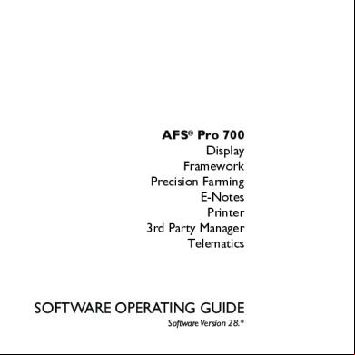
Afs Pro 700 Guide V28 Comp 1rn5x
April 2022 0
Afs Pro 700 Guia De Funcionamiento-guts 5t1d6s
December 2019 98
Clarisonic Guide Pro 4j304m
December 2019 41
Staad Pro Guide 53zl
October 2021 0
Fileapp Pro Guide 322x3t
December 2019 44
Ultimate Crj-700 Guide 4s1y3e
July 2021 0More Documents from "Steven Scott" 4k5r2j

March 2023 0
Afs Pro 700 Guide V28 Comp 1rn5x
April 2022 0
[tim Vasquez] Weather Forecasting Handbook (5th Ed(b-ok.xyz) 91e48
January 2021 0
Everworld Series Pdf 114j18
January 2022 0
Eu Rome Strategy Guide Pdf 3l1x47
December 2021 0