Iirs-elearning 2n4q4q
This document was ed by and they confirmed that they have the permission to share it. If you are author or own the copyright of this book, please report to us by using this report form. Report 3i3n4
Overview 26281t
& View Iirs-elearning as PDF for free.
More details 6y5l6z
- Words: 785
- Pages: 2
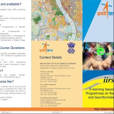
What Courses are available? Following courses are available under IIRS e-learning programme. Four (04) months duration: Comprehensive certificate course on Remote Sensing and Geo-information Science. One (01) Month Duration: Certificate course on Fundamentals of Remote Sensing. Certificate course on Fundamentals of Photogrammetry and Cartography. Certificate course on Fundamentals of Geographical Information System and Global Navigation System. Certificate course on Fundamentals of Digital Image Processing.
Eligibility and Course Durations Persons who have successfully completed graduation or 3 years diploma after 10th standard or equivalent are eligible. or Working Professionals with 10+2 educational qualification and minimum 5 years’ experience in geospatial domain or related areas.
How to ? Interested participants can through http://elearning.iirs.gov.in or http://www.iirs.gov.in
What is the course fee? The e-learning courses is available free of cost to all the participants. However to get a certificate from IIRS, the student has to appear in an examination for which a nominal fee will be payable through demand draft as per following: • For four months certificate-₹ 10,000/ • For one month course- ₹ 2500/
Details INDIAN INSTITUTE OF REMOTE SENSING Indian Space Research Organization Department of Space, Government of India Prof. P.L.N. Raju Group Head Remote Sensing & Geoinformatics Group [email protected] Tel: +91-135-2524130/4332 Fax: +91-135-2741987
iirs E-learning based Certificate Programmes on Remote Sensing and Geoinformation Sciences
http://elearning.iirs.gov.in
Background: During last decade the utilization of Internet technology by different groups in the society is emerged as a technological revaluation which has directly affect the life of human being. The role of internet technology is very important for capacity building in any discipline which can satisfy the needs of maximum s in minimum time. IIRS has been conducting satellite based outreach program since 2007 with the manifold from Standing Committee on Training and Education (SC-T) of National Natural Resources Management System. The program has been very popular across the country. We have so far trained more than 13000 participants from 12 courses conducted so far, representing 130+institutions/universities. However, this program remained limited to educational institutions that are having EDUSAT Studio setup and high speed internet connectivity within the country.
Why an e-Learning program? This online program is flexible for anytime, anywhere learning keeping in mind the demands of geographically dispersed audience and their requirements. The program is comprehensive with variety of online delivery modes with interactive, easy to learn and having a proper blend of concepts and practical to elicit students' full potential. The ed participants of IIRS e-learning programme can access: Relevant lecture notes, practical exercises developed for e-learning courses and EDUSAT programme of IIRS. geo-spatial data from open and free data archive and related services. Access to Student thesis and publication archive of IIRS. The recorded video of EDUSAT programme for relevant topics. Participation in Important lectures conducted at IIRS through live webcasting using NKN. Participants are allowed to participate in EDUSAT based interactive classroom. The same registration and Single Sign-on option will be available. Interaction with subject expert from IIRS through live Chat and interactive sessions.
The Need: Remote Sensing and Geoinformation Science have become key technology tools for the collection, storage and analysis of spatially referenced data for resource planning and decision making. Today it is the backbone to many decisionmaking systems and location-based services emerging in the New Information Economy. Planners and decision makers' that utilize these Geo-spatial technologies for variety of applications in agriculture, forestry, mining, market research, environmental analysis as well as the social, utility services and disaster management.
Course Objectives: a. To provide an opportunity for individuals to learn Remote Sensing and Geoinformation Science for the benefit of their professional career. This basic course in Remote Sensing and Geoinformation Science will allow graduates to build their knowledge and practical expertise in RS and GIS technologies with independent study and project experience at the certificate level. b. To provide considerable flexibility allowing students to quickly gain the RS and GIS knowledge and qualification they need today, and to add to their credentials. Students develop a capacity for independent research, problem analysis and solution. c. To empower students undertaking this course to develop their knowledge and understanding through formal coursework and a program of independent reading. It has a practical component and a project associated with it to develop learners' research, analytical and problemsolving skills. d. To undergo Laboratory Practical and Experiments in Cloud Computing Environment
Target Groups: State and Central Government Departments. Geospatial Industries. PSU/entrepreneurs / NGO. Students and Researchers.
Ministries
and
More Documents from "CommonMan" 4t1j4b